 |
TWO DAYS
in SUFFOLK 15-16 August 2023 |
|
| Welcome Day One Day Two Finale Map Read Me |

Welcome
A long-standing friend of over forty years, had quite recently moved to Woodbridge, and felt it might be nice to meet up to "exchange notes". At the same time, he offered to show me some of his part of south-east Suffolk. We fixed a mutually convenient two days. These turned out to be bright and sunny and so enabled us to enjoy the gently undulating Suffolk countryside in all its summer verdancy.
On the first day, the Ramsholt Arms on the River Deben, to the north east of Woodbridge was on our schedule. After this came Southwold, an erstwhile fishing community, still showing traces of its famous railway. More traces of this were at nearby Blyth, a short distance inland. A visit to the Maltings at Snape concluded our main travel for the day.
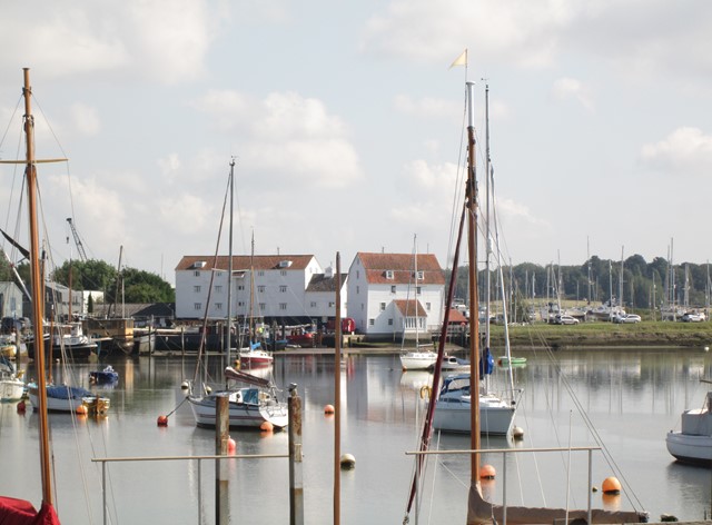
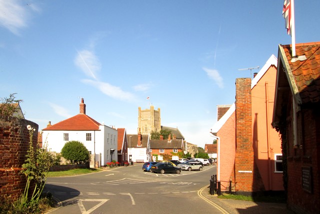
Woodbridge: Waterfront, boats and Tide Mill.
On the second day, the waterfront of Woodbridge, including the well-known tide mill, featured on our schedule. We also saw the work in reconstructing replicas of the Saxon Longboats, the work being based on the nearby find at Sutton Hoo and aiming to give further insight into Saxon boat building. In the afternoon, Aldeburgh on the coast was an interesting destination, as was Orford and its castle further along the coast.
My friend was driving one of the latest all-electric cars, and assured me that the running costs for the two days paled into insignificance when compared with conventional petrol and diesel versions. Technology marches on in support of the ecological challenges faced by our planet!
The improvised crest, which I have used on this page, is my ultra-simplified version of the elaborate Suffolk County crest. Both crests depict the sun rising above the North Sea and signify that Suffolk is the eastern-most county of England. My version is intended to give the same message, albeit with far less artistic detail!
|
This page is probably most easily viewed on a Windows® PC. Browsers running on Android® may require adjustment in "Settings" to avoid distorted ratios of text to image sizes. |
Day One
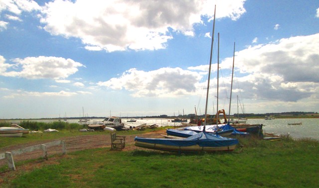
On the first day, the Ramsholt Arms on the River Deben, to the north east of Woodbridge was on our schedule. This was a relaxing culinary start to our day. After this came a visit to Southwold, an erstwhile fishing community. We then saw the fishing activity at Walberswick. We then saw first signs of the rebirth of famous Southwold Railway. More traces of this were at nearby Blyth, a short distance inland. A visit to the Maltings at Snape concluded our main "expedition" for the day.
Ramsholt Arms
The acclaimed "Ramsholt Arms" gastropub is on the River Deben, not more than three miles roughly south east of Woodbridge. This eatery provided a pleasant stop at the start of my two-day visit to south east Suffolk.
View along the Deben to the south from the Ramsholt Arms.
The sunny terrace of the Ramsholt Arms.
Southwold Railway at Southwold
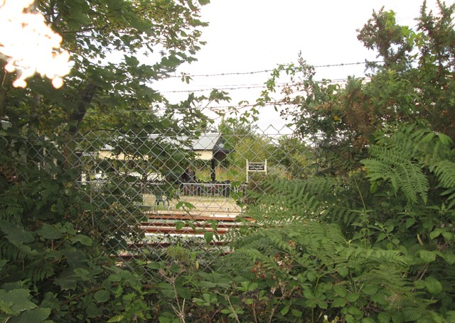
Between 1879 and 1929, the 3ft gauge Southwold Railway linked the GER/LNER main line at Halesworth to Southwold itself. Now there are ambitious plans to restore it. On this page, the first set of pictures below shows the activity at Southwold, and the next set of pictures shows Blyth Station.
At Southwold the station has risen again.
We are peering into "Steamworks".
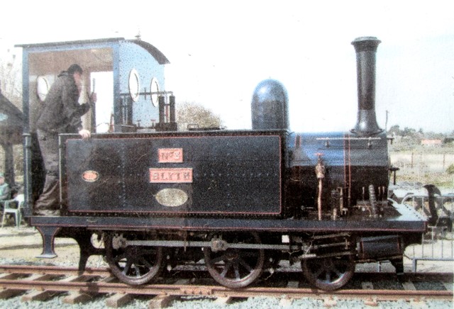
The replica of Sharp Stewart 2-4-0 tank number 3 "Blyth" has been funded by the generosity of an enthusiastic benefactor.
(Picture photographed from an information sheet.)

The Manx Northern Railway Coach arrived in 2012.
The 3ft gauge, whilst rare in England, is still widely used on the Isle of Man
and also found favour for rural lines in Ireland.
Tramcar trailer from Charleroi in Belgium.
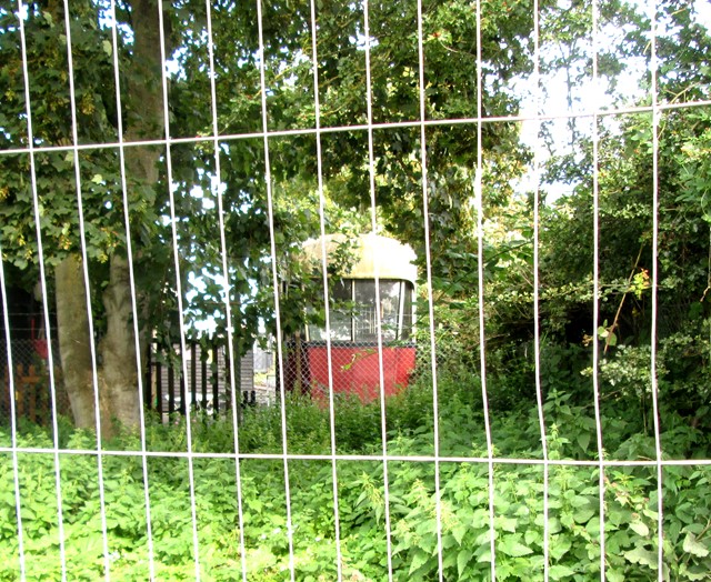
Southwold Railway at Blyth
Blyth was the third station out of Southwold, and nestles between the village of Blyth and a bend in the river Blyth itself. We got chatting to two enthusiastic volunteers who explained the work at the station - on the buildings and on the rolling stock.
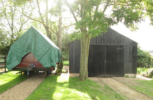
Covered wagon and station shed.
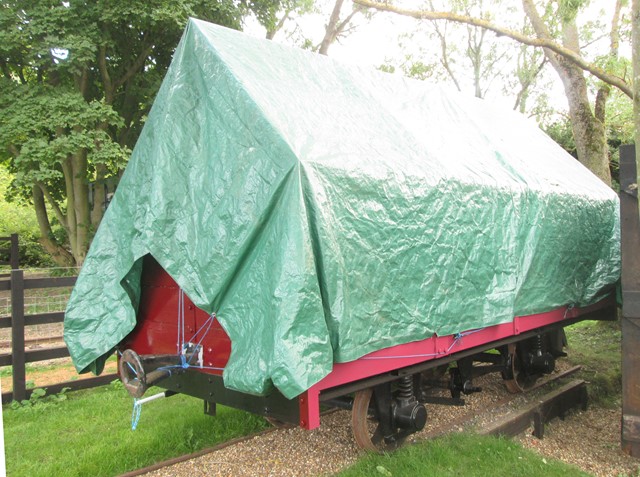
Covered wagon again.

High curved end open wagon at Blyth Station.
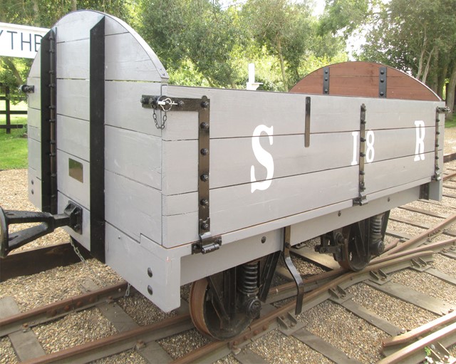
Number 18 again.
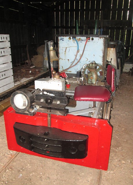
"Side saddle" battery shunter.
Snape Maltings
The Maltings at Snape were, as the name suggests, important for beer production. When this site became available, the largest of the Victorian malthouses was converted into the "Snape Maltings Concert Hall", and originally opened in 1967. Benjamin Britten (the composer) and Peter Pears (the singer) are indelibly associated with Snape Maltings.
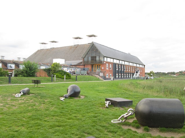
Snape Maltings.
Someone seems to have forgotten to remove the litter.
"But that's art", I hear some retort indignantly.
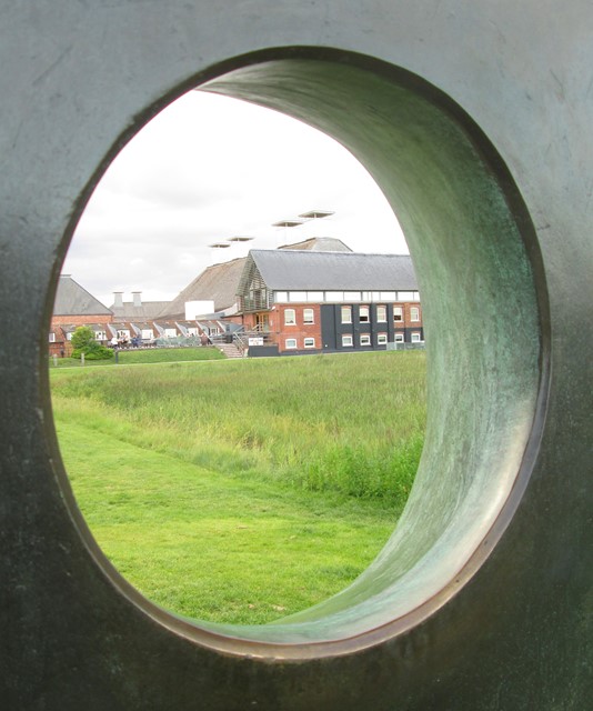
Another art form of the modern age is that created by Barbara Hepworth. I am not a devotee of Barbara Hepworth's creations, but this part of her sculpture at Snape and entitled "The Family of Man", provides a frame through which to view the Maltings.
Day Two
In the morning we saw a number of activities and sights accessible from the waterfront at Woodbridge. In the afternoon, Aldeburgh on the coast was an interesting destination, as was Orford and its castle further along the coast. A day of interesting impressions! New things to be learnt and experienced!
Woodbridge - The Waterfront
A number of activities and sights greeted us on the waterfront at Woodbridge. These included: the famous Tide Mill, Saxon boatbuilding projects aimed at understanding the techniques used by the Saxons who left their mark on this part of Suffolk, and of course, the interesting (absorbing) Woodbridge Museum.
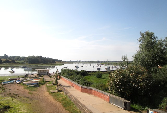
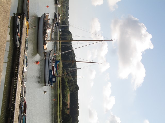
Woodbridge is on the River Deben.
Looking towards the Tide Mill (on the right).
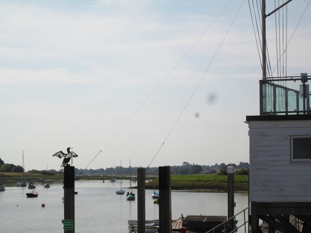
River Deben
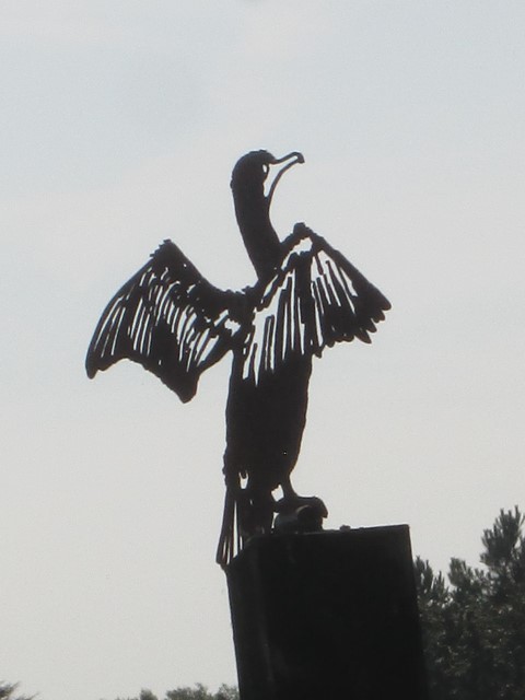
Bird Sculpture
River Deben
Behind us is the Museum, our next stop.
Woodbridge Museum
On the Waterfront, near the Saxon longboats (see next section below) is the Woodbridge Museum, its compact space filled to the brim with all sorts of mementoes and pictures of Woodbridge from times past.
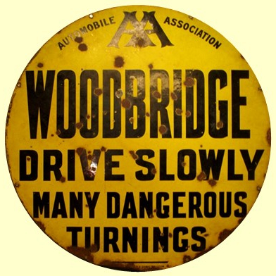
One of the mementoes in the Museum, is this AA sign from between 1906 and 1909. Usually, distances were shown on AA signs, but occasionally warnings were the subject, as here. As we see, Woodbridge was not without its challenges for the pioneering motorist in Edward VII's time!
Saxon Longboats
The Sutton Hoo burial site, a short way out of Woodbridge, revealed the imprints or hollows left by the original long boat, whose timbers, long ago, had been obliterated by the march of time. These hollows or voids were carefully studied and have led to two boat building projects. One of these projects is a full-scale (river going) replica of the original long boat. The other is a small-scale boat aiming to focus on understanding Saxon boat building techniques.
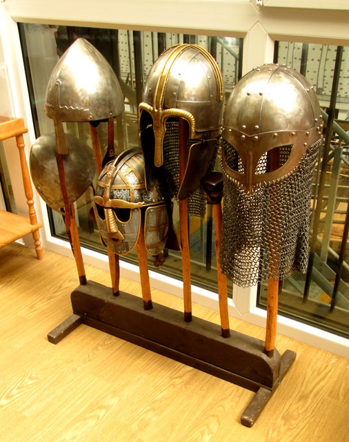
Saxon Warriors are bidding us welcome!
These are the helmets on display at the Woodbridge Boatyard (see below) of five of the Saxon warriors who probably manned the long boats.
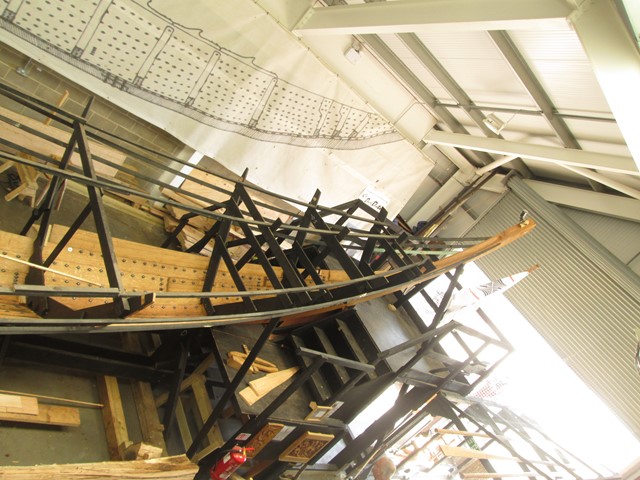
-- Saxon Longboat - Full-Scale Replica --
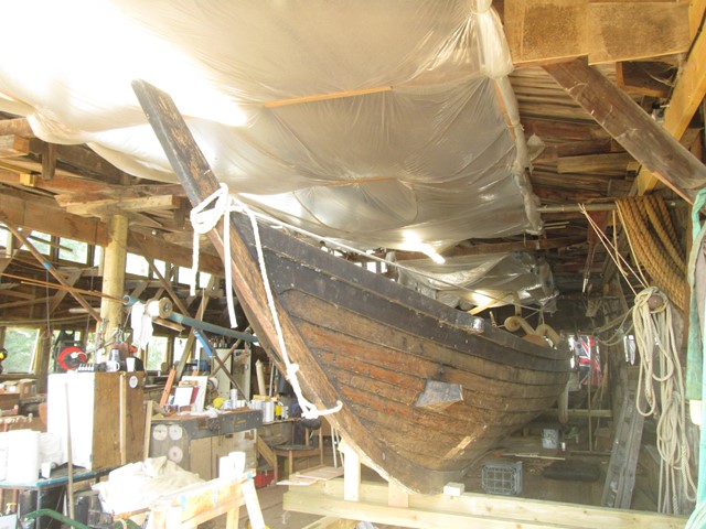
"Sae Wylfing" ("Sea Wolfcub") will be a full-scale replica of the 7th century Sutton Hoo ship that sailed before becoming the burial chamber of a king. It is being built in the "long shed" by the Sutton Hoo Ship's Company project, and will use original materials where possible.
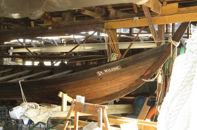
It's "Sae Wylfing" again.
-- Saxon Longboat - Smaller "Study" Version --
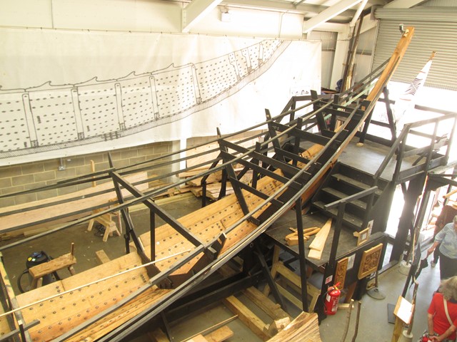
A smaller size version is also being constructed at the adjacent Woodbridge Boatyard.
This will enable Saxon boat building techniques to be studied and understood.
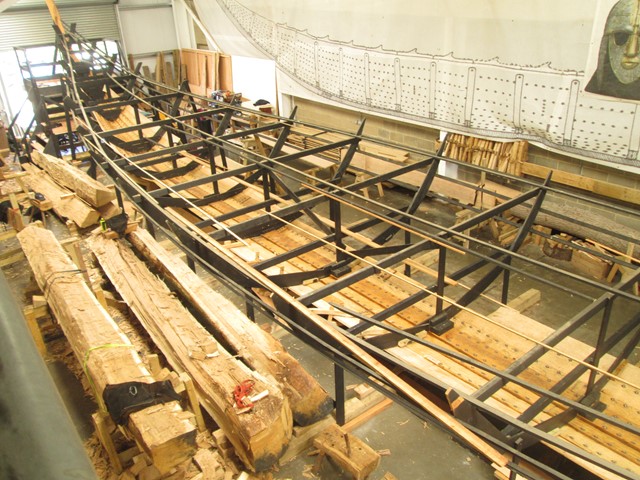
Timbers are cut from the "tree trunks" on the left.
Timbers are joined and held in position by transverse stays.
Tide Mill
A tide mill enables the ebb and flow of the tides to drive the mill machinery. Tide mills do not occur widely in Britain. However, the Woodbridge mill is a working mill and has been used to make flour for over 850 years! Now it is time for us actually to visit the said mill!
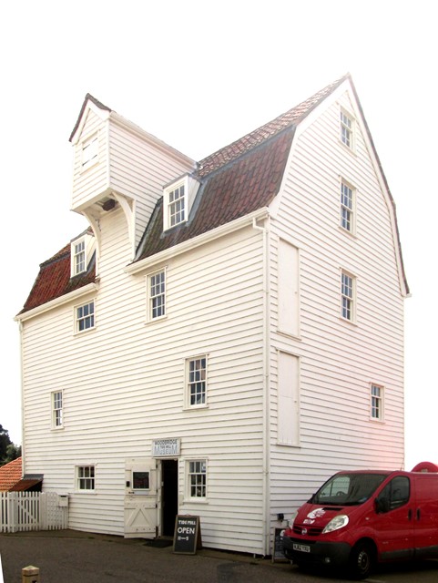
The mill in all its full glory of Suffolk weather-boarding.
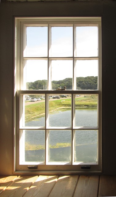
One of the mill's old sash windows looks out onto the storage pool which holds back the water supplied by the incoming tide. The area behind the cars on the left was originally a second retention pool. The pools acted as mediaeval "batteries", storing energy, to be used by the mill as required.
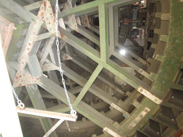
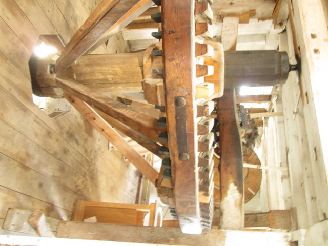
The main drive wheel works in undershot mode.
(Some metal reinforcement).
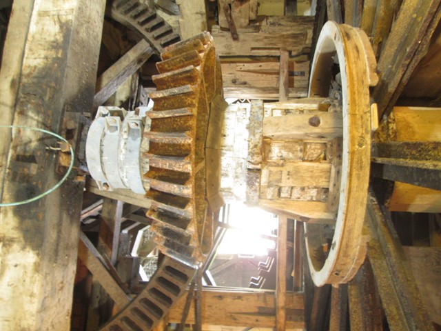
The horizontal movement of the main drive wheel is converted by the bevel gear to the vertical movement of the shaft passing through the several floors of the mill. Mediaeval mechanics! There is some metal strengthening to keep the old lady in business!
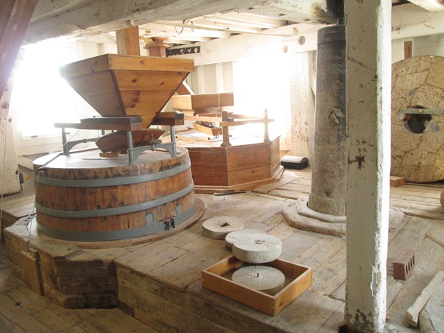
Of mill stones (querns) and grain hoppers.
The main drive shaft appears from behind the column.
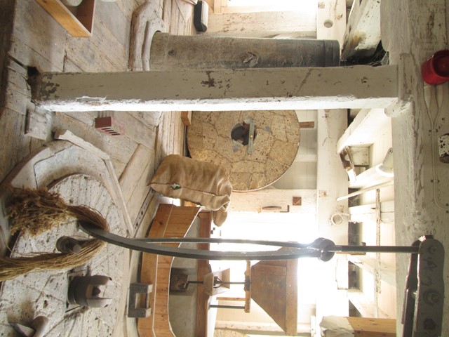
Another view of the querns and grain hopper.
More drive machinery.
Aldeburgh
Aldeburgh was our first stop in the afternoon. On the waterfront we saw one of the distinctive Victorian look outs. The lifeboat station also proved to be an interesting visit. However, our intended restaurant was full, which indicated popularity but - for us - not availability! On leaving town, we saw the "House in the Clouds".
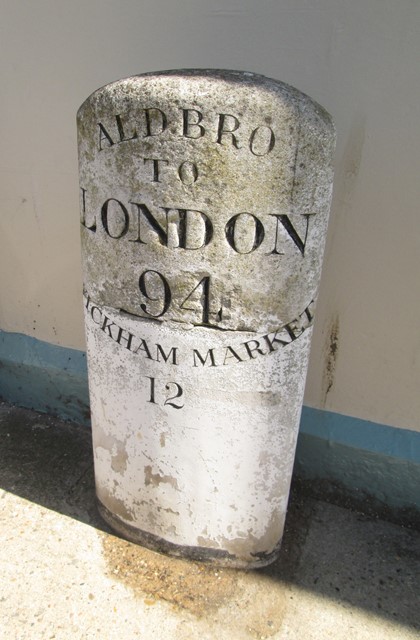
Typical East-Anglian milestone.
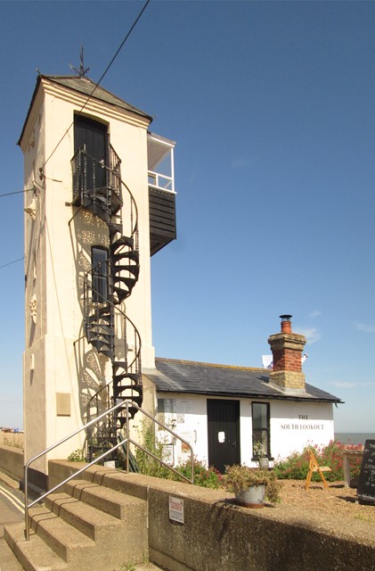
The South Lookout.
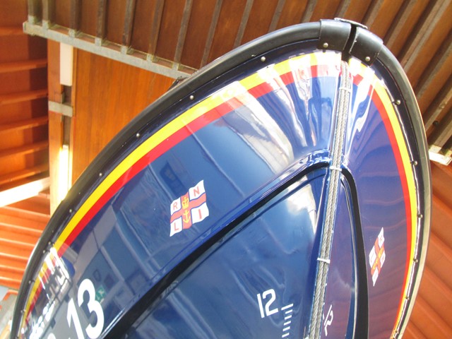
With the South Lookout in the distance, we come to the RNLI lifeboat station.
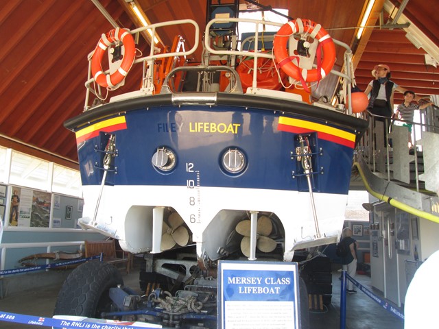
Very colourful, these lifeboats.
They are launched stern-first.
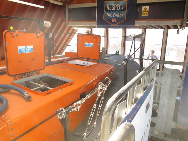
Watertight Hatches
A large caterpillar vehicle is used for the launch.
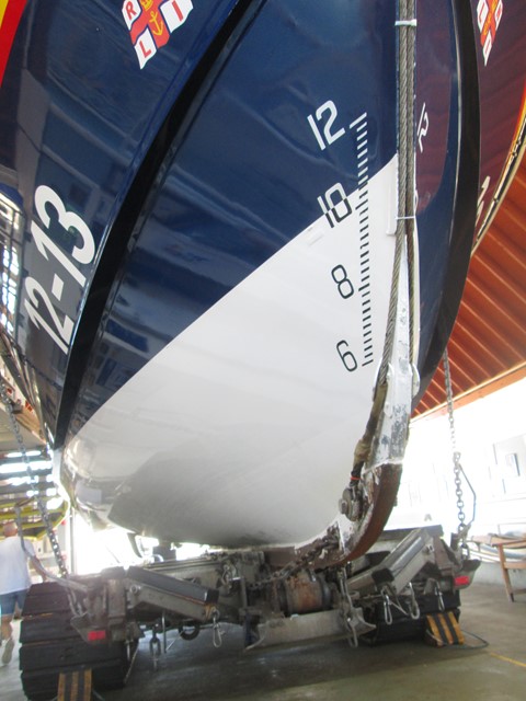
Detail of the prow.
The nature of weather-proofing is the result of many years' experiences.
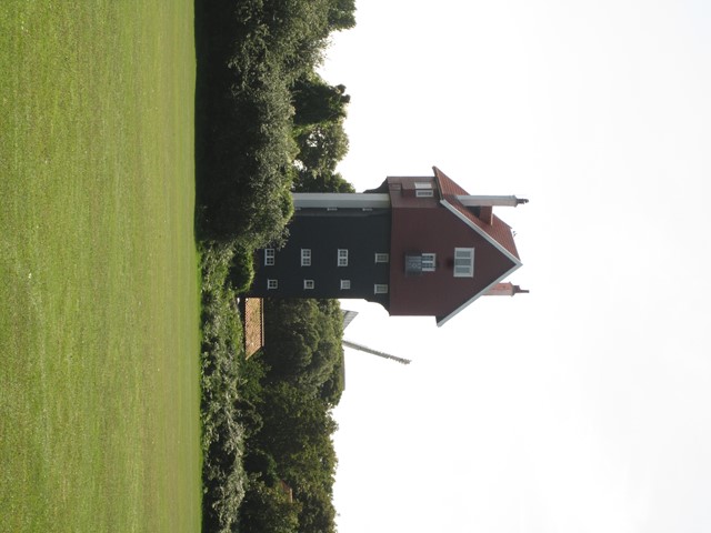
"The House in the Clouds" outside Aldeburgh was once a water tower fed by a windmill!
It now provides holiday accommodation.
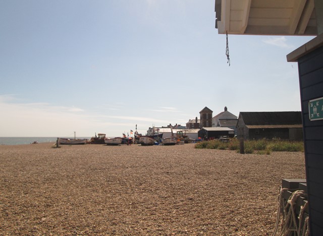
Orford
And finally, we came to Orford. A compact little place on the River Ore - presumably at one time a convenient ford across the said river. The castle dominates the town.
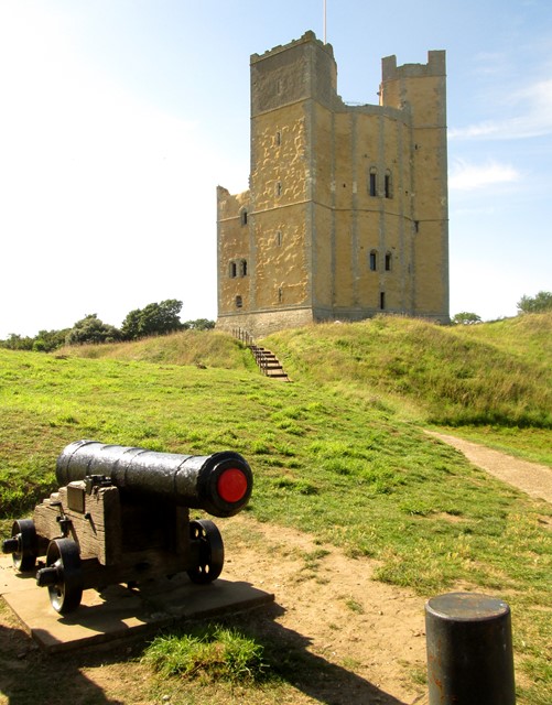
Orford Castle dates from the late 12th century, but only its keep "has been kept".
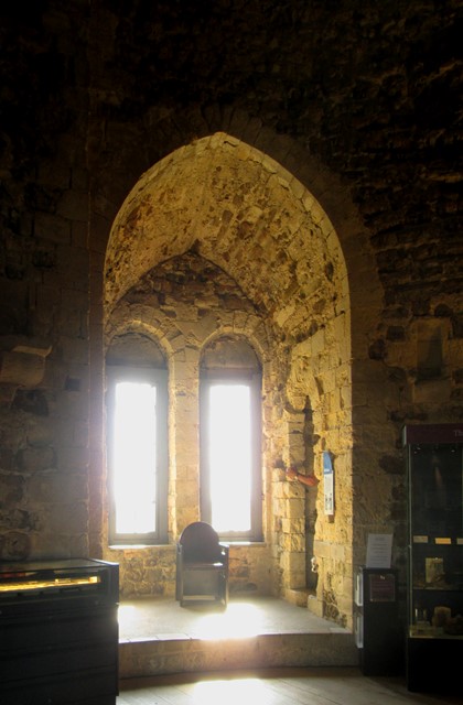
Apart from the dungeon and the roof, each floor has a centre and recesses
to admit light through "wind's eyes" or windows.
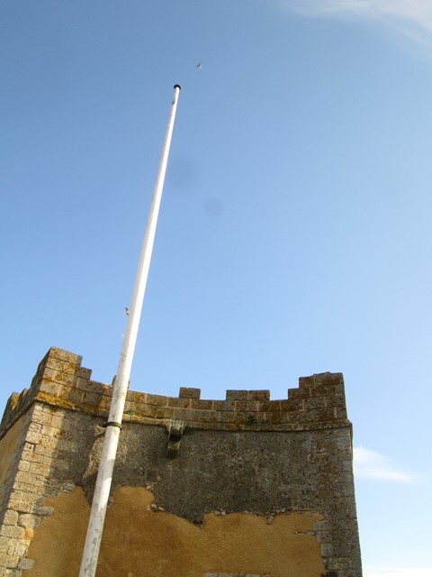
The top has the obligatory flagpole.
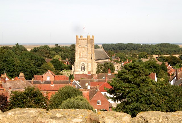
The top affords views across the surroundings, including downtown Orford ...
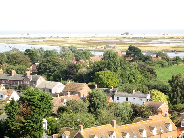
... and the open sea a short distance away.
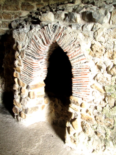
The guards that were stationed in this lofty location, could make their own bread.
The old main square of Orford is close to the Castle.
Finale
The end of two pleasant sunny days was nigh. Ipswich Station was eventually reached after persevering with the surprisingly heavy evening traffic. I thought traffic jams were usually associated with the Capital!
Or course, the purpose of the visit was to chat about times past and times in-between. However, seeing some of south-east Suffolk was a nice and educative way of doing this. My friend's all-electric car worked wonders, without the cost and pollution overhead of traditional vehicles. This page is a visual record of a very successful two-day visit! I am indebted to my friend for suggesting this meeting. Many Thanks Indeed!
Maps
The places described on this web page are shown in the maps below. The first map focuses in detail on south-east Suffolk. The second map relates these places to the wider context of East Anglia, London and the South-East. Charing Cross is regarded as the centre of London, and is not to be confused with the nearby station nor the Victorian cross itself!
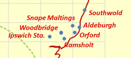
South-east Suffolk and the places we visited.
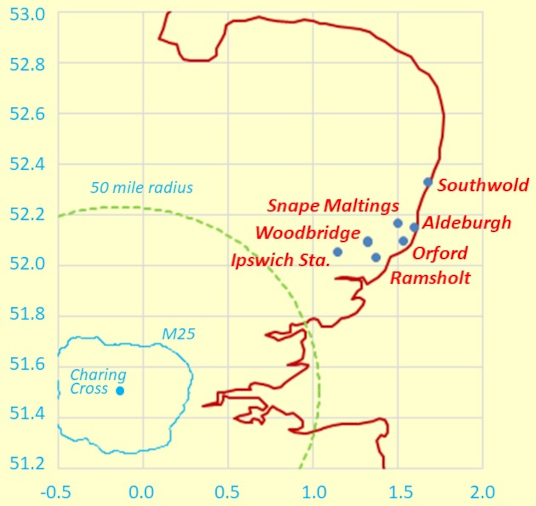
The wider context.
Vertical and horizontal axes are in
degrees latitude and longitude respectively.
Eric Scharf
Original: 2023-08-23 @16:16
Update: 2023-08-28 @16:59
Update: 2023-11-18 @12:40
Update: 2023-11-21 @10:02
SAGAX REX HANC RETIS ORBIS PAGINAM PINXIT ANNO MMXXIII
© Eric Scharf 2023