 |
WETHERLAM 2014: April 19 |
|
Today is devoted to Wetherlam
The weather was good and the view from Wetherlam promised to be good. So a select group of us decided to approach Wetherlam via the old quarries and mines mentioned by Wainwright and by the steep scramble which appears as a straight footpath on the OS map. While the steep scramble was not expected, it was doable, and our reward was an all round (360°) view from the summit of Wetherlam. The view was best described as panoramic. Our descent was around the north of Black Sails and down by the Levers Water reservoir. Another excellent day in the Great Outdoors!
The Morning
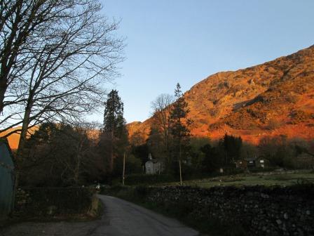
Some more early morning, pre-breakfast, pictures were on my agenda again. There is something about sunny late spring mornings in the Lake District, and I wanted to capture the experience, at least in pixels.
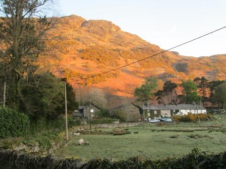
The bright orange glow appeared again behind the cottages, ...
... our hostel, ...
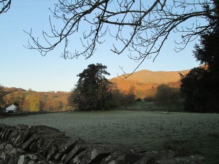
... and the field in front of our hostel.
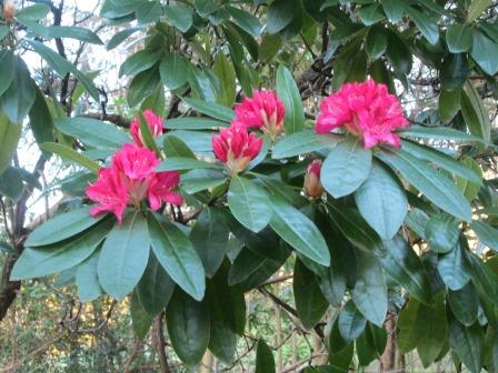
My repertoire of flower names is not that brilliant,
but these red flowers in the grounds of the hostel were.
Come to think of it, it could be a rhododendron.
Answers on a postcard please.
The Quarries of Tilberthwaite
From behind the hostel, we made our way to Low Tilberthwaite and from thence to the quarries and mines that featured in Wainwright's descriptions. Yellow gorse and the bright green of late spring characterised this first part of our walk.
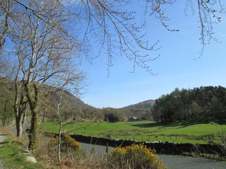
The greeness and the yellow gorse of late spring characterised the way to Low Tilberthwaite.
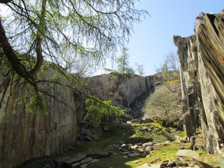
There was a grandeur to the old slate quarries ...
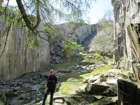
... which Hazel, and all of us, found impressive.
This is a view from one of the quarries onto the Furness Fells which hide Lake Windermere beyond.
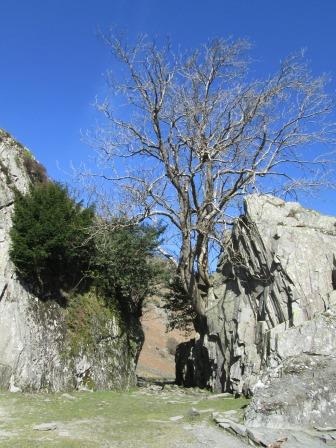
The entrance to the quarry is quite impressive - tree and dynamited slate.
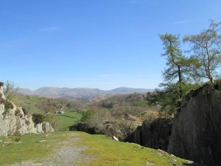
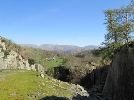
Another view of the Furness Fells from the quarry.
Ascent Part One
From the quarries we had some small scrambles and crossed a stream to reach an old mine working - which looked interesting but probably not that safe to enter. The path snaked up to two lonesome pines - well, they probably kept each other company of over many years. From the lonesome pines, we had a good view to the south and decided that the pines would make a grand lunch stop.
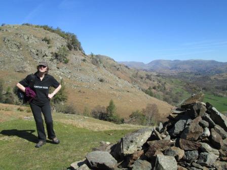
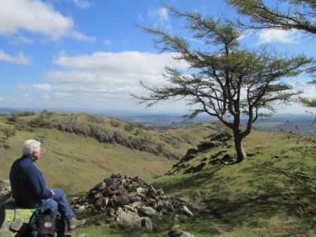
Hazel is in charge here!
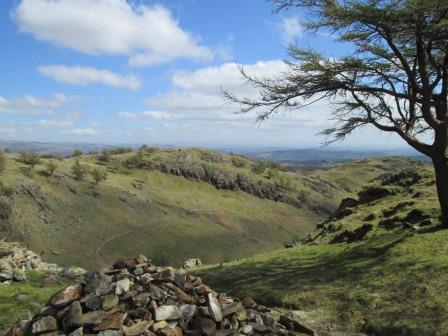
The cairn marks the spot from where there is another good view across to the Furness Fells.

Yours Truely has the air of one who has just crossed a babbling brook
- or "beck" as they say in these parts.
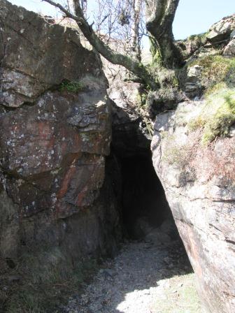
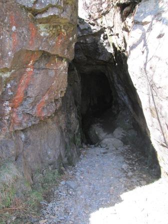
This is the entrance to one of the old copper mines. I would normally associate the red colouration of the rocks with iron; it's usually green for copper ores. But there you are.
Another puzzle to solve - isn't life interesting!
It looks as if there is indeed a passage here ...
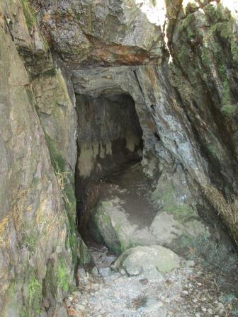
... a passage that leads off into the hillside. What sort of people spent a good part of their lives toiling away here?
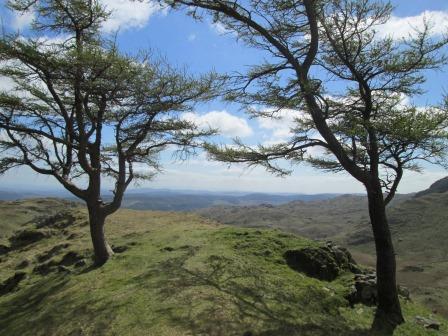
We reach the two lonesome pines; well, at least they have kept each other company for many a year.
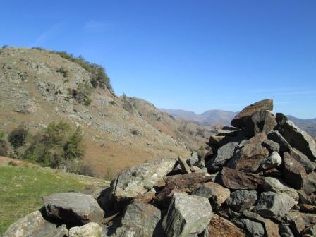
There is a good view to the south and on to the path by which we have just come up.
Tim is using the view for inspiration.
Before we leave, it's nice to catch the interplay of shadow and sunlight on our scene.
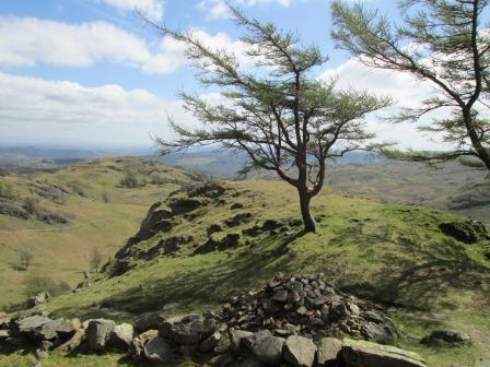
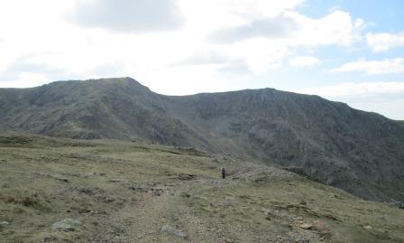
We are about to reach Wetherlam edge but stop again to admire the view
across to what looks like Lake Windermere.
Scramble to Wetherlam
The ascent to Wetherlam along Wetherlam Edge looks on the OS Map like an innocent - albeit steep - footpath. It's really a steep rocky scramble requiring more effort than anticipated. Actually very interesting and really quite doable.
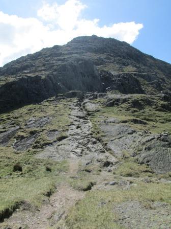
We go up here ...
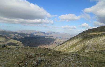
... but not before we take another look towards the Furness Fells ...
... and Lake Windermere.

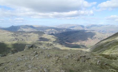
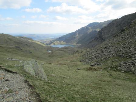
The ascent is up from the edge left of centre. We can see Little Langdale Tarn, with Little Langdale (tomorrow's walk) to the right (east) of the said tarn.
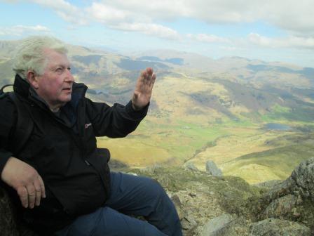
Tim joins us and raises his hand in thanksgiving.
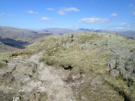
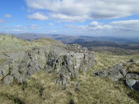
Wetherlam - the Summit
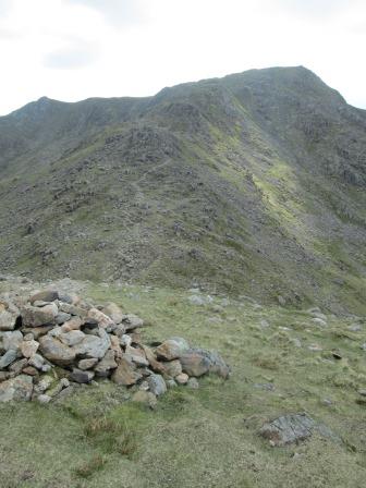
Abit more along Wetherlam Edge, and the summit is in our grasp. The interplay of clouds and sunshine seems to add to the dramatic nature of the panoramic view. Wetherlam has certainly lived up to expectation!
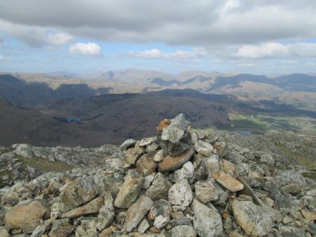
The cairn on Wetherlam looks a bit modest ...
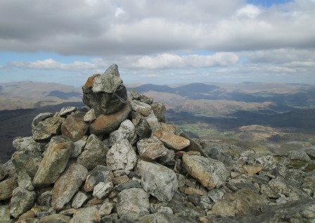
... for such a grand view.
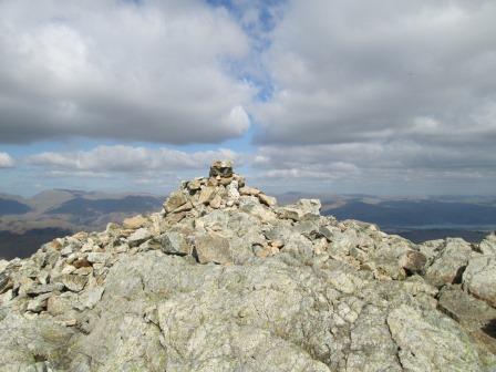
Cairn, sunshine, clouds and mountains.
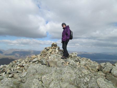
Hazel has just performed the time-honoured ritual of placing another stone on top of the cairn. How large will the cairn be at the end of the century?
Wetherlam to Coniston
The descent from Wetherlam leads on to Keld Gill Head to the north of Black Sails. At Swirl Hawse one path leads up to Swirl How, from where one can reach the Old Man of Coniston. We take the other option: a quite rocky and "ballasty" path (so it transpired) to Levers Water and, via the Coniston Fells, to the Copper Mine YHA and the Miners' Bridge, and so back to base. A good day: plenty of good views and good exercise.
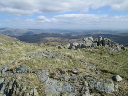
We are on Keld Gill Head from which we can look westwards
to the ascent to the ridge leading to the Old Man of Coniston...
... and we can look north towards the Langdales ...
... and beyond towards Grasmere Common and Keswick.
Ahead is the ascent to Swirl How, from which one can reach the Old Man to the south.
We take the other option - a path leading south past Levers Water to Coniston.
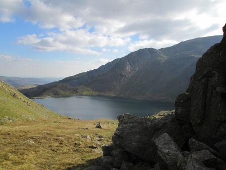
Sun and clouds lend an air of drama to Levers Water.
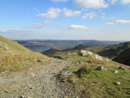
Lake Coniston hoves into view. It's still a very rocky path to the Coppermine YHA. From there we get to the Miners' Bridge, and so back to base. It's been a good day indeed. No rush. No hurry. Time to absorb the rocky majesty that is the Lake District.
Contact, Copyright & Please Read Me!
Please click here for more general logistical and copyright considerations relating to this page and other pages on this web site. Thank you!
Eric Scharf
Latest Version: 2014-04-11 @11:49
SAGAX REX HANC RETIS ORBIS PAGINAM PINXIT ANNO MMXIV.