 |
Enjoying the Outdoors A WALK FOR CORONA TIMES 8th May 2020 |
|
| The Walk Corona Lower Flowers Upper Summit Field Finale Thank You Maps Please Read |

The Walk
It is not often that I include a walk of just 1 mile in these pages, but then, these are exceptional times. This short walk, I believe, fits into the national request at this time for only modest exercise in the context of social distancing. And yet, this walk offers views over the undulating countryside and a nice encounter with local history as well as with the natural world. In fact, this walk has given me the opportunity to try my hand at identifying various flowers and flowering shrubs - an interesting exercise!
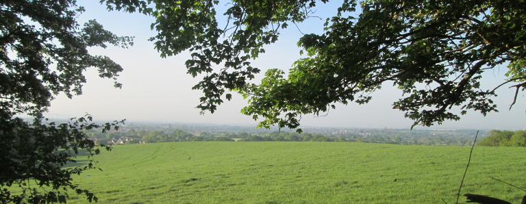
View towards the hills of Kent.
A crown is the logo for this walk. The crown signifies the pleasantness of the walk and the heights - albeit modest - achievable on this walk. On a perhaps more sombre note, "Corona" is a medical term used to describe the virus which is turning the present world upside down. Now "Corona" is the Latin for crown, and I think you'll agree that a crown presents a nicer picture than the virus!
Corona & VE Day
On the way to the start of the walk, there is a display of posters to remind us of the sacrifices made by the NHS to care for those unlucky enough to have caught the virus. In addition, being the 75th Anniversary of VE Day, there is, even in these times, something to celebrate, and the flags and bunting remind us of this too.

Corona Viruses are actually a group of viruses which typically include the flu viruses. The protrusions are reminiscent of a crown, hence the association with the said regal head dress and its Latin name "corona". This picture represents the Covid-19 virus which apparently has more protrusions than its relatives. The number of these protrusions is significant, but for further info consult your medical friends. The picture is part of a colouring sheet, which in turn, is one of a wider selection from the St. Jude web site, in particular from the St. Jude covid-19 resources page. As you see, it has been duly coloured in by one of the younger members of our community.
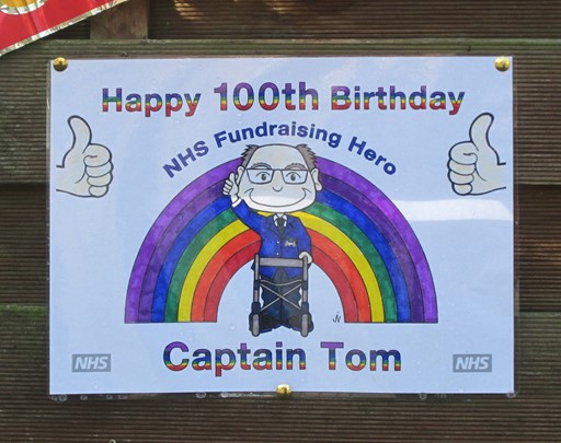
Captain Tom has just become a centenarian and has shot to fame by doing hundred laps around his garden in order to raise funds for the NHS.
The tally of his years, of course, matches the tally of his laps.
I don't know the publisher of this slide, but it could be the NHS itself.
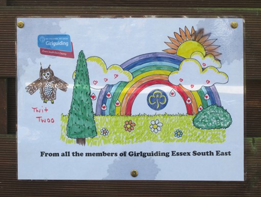
The Girl Guides are still very much active and doing their good works.
This slide looks like a nice DIY production by members of the Girl Guides.
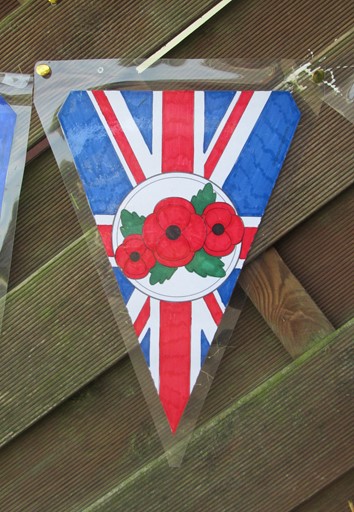
May 08 happened to be the 75th anniversary of VE Day (WWII), so appropriate flags and bunting decorated the streets. The poppies are a reminder from WWI.
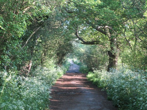
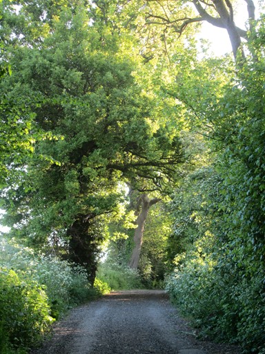
Lower Path
The route of the first part of the walk goes along the foot of "The Hill", called such here, because I have never found out its actual name! The farmer on Brock Hill uses "The Hill" to graze his cattle. The walk itself starts at the end of Downham Road, Wickford. The path has survived successive housing developments, and as such, its rural ambience can be enjoyed today. After the 90° turn to the right, this lower path becomes part of "Grange Lane". The path then continues as far as the turn off to "Littlemead".
"The Hill" rises up to the north of the path.
No cattle out to chew the cud yet this morning.
On the start of the walk, the verdancy of late spring is all enveloping.
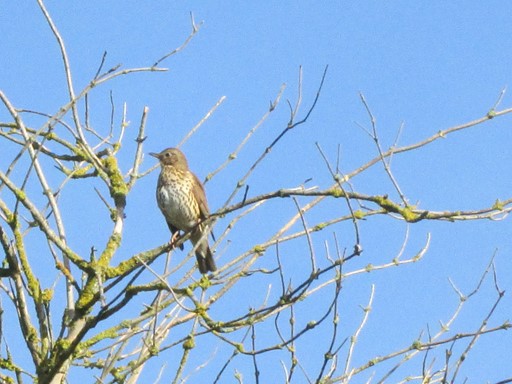
To the right of the path, a song thrush has found a perch.
The song thrush singeth.
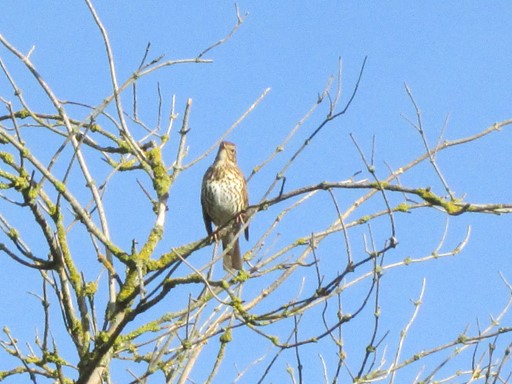
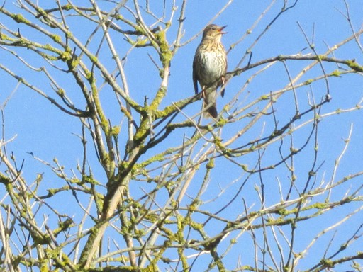
I do not claim any expertise in avian behaviour,
but this does look like the male of species staking out "his" territory.
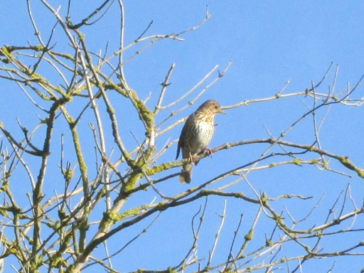
The thrush may have espied a tasty morsel lurking in the undergrowth,
so off "he" flies. Or has "he" seen me taking "his" picture?
Birds are flighty at the best of times!
To the left is a field, walking through which, one eventually reaches the station.
This field is a favourite destination for local dog walkers.
The path leads onwards until the corner with "Grange Lane" is reached.
Here's another view of "The Hill".
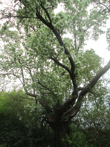
Almost at the corner is a venerable "European Pear Tree" showing off its white spring blossom.
However, it needs a harsh winter actually to produce pears.
This tree has only produced fruit once in the last 15 years (2006 to 2021).
(This, and the next picture were actually taken on 3rd May 2021, but both pictures fit in here!)
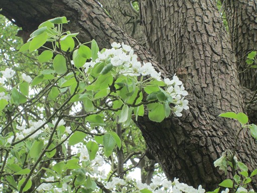
A look at the blossom and a detail of the trunk.
At the corner, one path leads off across the fields to Downham Church and a track leads to Castledon Road. Yet a further path leads to the Station. At this corner one can look west to a half-timbered "mock Tudor" house (Oak Farm) on the left and a corner of Downham Farm on the right.
"Grange Lane" then goes north over two "humps".
Let the viewer of this page consider the possible origin and purpose of these two humps!
After this comes the turn off to "Littlemead".
Floral Introduction
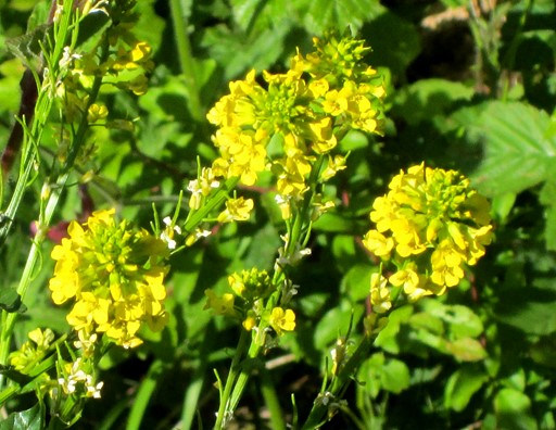
After the turn off to "Littlemead", where the walk starts to gain height, I took some pictures of what appear to be quite common wild flowers hereabouts. The use of the word "appear" also implies that I do not claim to be a Botanist - not even an amateur one! However, the flowers add some additional colour to the late-spring landscape. They also provide a nice floral introduction to what can be seen on the walk.
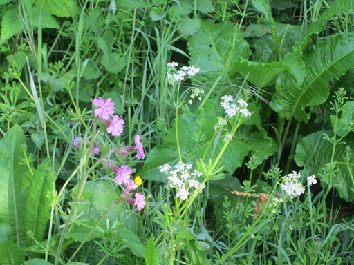
First one can see Red Campion and Cow Parsley and a Buttercup growing closely together.
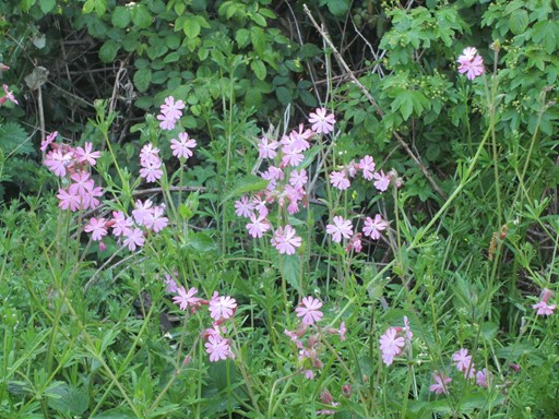
Red Campion may be the name, but the colour of the petals is more of a dark pink.
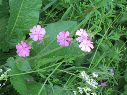
Red Campion in close up
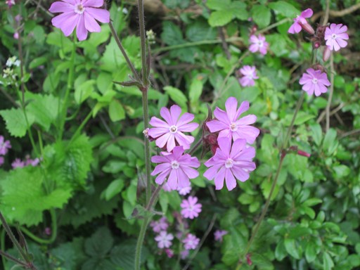
More Red Campion in close up
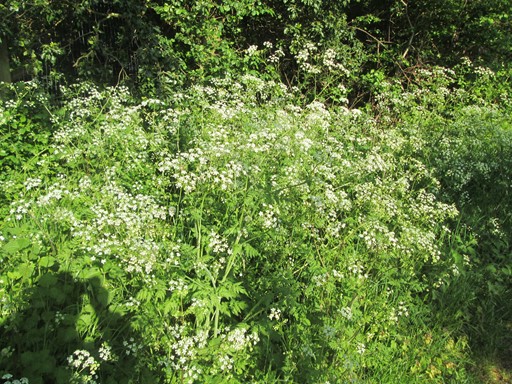
After this comes Cow Parsley.
Lots of Cow Parsley lines the sides of the footpath.
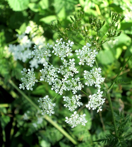
More Cow Parsley.
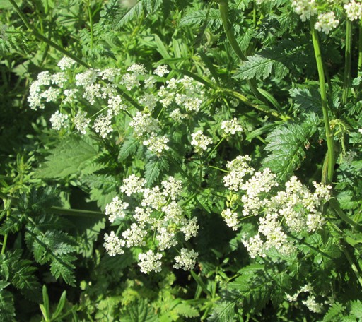
Yet more Cow Parsley.
And then there are the Buttercups.
Indeed a whole congregation of Buttercups.
Buttercups in close up.
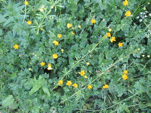
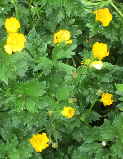
Nearby some mysterious flowers are growing. A mystery to me, anyway!
Didn't I say I'm not even an amateur botanist!
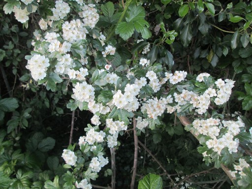
Just slightly further up, in view of Downham Church, there is the Hawthorn.
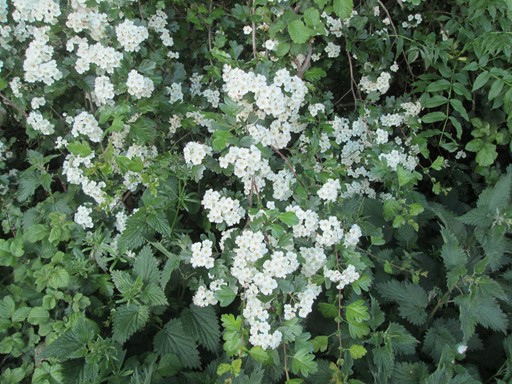
And yet more Hawthorn.
Going back for a moment to the two "path humps".
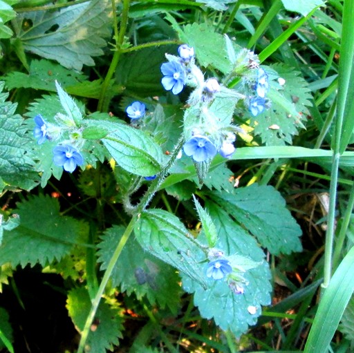
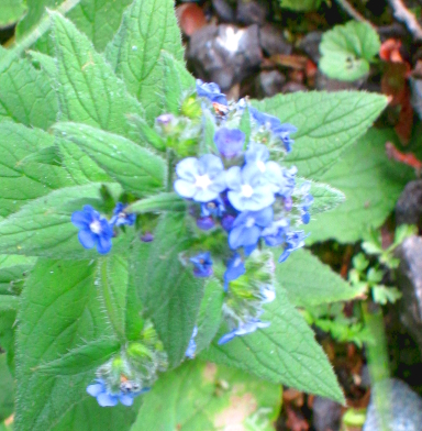
On one side of one of these are some of these flowers.
They could be woodland forget-me-nots.
Rising to Higher Things
After the turn off to "Littlemead", the walk gains height and the walker gains a number of views across the countryside. Where the lane starts to rise is where the Frenchman got stuck. There seem to be a number of categories: namely "Bridle Way", "Bridle Path", "Footpath", "Permissive Footpath" and "Public Byway". There are probably more, but "Grange Lane" is a "Public Byway" and much further up there is a sign to verify this.
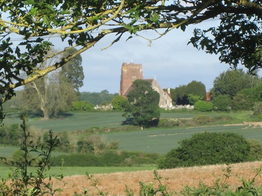
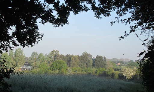
As we gain height, we can glimpse Downham Church through the hedgerow.
Here it is framed by the foliage.
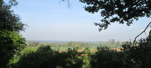
As more height is gained, there is a more expansive view
towards the left (west) and Downham Church.
Coming up to the brow of the hill.
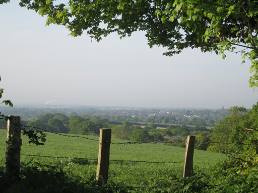
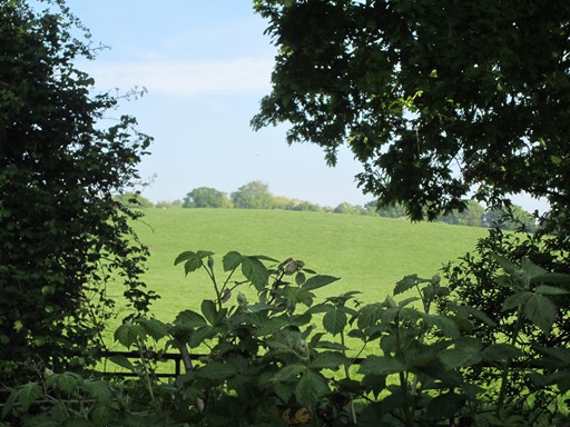
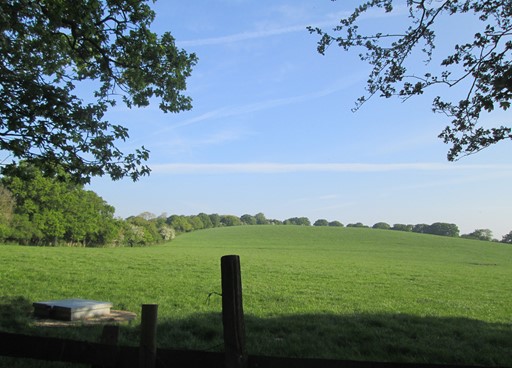
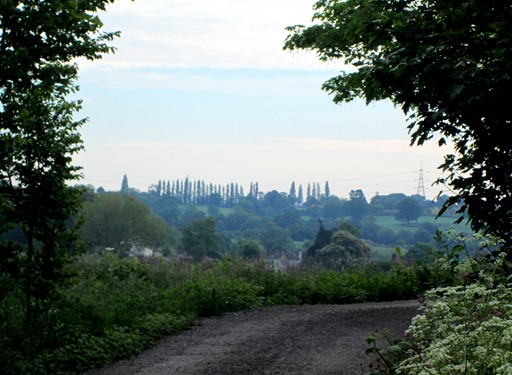
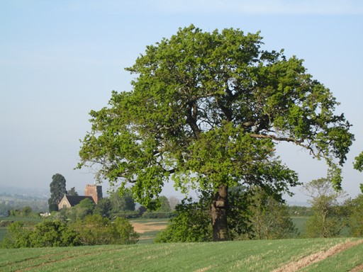
It is then possible to look across to the hills of Kent in the distance.
And here is the distant view in broader perspective.
After the almost 90° turn to the left, there are some more flowers
including some clumps of wood forget-me-nots.
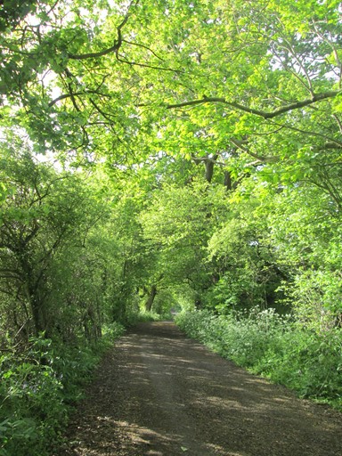
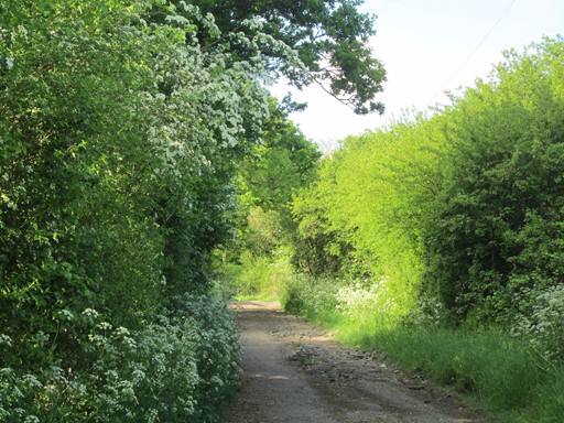
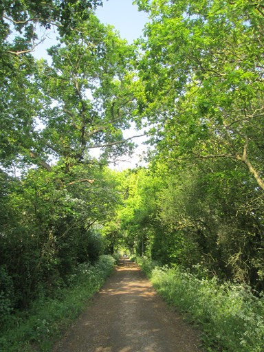
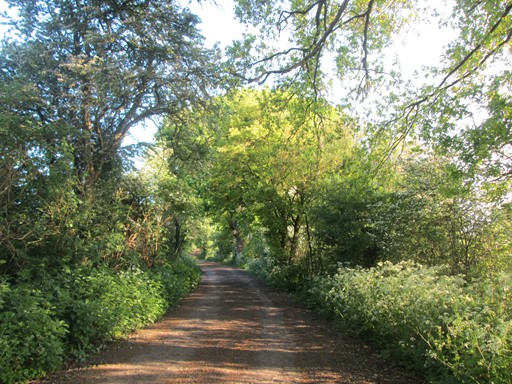
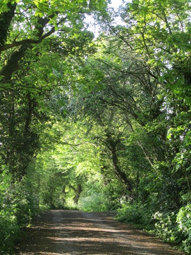
Onward through the green arches.
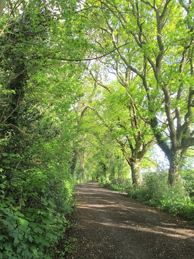
Greenery, sunlight and shade.
More greenery, sunlight and shade.
Yet more greenery, sunlight and shade.
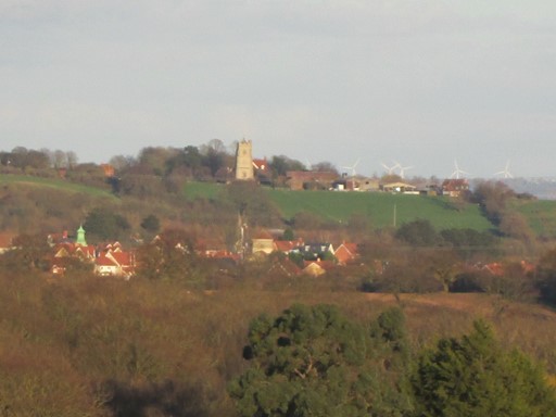
Here Rettendon Church comes into view, together with
those modern age "embellishments" of the rural landscape - wind turbines.
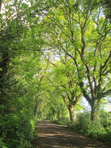
More greenery, sunlight and shade.
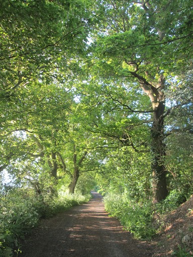
Yet more greenery, sunlight and shade.
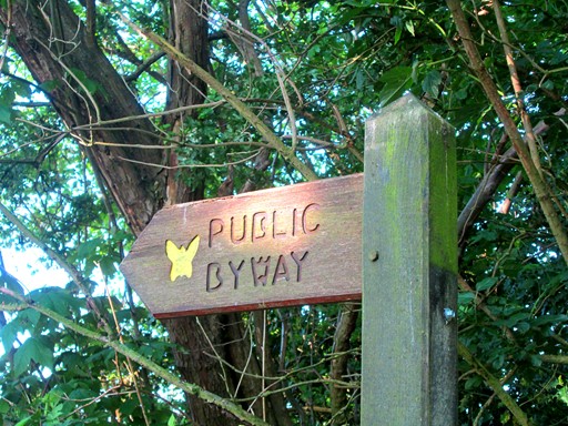
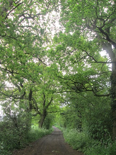
Yes, this is a "Public Byway".
Now, you legal people. What is the definition of a public byway?
Pedestrians, Horse Riders (with horses), automotive traffic?
But, cattle and sheep droving? Now you are asking!
Of course, "Grange Lane" may well have started life, many centuries ago, as a drover's road - cattle and sheep driven to market. The high ground would have provided some protection against marauders. Tough times that long ago!
View towards Brock Hill.
More greenery, sunlight and shade.
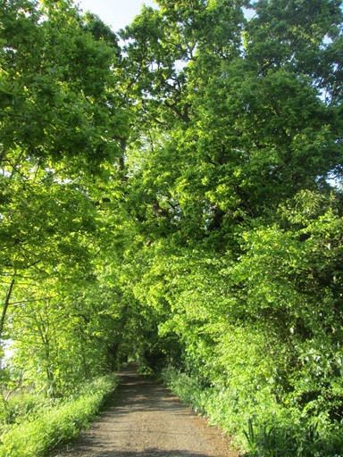
Yet more greenery, sunlight and shade.
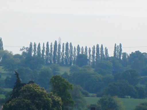
On approaching the "summit" of the walk, a row of Fastigiate Poplars appears on the more distant right. Poplars Farm is close to the poplars. Behind the poplars is the "Running Well"
which gives its name to the village of Runwell.
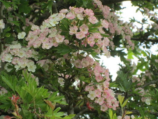
By the path on the right is a Hawthorn Tree.
Hawthorn flowers seem to develop this pinkish hue when they mature.
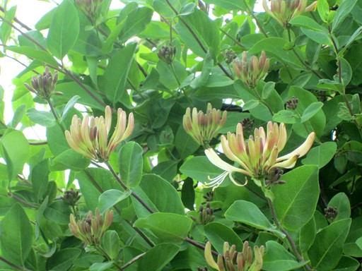
Embracing another Hawthorn, two or three yards further along the path, is some Honeysuckle.
The Honeysuckle seed may originally have escaped from a nearby garden.
Perhaps it was carried from there by the wind or by a bird.
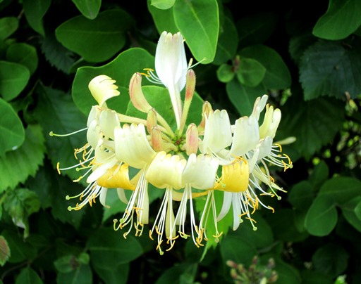
Some of the Honeysuckle flowers have also opened out.
As we get closer to the "summit" of the walk,
the poplars gradually recede into the distance.
Flowers on the Summit
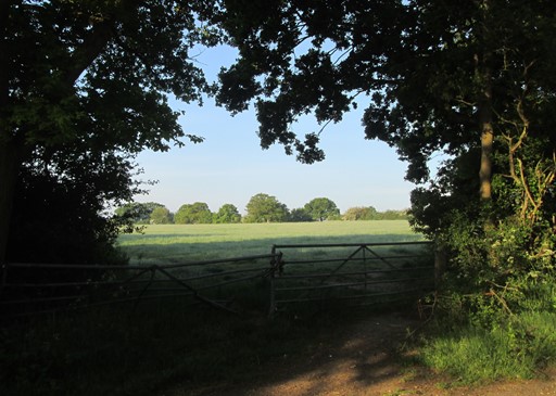
On the summit of the walk there are a number of houses, including the "Grange". There is the expansive view across the field towards Kent and towards the west. There is also small pond. A number of flowers and flowering shrubs welcome the walker. It's worth the walk!
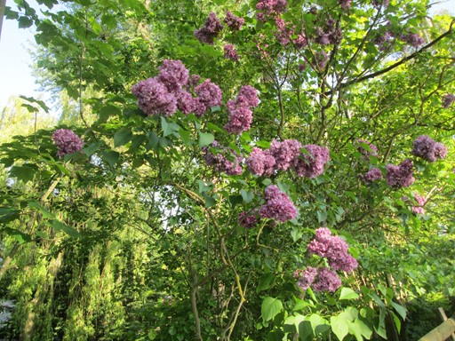
The next feature is a Lilac tree.
Lilac as in "We'll gather Lilacs in the Spring"!

Here are the Lilac flowers in close up.
Behind the Lilac tree is a pond.
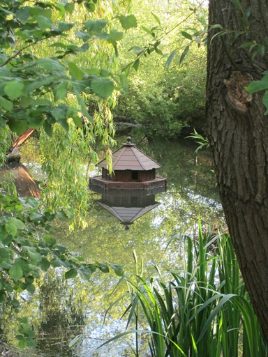
This pond is close to the nominal end of our walk.
This pond was once covered in green algae,
but barley straw saved the day - the pond I mean.
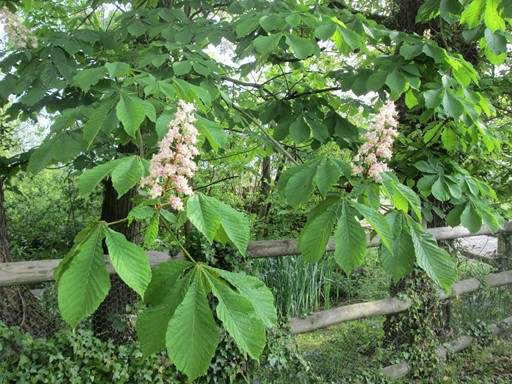
In front of the pond is a small - very small - horse chestnut tree.
There seem to be only six candles on the tree,
so the tree may have quite a few years in front of it.
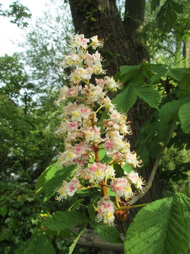
One of the candles in close-up.
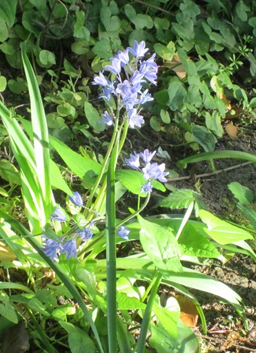
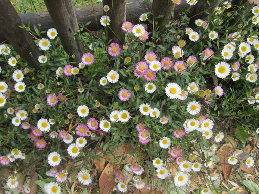
Between the pond and the fence is a shady area. Here I espied what at first sight seemed to be Bluebells. I thought the Bluebell season had passed, with only a few dischevelled specimens remaing before one gets to the "Public Byway" sign. However, it appears that, despite the different colours, they were actually Polyanthus (bluish-purple), a cultivar of Primula (which is yellow).

Yet more Polyanthus are close by.
After the pond and before the Rhododendrons there comes a fence.
Here there is a congregation of common or garden Daisies.
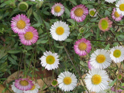
Daisies in more detail.
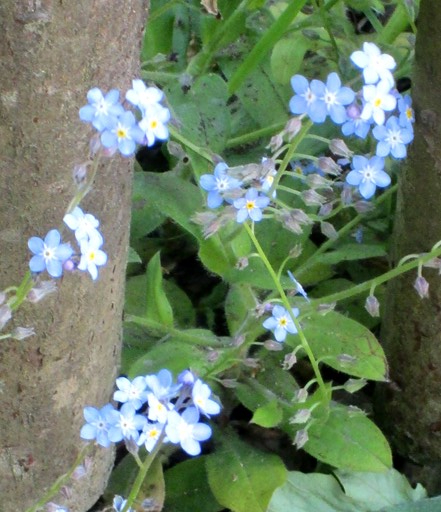
After the Daisies, and by the same fence,
there are some small flowers which appear to be forget-me-nots.
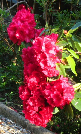
Further on, some Rhododendron flowers grace the front of a house.
"Rhododendron" is Greek for "Rose Tree", in case you ask!
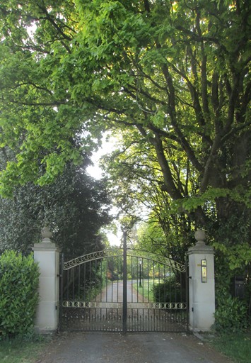
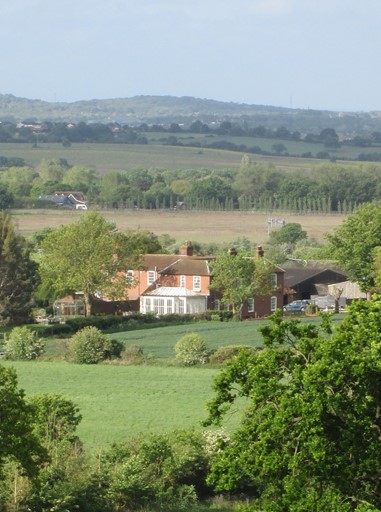
This is the entrance to the Grange. The Grange is a large, rambling, Edwardian house originally built for the family that owned the large "Keddies" department store in Southend and a number of smaller shops besides. The Grange occupies an outlying spur of the hill we have just climbed. Since Edwardian days, the house has had several owners. Three members of the Keddie family died in action in WWII, as the war memorial by Downham Church (not on today's walk, but, of course, seen from today's walk) tells us.
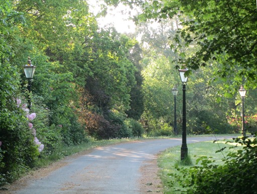
Behind the main gates, the Victorian style street lamps exude an air of elegance.
Some flowers line the left of the drive.
Views from the Field
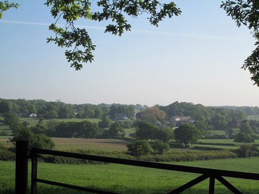
Access to the field itself is by the courtesy of the farmer. It may be possible to go around the edge of the field. The crops must be respected, and the farmer may change his view depending on circumstances. However, the view from the field is impressive. There are a number of features in the landscape, the immediate features towards the west being Downham Church and Downham Hall nestling below it.
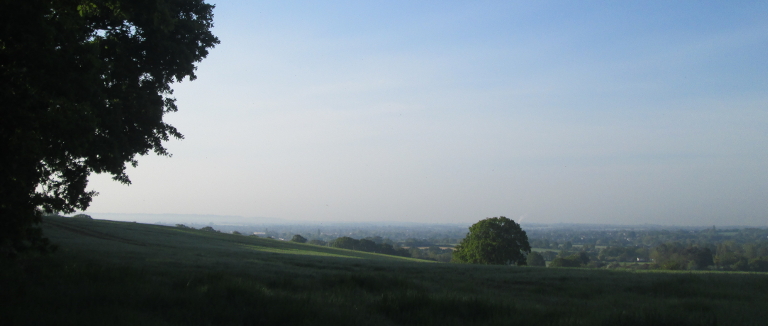
Here is the view towards the south and Kent.
It looks dark because of the early hour and the sun is still rising in the east!
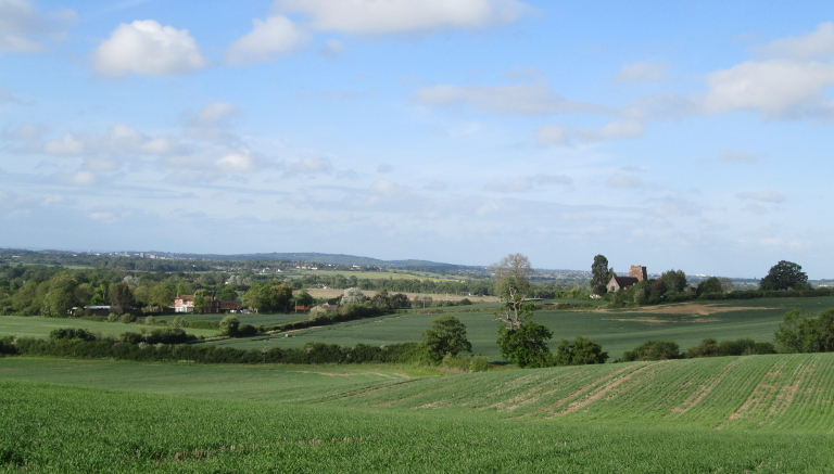
Here is the view towards the west.
The view towards the west and Billericay takes in
Downham Church (to the right) and Downham Hall (to the left).
What you are looking at is an example of the local mediaeval axis of power. Between them, the church and the squire (in the Hall) - power divine and temporal - held sway over the local community. Many English villages have this set up - the church, and usually very close by, the Hall.
Here again, framed by the oak, is Downham Church (see also this link) which is dedicated to the dragon slayer, Saint Margaret of Antioch. The red brick tower is believed to be from the 15th century, but the Victorians "restored" the remainder of the church, which was rebuilt again after a fire in 1977 and subsequently reopened in 2000.
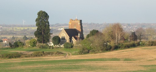
Here is another view of Downham church in the wider landscape.
Downham Hall was once the home of the De Beauvoir family.
The present building is smaller than the original 17th-century mansion.
(See also Wikipedia entry for further info on Church and Hall.
Floral Finale
The "summit" marks the place to your retrace steps. So it's your chance to savour again the natural variety on the walk. It's only one mile back, so why not take the return at leisure, in case there was anything you missed on the way up!
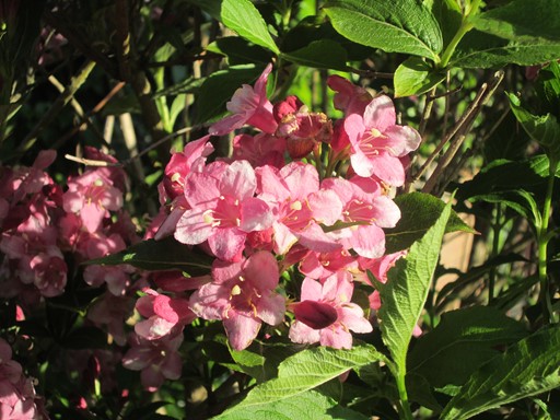
Right at the end of the walk we are just in time, at this time of year,
to be able to appreciate the bright flowers which I think are Azaleas.
A colourful note on which to finish the walk!
Thank You
Thank you for visiting this web page and doing this virtual walk. As I hope this walk shows, there is much to see in the world about us. Indeed, the world rewards walkers who cultivate an observant and a perceptive approach to life! Much that is new and interesting can be learnt and appreciated, even within the constraints of challenging times such as the present! Oh, and for the actual walk, don't forget your walking boots!

A Healthy mind in a healthy body.
The body to walk. The mind to observe.
The Old Romans knew a thing or two!
Eric Scharf
Original Version: 2020-05-10 @15:24
Updates: 2020-06-07 @14:47 & 2021-05-03 @13:45
SAGAX REX HANC RETIS ORBIS PAGINAM PINXIT ANNO MMXX ET MMXXI.
© Eric Scharf 2020 & 2021