 |
GODALMING CIRCULAR 2015 - September - 27 |
|

Our Walk
Our Sunday walk of about 11 miles (17½ Km) was led by Danish (pronounced "Darnish") on behalf of Helen, his better half, one of whose favourite walks this is. I had actually done this walk as an IVC walk 5½ years ago, but it was well worth reliving my old memories!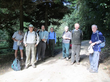
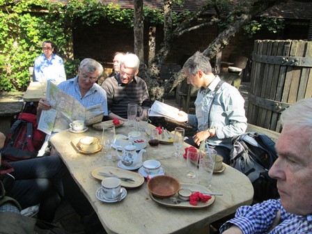
On the first part of our walk, some of us pose for a group photoograph.
Our walk took in some interesting facets of the Surrey Countryside. We saw the Wey in its busy incarnation as a (leisure) Navigation, and in its more tranquil mode upstream from Godalming. The Hog's Back, that geological divide between London Clay and Surrey Sand kept us company on the northern reaches of our walk. The 16th century Withies Inn on the outskirts of Compton made a nice lunch stop, and Loseley Park, normally very sedate and quiet, today echoed to the sounds of day tripper merriment and Clay Pigeon shooting. The historic Saint Catherine's Chapel - at one tine marking the river crossing point for Canterbury Pilgrims, welcomed us to the Wey Navigation. Before we reached Godalming along the Wey, we enjoyed a nice evening tea at the Farncombe Boat Hire. A nice IVC day out.
So here is what this page has in store for you. Even if you were not able to join us, here's your chance to find out how we enjoyed our nice early autumn Sunday IVC event.
- Getting to Godalming with a Railway Flavour
- Our Pre-Prandial Walk
- Our Lunch Stop at the Withies
- Loseley Park - Fun Fair and History
- Saint Catherine's Chapel on the Pilgrim's Way by the Wey
- Sunny Afternoon along the Wey Navigation
- Map, Heights and Some Figures for those who like to Wax Numerical
- Thank You All for a Nice IVC Day Out!
- Please Read Me
Enjoy your browse!
Railway Journey to Godalming
The journey to Godalming was, like to the start of many hike events, by rail. However, this time, the arrival was even more railway focussed than usual. It started with the famous clock hanging over the concourse of Waterloo Station. And then there was an extra special dose of "railwayana", for inside the ticket hall of Godalming Station there is a display of fading pictures illustrating local railway history. I have tried to breathe new life into the three display pictures I show you here, by using some image enhancement, which hopefully has not blunted their original visual appeal. What all this goes to show is that there is often so much to see and do, even while waiting for a train or two!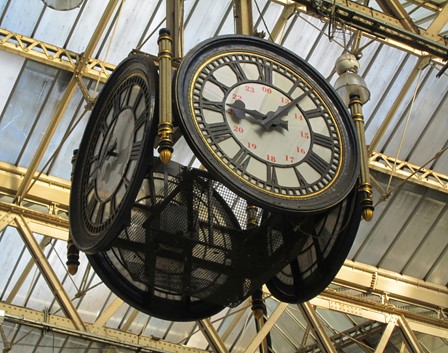
This 4-faced clock hangs from the roof of Waterloo Station and is thought to date back to the 1920s.
It provides a well-known meeting point on the often crowded station concourse.
The clock shows 09:07 - there was some delay with the trains, so it seemed a good idea to take the delayed 09:00 and wait at Godalming Station.
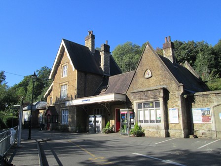
Godalming's station dates back to LWSR times, 1859 to be precise.
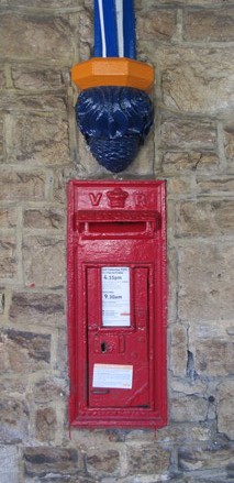
Victorian railways were a very effective way for transporting mail. This mailbox is on the station platform and proudly displays its "VR" credentials. In true British style, layers upon layers of "pillar-box red" paint have been applied to it over the decades, but the "VR" initials still stand out in defiance of the enthusiastic painters.
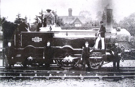
One of the fading pictures displayed inside the ticket hall at Godalming dates back to 1885 and shows "Phoenix", a Beattie well tank, at Godalming Old Station. These engines were originally intended for London suburban passenger duties on the LSWR. Two of these engines have now entered preservation (in operational condition). Whilst the Victorians had already become used to steam powering industry and transport, photography was still very much a novelty, and people would try and get themselves on the picture whenever a photographer was at work - glass plates and tripods and long exposure times in those days. Here are the driver and fireman of "Phoenix" and four others - presumably colleagues "at work". For many, the Victorian railways must have offered better job prospects than the traditional, centuries old, agricultural sector.
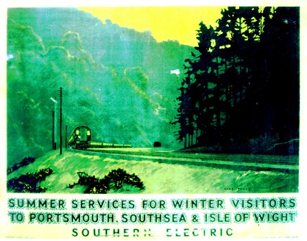
In comparison with the GWR, LNER and LMS, most of the Southern Railway routes were shorter, although very intensively used. This led to the Southern becoming a pioneer in main line electrification, and this poster, dating back to 1937, proudly states that the Waterloo to Portsmouth route was now fully electrified. Indeed, electrification was very popular with the travelling public. The technology of the day favoured third rail 660 V DC electrification - less unsightly but operationally less efficient, than today's preferred 25 Kv overhead approach.
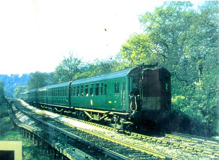
This is a train of Southern electric multiple unit stock, in British Railway days, judging by the livery. The front yellow warning panel suggests a scene from the 1970s.
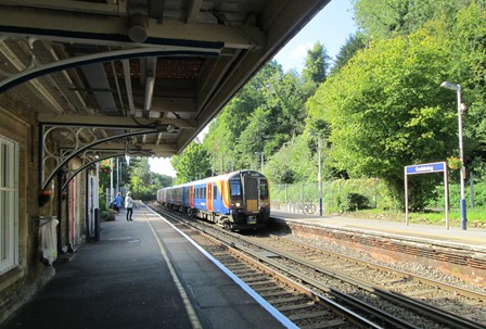
By comparison, outside, in the real world of today, a London-bound train of modern - but still third rail - stock, enters Godalming Station. The scene is partially framed by the Victorian platform awnings gracing the down platform.
To Compton in the Morning
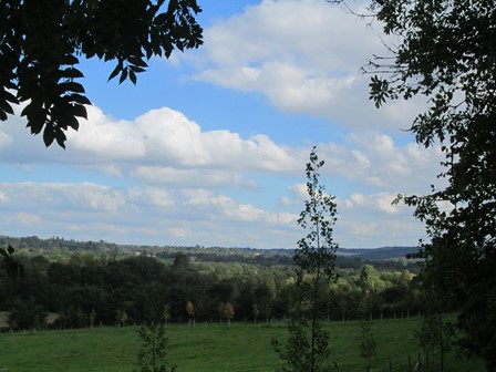
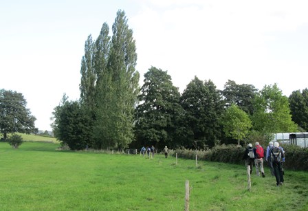
We leave Godalming in an easterly direction along the wooded banks of the River Wey. Surprisingly, the path out of Godalming is a tad challenging to find, but nothing is too daunting for intrepid IVC hikers! Eventually, after a slight deviation and a check on our trusty OS maps, we take a sharp turn to the north and reach the highest parts of our walk. After Foxhanger Cottage, we see the Hog's Back, and know that we are getting close to our lunch-time stop at the attractively affluent 16th century Withies Inn on the outskirts of Compton.
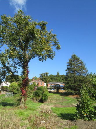
We leave Godalming amid the lush green early autumn surroundings along the River Wey.
There is time for a group photograph amid the arboreal surroundings of this neck of the woods. Thanks for reminding me about facing the sun! Lighting is of course highly relevant in photography!
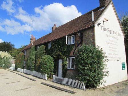
A slight deviation brought us to the "Squirrel Inn", pictured here because it looks quite pretty.
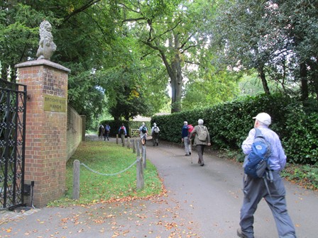
As we leave Hurtmore, one of the stone lions guarding Broomfield Manor watches us intently ...
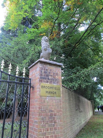
... as if to make sure that we stay on the path dedicated to the public!
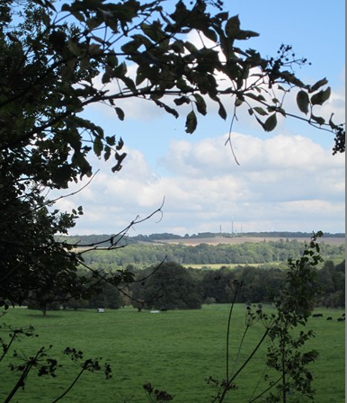
After Foxhanger Cottage we get this view of the Hog's Back to the North ...
... and to the North East.
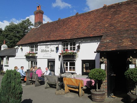
Lunch at the Withies
We stop for an hour or so at the 16th Century Withies Inn on the eastern outskirts of Compton. Compton is associated with the Victorian sculptor, G.F. Watts, whose statues include "Physical Energy" - the horse and rider in Kensington Gardens. Compton Church, Watts Chapel and Watts Gallery are all interesting for the visitor, but for us, they'll have to wait for another time. The Withies Inn is definitely a favourite "Watering Hole" for the affluent locals - service excellent, even when crowded, but prices reasonable.
These are not part of our group, but happen to be enjoying life by the front door.
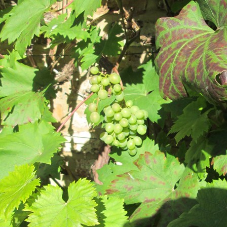
These grapes will probably not ripen, but the rambling grape vine is a nice backcloth for our visit.
After our midday refreshment, we are almost ready for the next "leg" of our walk, however, it is always good to know from the map where we are going!
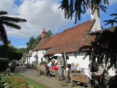
A last look at our lunch time stop and we are off.
Loseley Park
Suitably refreshed, we head, in a slightly circuitous way, to the northern reaches of Loseley Park and discover that a fun fair is seriously in progress - many visitors and many stalls and activities, no roundabouts but (as our host at the Withies told us) much clay-pigeon shooting. Definitely an event for day trippers who may not have realised that today's activities are probably an exception in the normally sedate surroundings of the Elizabethan Loseley House.
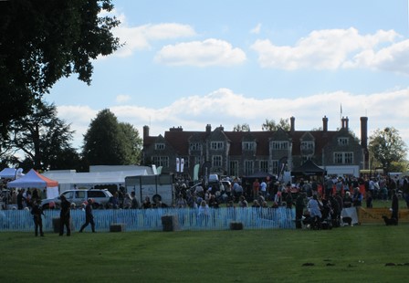
At Loseley House today, there is a fun fair without the roundabouts but with noisy clay-pigeon shooting. Probably all this commotion helps to bolster the finances of Loseley's Molyneux family!
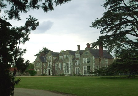
On Thursday, 13th May 2010, I last visited Loseley House, and then it was much more peaceful - what one would expect the traditional English Country House to be. At the time it was a cloudy day, so my picture does not jump out at you in chromatic splendour!
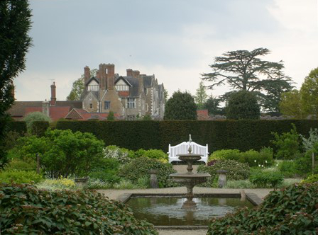
The gardens of Loseley House also merit a visit if you have a chance. Here you see part of the gardens on the same dullish day, 5½ years ago. Despite the clouds, and it being still spring at the time, the gardens already showed some of their summer promise.
Today, we skirt around the hectic goings-on at Losely Park, and head past the pond, on on towards the River Wey at Saint Catherine's Chapel.
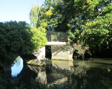
Saint Catherine's Chapel
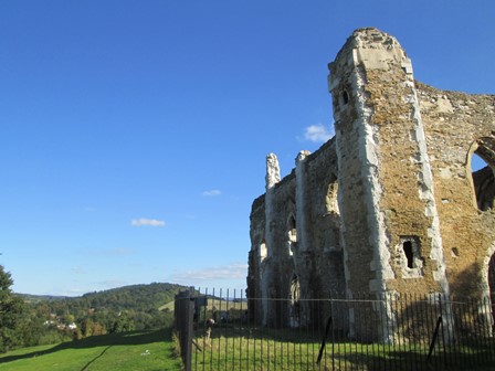
The remains of the 14th Century Saint Catherines's Chapel proudly command the position above the crossing point of the River Wey and the Pilgrim's Way (Winchester to Canterbury). The pilgrims were taken across the river by ferrymen who probably made a nice little earner from their occupation. Even Turner came along around 1830 to paint the hectic activities at the annual two-day Saint Catherine's Fair. Anyway, the short two minute climb to the Chapel is well worth the views and the opportunity to immerse oneself in a bit of English history.
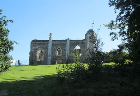
The ruins of the chapel greet visitors on their short climb.
Here's looking back to the ascent and enjoying a view of Guildford to the North.
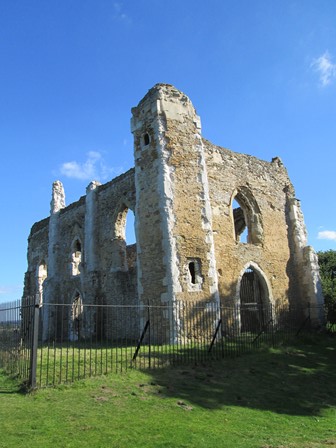
The chapel ruins are as well preserved as ruins can be.
This is looking eastwards to the opposite bank of the Wey,
where the Pilgrim's Way continues past St Martha's Church and on to Canterbury.
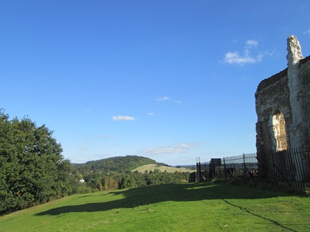
And here is the view again.
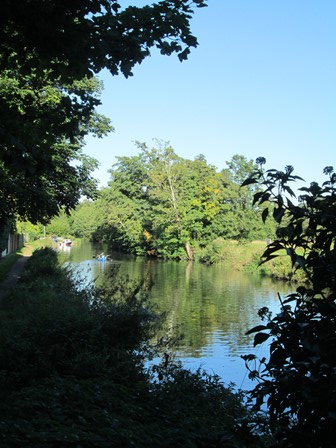
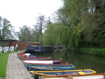
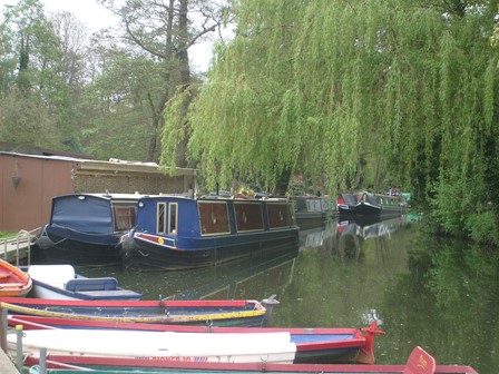
Sunny Afternoon along the Wey Navigation
The stretch of the Wey Navigation from the foot of Saint Catherine's Chapel to Godalming is about 3½ miles. For us it's a leisurely Sunday Walk as we take in the sleepy river scene - locks, boats and trippers. The tea at the Farncombe Boat Hire is a splendid way to finish what has been a lovely walk.
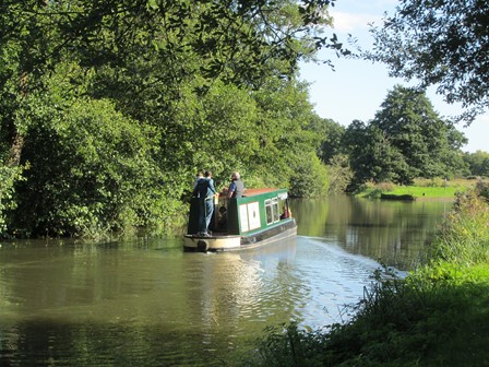
It's busy on the Wey today - in a leisurely sort of way - with boats going south ...
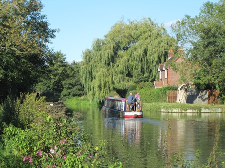
... and boats going north, all at dizzy speeds of about three to five miles per hour.
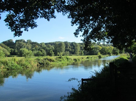
In the intervals between boats, the Navigation relaxes into a deep sylvan slumber.
This is at Trowers Footbridge.
As we look north from the said footbridge, some boats are coming into view. These are pleasure boats of course, and not the freight boats for which the Wey Navigation and similar canals were originally constructed before the advent of the railways.
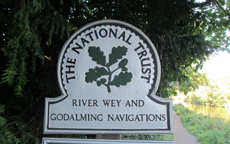
Here we are reminded that the National Trust plays a key role
in preserving much of the Nation's heritage.
Here is Trowers Bridge itself, which was probably built between 1760 and 1782 as part of the entrance drive to Unstead Park. The centre span appears to be a more recent renovation of the original 18th century span.
This is the pleasant scene at our riverside tea stop at the Farncombe Boat Hire. The scene, your company and my pot of Earl Grey Tea and flapjack
were all a nice way to end a nice day.
Here is another view of our tea stop scene. This and the previous view actually I photographed on a previous IVC walk, which followed the same route as today, but 5½ years ago on Sunday 9th May 2010. However, the scene itself has not really changed over half a decade.
Some things appear to be timeless!
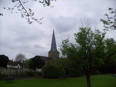
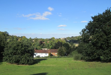
Shortly before we reach Godalming Station, we are greeted by the evening silhoutte of Godalming's historic church. We also passed this view on the outward "leg" of our walk. I also took this picture on 9th May 2015, but the scene has changed little since then, so it's probably OK to include it here.
Our Walk - Some Facts and Figures for Fun!
Our Sunday walk of a leisurely 11 miles (17½ Km) was led by Danish on behalf of his better half, one of whose favourite walks this is. Our clockwise circular walk took in some typical Surrey countryside - and was an invigorating, yet relaxing, way to welcome the autumn.
Now prepare ye for some plots and graphs. Not too overwhelming, but hopefully quite interesting! You will see here:
- An Outline Map of Our Walk
- Height Profile of Our Walk
- Some Facts and Figures
- Average Rising and Falling Gradients
Outline Map of Our Walk
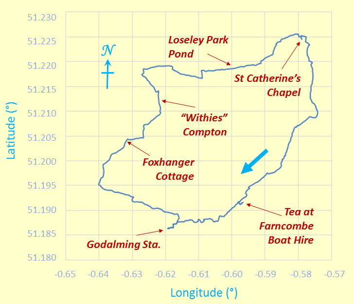
Outline Map of Our Anti-Clockwise Circular - or should it be "Triangular" - Walk
The minus signs for the longitude angles indicate "degrees west of Greenwich". The map grid scales translate to 0.6972 Km per 0.01° longitude and 1.1119 Km per 0.01° latitude, all when using 6371.0 Km as the volumetric mean radius of the earth - derived from the WGS84 standard!
Height Profile of Our Walk
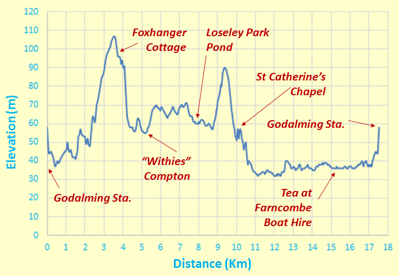
Height Profile
This height profile emphasises that our main climb was in the morning when we reached 107 m (351 ft), having started at at 58 m (190 ft). In the afternoon, we dipped below railway level on our walk along the Wey Navigation. All quite leisurely!
Some Facts and Figures
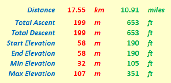
"Walk facts and figures"
Here are some "vital statistics" in metric and imperial units. Of course, the total ascent (here 199 m) usually exceeds the difference between maximum and minimum elevations (here (107 - 32) m or 75 m); I'd suspect things, if the reverse transpired! Start and end elevations are the same at 58 m and total ascent and total descent are also the same at 199 m - as expected, for this walk was circular after all! I can pat myself on the back (hmm, hmm) for doing the hand plotting reasonably accurately!! The total distance, as always measured on a conceptual "flat" plane, is 17.55 Km or 10.91 miles.
Average Rising and Falling Gradients
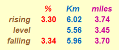
Rising and Falling Gradients
And here, for the numerical fun of it, are the average gradients we overcame on our walk. The rising and falling (negative) gradients are both averaged over the distance given, with level stretches having rises and falls of less than ± ½ metre. By comparison, Hertfordshire County Council recommends that its roads should not have longitudinal gradients of more than 5% and one of the steepest adhesion railways in the world, in Austria, has a maximum gradient of 11.6%. By way of further interest, the clockwise route of the Fairfield Horseshoe in the Lake District has a total distance of 15.62 Km (9.71 miles), with the following calculations: an average rising gradient of 14.66% over 6.589 Km, a level part over 0.345 Km, and an average falling gradient of 11.11% over 8.676 Km. This is seen by many as really quite challenging - but then, when you compare it with our Godalming walk, it can be said that in Surrey we had a more leisurely and less demanding aim compared with Lakeland challenges!
Thank You All for a Nice IVC Day Out!
Thank you Danish for leading this walk - indeed, one of your wife's favourite walks. So also thank you to Helen for putting it on the IVC agenda. Thank you all for your good company. It certainly has been a nice and successful day out - lots of nice countryside and good exercise AND excellent weather for walking. A rewarding way to spend an early Autumn Sunday - the Autumn Equinox was only a few days ago!
Eric Scharf
Original: 2015-10-02 @12:47
SAGAX REX HANC RETIS ORBIS PAGINAM PINXIT ANNO MMXV.