 |
GUILDFORD CIRCULAR 6th July 2014 & 10th April 2016 |
|

Our Sunday Walks around Guildford
An interesting and varied walk through some of the best of Surrey. This how Paul, who first led this walk almost two years ago on Sunday, 6th July 2014 described it at the time. This description certainly stood the test of time when he led this walk again, with a slight variation, almost two years later.
Our two Sunday IVC walks, which I describe here were both "clockwise circular", with Guildford Station as the starting point and with large parts of the respective tracks shared by both walks. The two walks had respective lengths of about 11 miles (2014) and 10 miles (2016).
In the morning, we took in the attractive hilly countryside to the east of Guilford, starting along Pewley Down and continuing to Saint Martha's Hill and - on the earlier walk - also taking in the sandy heights of Blackheath. We then dropped down to picturesque Wonersh for lunch. From Bramley onwards we walked along part of the track bed of the old Guildford to Horsham railway and saw something of the Wey & Arun Navigation which volunteers are striving to resuscitate from its decades-old slumber. Our home stretch into Guildford was along the Wey Navigation, which, as we could see from the numerous leisure barges, is definitely alive and well. Overall, an excellent walk, not unduly taxing on the constitution.
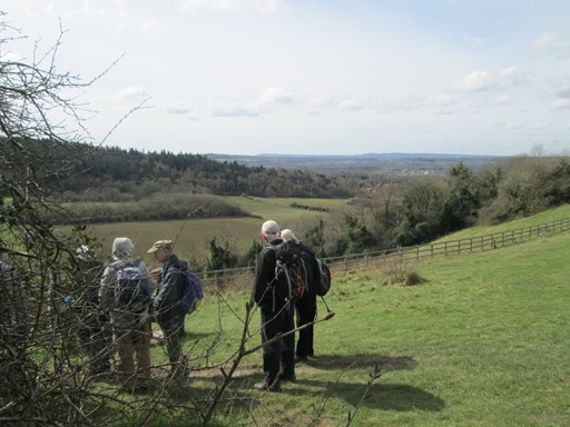
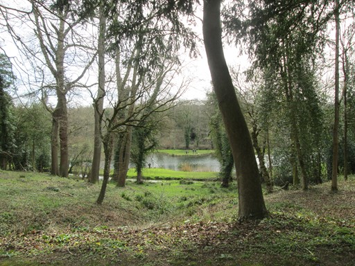
Good views are a feature of these two walks. Here we have just descended from Pewley Down and stop to admire the distant prospect of Hindhead, which is an iconic part of the rolling Surrey Hills.
So here is what these pages have in store for you. Even if you were not able to join us, here's your chance to find out how we enjoyed our two fine Sunday IVC walks in the undulating leafy and sandy Surrey landscape. By the way, captions ending with "[2014]" relate appropriately to pictures I took on our first walk.
- Guildford & Pewley Down
- Saint Martha's Church
- To Wonersh via Blackheath & "The Villagers" (2014)
- To Wonersh via Chilworth Manor (2016)
- Wonersh
- Of Railways and Canals - Our Walk from Bramley to Guildford
- Features of Our Two Walks
- Thank You All for Two Fine IVC Days Out!
- Other Walks in the Guildford and Godalming Area
- Some Technical Bits and Pieces
- Please Read Me - Thank you!
Enjoy your browse!
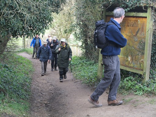
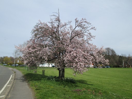
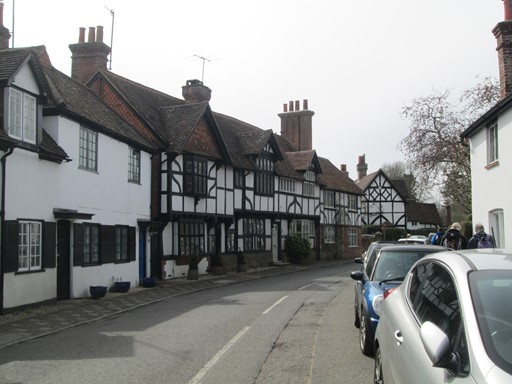
Guildford & Pewley Down
Some of the iconic landmarks of old Guildford are on our route out of town. After our climb past the early Victorian semaphore station, we reach Pewley Down where we are rewarded by distant views to the south, including Hindhead.
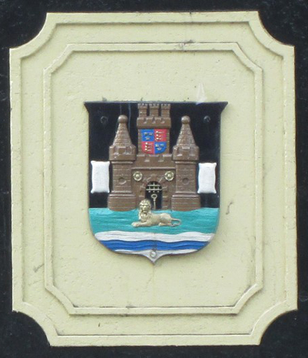
We cross the River Wey by the Onslow Bridge on which there are two copies of these coats of arms of the Borough of Guildford. These crests are of course before the slight official change in 1975.
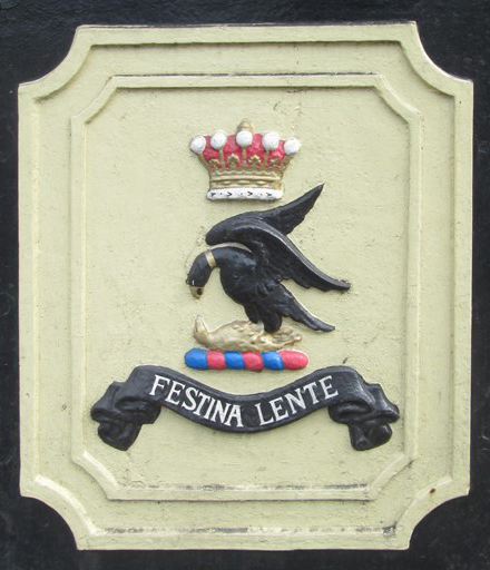
Onslow Bridge opened in 1882 to provide a much needed second river crossing. The construction of the bridge was funded by the then Lord Onslow, whose family home at Clandon Park was recently ravished by fire. The bridge sports two copies of the Onslow family crest, bearing the famous motto "Festina Lente" - hasten slowly. This motto is befitting for adept and seasoned ramblers who can sustain a good walking pace whilst still appreciating the countryside and its interesting features.
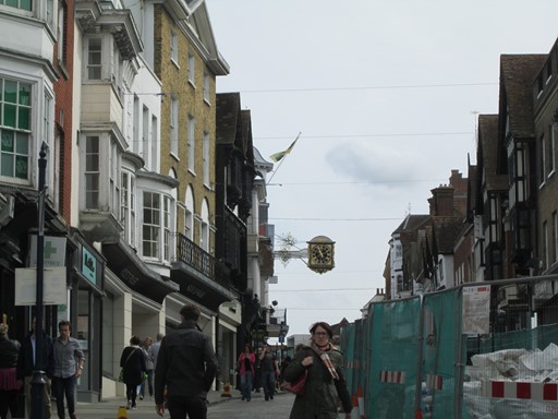
We soon cross the foot of Guildford's High Street, watched over by its famous clock. In the late 1970s, Sundays in Guildford town centre were very quiet, but now on Sundays, the town centre takes on the air of a bustling city, with many famous name shops and stores open for business. However, although Guildford has acquired a university and a cathedral, the town is still steadfastly a borough and not a city.
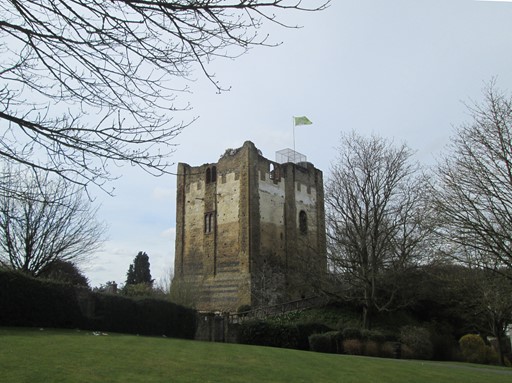
In a short while we escape the busy High Street and pass William the Conqueror's castle with its typical square Norman construction. Quite a few centuries later, castle keeps were made round (e.g. like Windsor Castle) to make life more difficult for assailants with battering rams.
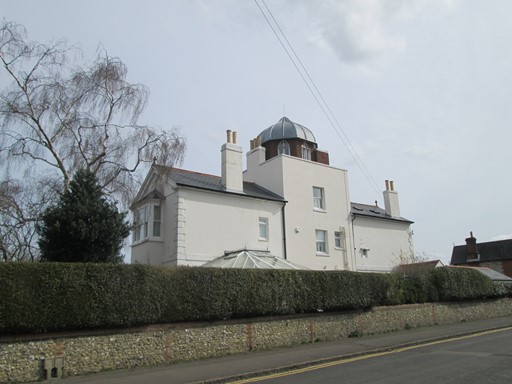
On the climb to Pewley Down, we pass a semaphore station, which was built between 1821 and 1822 to form a link in a chain of such stations between London and Portsmouth. The Admiralty in London were of course keen to be warned of any attack by Napoleon's navy. The electric telegraph came in 1847 and made the semaphore stations redundant, but quite a few of the semaphore stations - like this one - live on as private residences. No doubt, "des res" in this area!
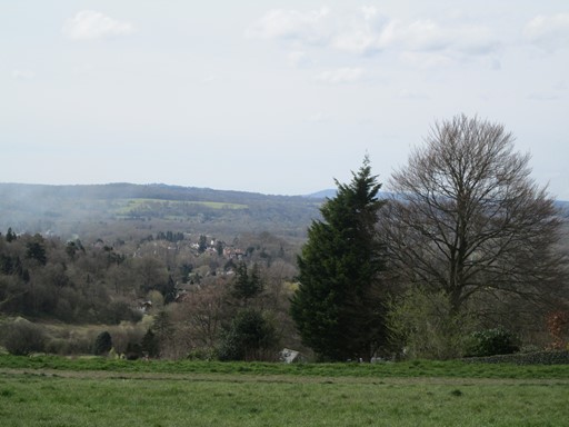
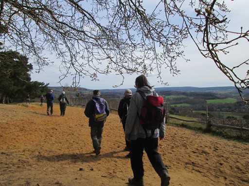
From Pewley Down we have views
across to Hindhead in the distance and down to Shalford just below us.
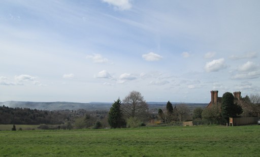
Indeed, we have a splendid wide vista of southern Surrey.
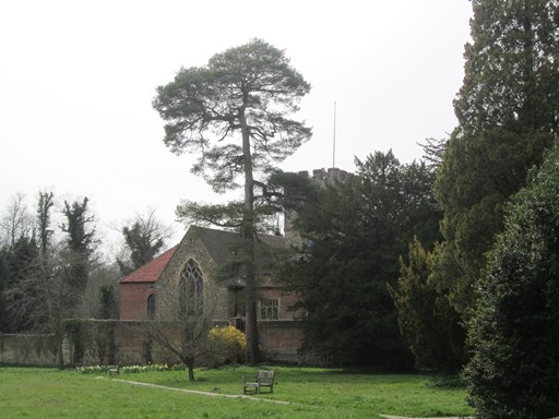
Saint Martha's Church
A "down and up" through a typical Surrey landscape of sand and pines, brings us to Saint Martha's Church, which, at 166 metres (545 feet) above sea level (as defined on OS maps) is the highest point on our walks. The benches outside the church invite us to tarry awhile for a snack and a natter whilst we enjoy the fine views across the Surrey countryside. Suitably refreshed in body and soul, we descend on the North Downs Link towards Blackheath (2014) or towards Chilworth (2016).
The distant views accompany us as we descend towards Saint Martha's Church.
We have probably reached our lowest point between Pewley Down and Saint Martha's Church before we start climbing again.
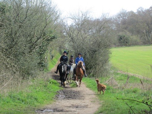
As befits an affluent area, horse-riding is a popular pastime hereabouts.
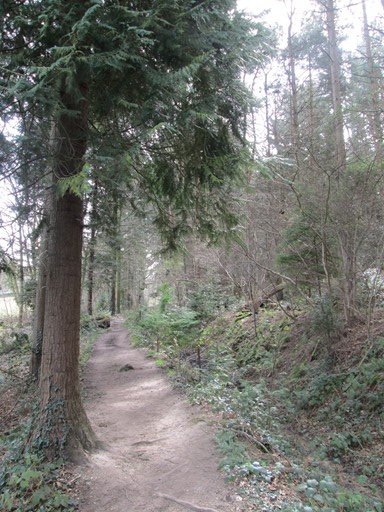
Sandy ground (Bagshot sand beds?) and evergreens - the iconic Surrey landscape.
We start our ascent to Saint Martha's Church, essentially the highest point on our walks.
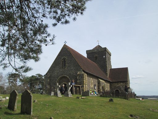
Saint Martha's has a commanding position in the Surrey landscape ...
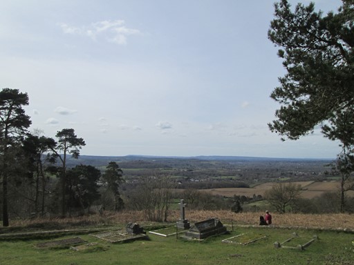
... and from the church we can once again enjoy the expansive southerly view.
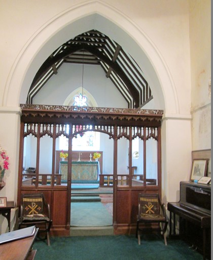
We timed our earlier (2014) walk just right,
so that we were able to have a short look inside the church.
Some prints and pictures tell of its demise and rebirth. [2014]
|
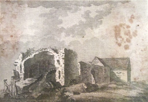
"MARTHA's HILL, NEAR GUILDFORD, SURRY"
(lettering and old spelling intended!) is the title of this print, published in 1772 at No. 25 Ludgate Hill. The name of the publisher is unclear on my photograph - it reads like "S. Harper". Of course, creating and publishing pictures was a great thing before photography, so a "song and dance" was invariably made about the production of these prints. By the way, the mount and frame on this page are my embellishments, courtesy of HTML5.
The original 12th century church on the present site had fallen into ruin by the 18th century, as the picture shows. The two gentlemen on the left of the picture may have just made the climb up to the site, and appear to be taking a close interest in the ruins, which to them, so it would seem, are not just any old pile of old stones. Our 18th century visitors had to wait until the next century for the church to be rebuilt. Indeed, it was rebuilt in the original Norman style, between 1848 and 1850, and is now Grade II listed. Howzat for a bit of history! [2014]
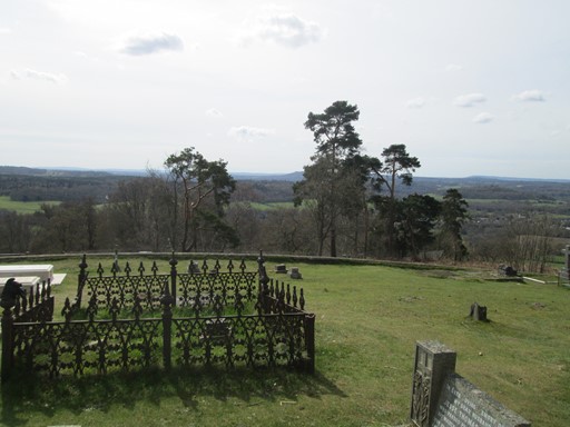
Outside in the sunny churchyard we can enjoy
a distant view over the Surrey hills towards Hindhead.
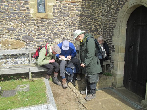
There's time to consult the "OS oracle", ...
... ere we wend our scenic way towards the North Downs Link.
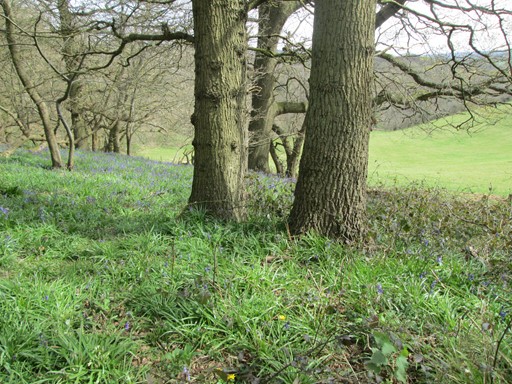
It's Bluebell time ...
... on the North Downs Link.
To Wonersh via Blackheath & "The Villagers" (2014)
On our 2014 walk we scale high ground of Blackheath, where we can soak up yet more of that iconic Surrey ambience - sandy ground and Scots Pines. At the same time, we mourn the closure of the much loved "Villagers" pub, and have our packed lunches on the edge of the local cricket green.
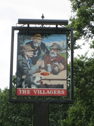
"The Villagers" was a pub much loved by locals and walkers alike. [2014]
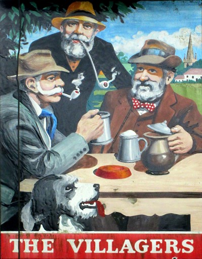
It closed several years ago and its present owners don't seen to favour attempts by the local residents to save the building from dereliction and convert it into a community centre with useful facilities plus a pleasant place for a drink. The pub sign has still not been completely weathered by the elements and the characters depicted thereon seem as if they might not be out of place in that long running story of country folk - "The Archers". [2014]
To Wonersh via Chilworth Manor (2016)
Our 2016 path takes us past a vineyard to Chilworth Manor (grade II listed) and on past daffodils and snowdrops - it's spring time you know - and some parkland complete with an actively used fishing lake.
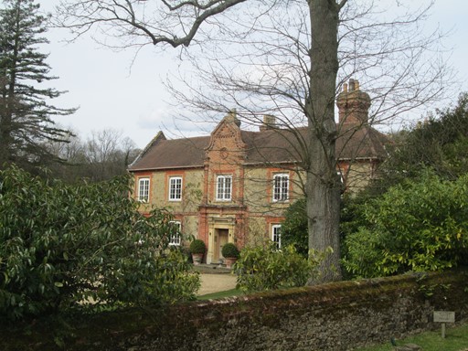
Chilworth Manor dates back to the monastic times before Henry VIII.
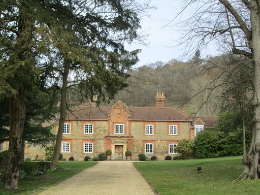
Chilworth Manor has been considerably altered over the years and now sports a Dutch-style gable. Despite alterations, English Heritage has bestowed a Grade II status on the said edifice.
The nearby parkland is probably connected - at least historically - with Chilworth Manor. The lake may have been a source of fish for the original monastery and for subsequent occupants of the Manor. Questions for local historians.
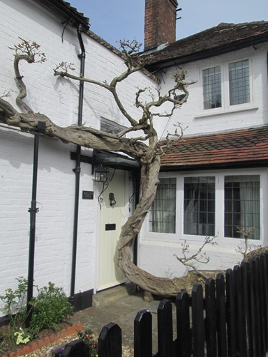
Wonersh
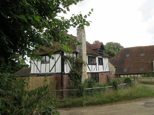
Our two paths - 2014 and 2016 - meet at a "ye olde" half-timbered house behind which lies the historic "Great Tangley Manor". Some picturesque spring time blossom later, and we reach the "Grantley Arms" in down-town Wonersh. We then aim for a row half-timbered houses in the main street, which leads to the village church and to Wonersh Bridge, whose brick parapet greets us with some interesting snippets of local history.
This half-timbered house marks the joining of our two paths - 2014 and 2016.
(I took this picture in [2014]).
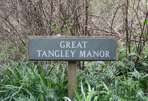
Behind lies Great Tangley Manor.
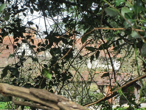
Its Tudor appeal can only be glimpsed from the public path. Any closer, and we are trespassing!
In Wonersh this tree ...
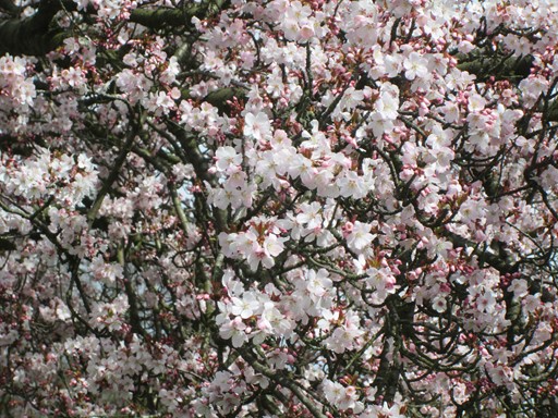
... tells us that spring has surely come again!
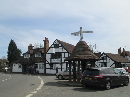
The "Grantley Arms" in down-town Wonersh now sports a very boring pub sign.

Two years ago in 2014 the old pub sign gave an interesting flavour of local history. In addition, the pub itself now gives the unfortunate impression of asking high prices for small portions of food. Anyway, walkers are a resourceful lot who have learnt how not to have to rely on pubs when enjoying a day in the country. [2014]
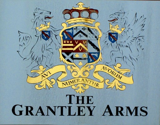
The inn sign of two years ago displayed the coat of arms of the local "Grantley" family, whose motto was "Ancestors are counted of Ancestors". Err, well, in better English that translates as "I am descended from a long line of ancestors". Aren't we all?
Yes, but the motto probably suggested a sense of permanence and being embedded in the locality - at least as far as the Grantleys were concerned. [2014]
We leave town via the half-timbered houses which line one side of the high street ...
... while, opposite, a very mature Wisteria attracts our attention.
Once in flower, it'll look a right purple treat.
The old church shyly looks out from its sylvan embrace, ...
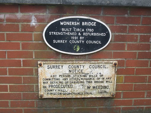
... ere we reach Wonersh Bridge, whose parapet regales us with snippets of the bridge's history.
Transport of the Past & Guildford of the Present
Railways and the canals before them once reached many far-flung corners of the land. On our Guildford visits we walk along the part of the track bed of the old Guildford-Horsham line, where it hugs the remnants of the Wey & Arun Canal. Our "home straight" into Guildford takes us along the Wey Navigation, which is still "alive", but where leisure activities have long since supplanted the freight traffic for which the Navigation - linking the Thames to Godalming - was originally constructed.
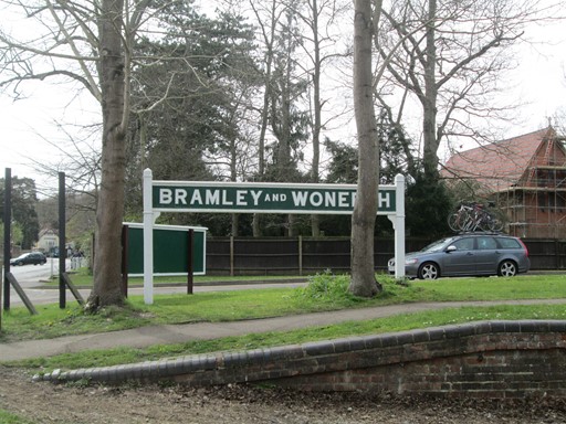
We reach Bramley and Wonersh Station on the Guildford-Horsham Line. This 31 Km (19¼ mile) line passed through Cranleigh but was always regarded as a loss-making enterprise. It closed on 14 June 1965, four months before its centenary and before Beeching wielded his (in)famous axe. Nowadays it takes longer to reach Guildford from Cranleigh. A tramway solution was at one time proposed to regain the former speed advantage which the railway had, at the time of its closure, over present day road-based transport.
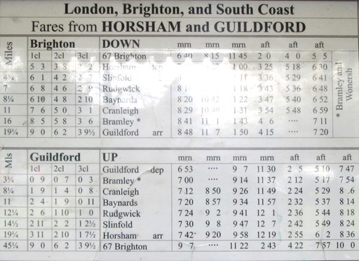
This timetable appears in the station shelter and is taken from Bradshaw's Timetable for February 1890. (Apologies for the light which wanted to reflect and which I could not deflect - as it were.) It appears that every day (it's not clear if this included weekends and public holidays), there were 6 trains in each direction, of which 5 were through trains. Of additional interest are the three classes, the fares, and the use of "mrn" and "aft" - no "AM" or "PM", let alone a 24-hour clock!
Overall timings for the journey vary by a minute or so between journeys, but if we assume 50 minutes for the total journey between Guildford and Horsham and 2 minutes pause at each of the five intermediate stops (for passengers, parcels and small goods items), the total time spent on the move is 40 minutes, giving an average speed of almost 30 mph. Quite leisurely, and less than what you would expect for free-flowing traffic on today's motorways.
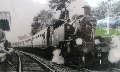
Whilst the line closed completely - for passengers and freight - in 1965, the last passenger train actually ran three years earlier. Here it is, headed by an LMS Ivatt 2-6-2T loco, with a "THE END" headboard, and making its sad journey to Horsham. Health & Safety was probably not on the mind of the young chap on the left, dangling his legs over the edge of the up platform. This picture is also displayed in the station shelter. (Once again, apologies for the reflected light, which is competing with the steam in this picture.)
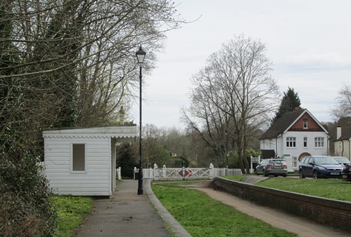
This is Bramley Station today.
In the 1920s, private cars began to creep up on the railways by stealth. In that context, the cars on the right of the picture tell us a never ending story: new technology is often not taken seriously by large, established organisations until the penny finally drops at a late hour. Examples from today's commercial and computing scenes are, in a way, merely a repeat of the old, old story.
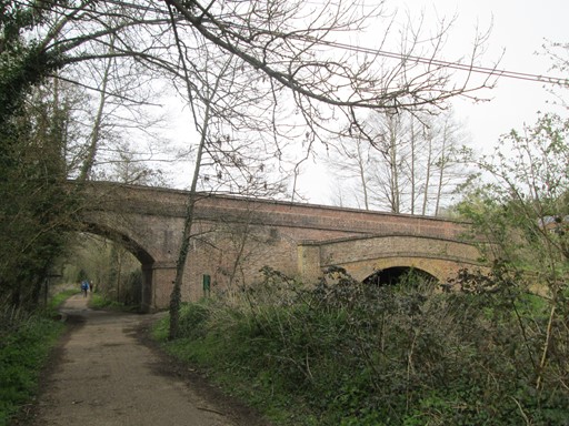
The track bed and the remains of the "Wey & Arun" canal - transport systems from times past - advance next to each other until we reach the Wey Navigation.
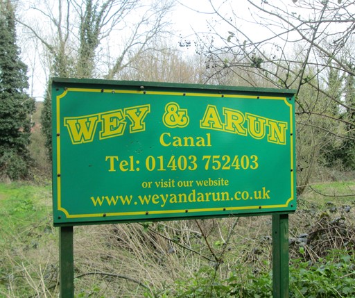
The "Wey & Arun" is the focus of a volunteer restoration bid. However, these efforts take time, even though the tourist industry - and thus the local populace - can potentially reap great benefits from the finished result.
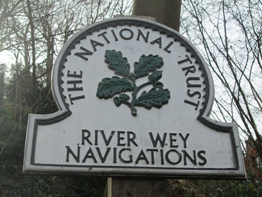
And so we reach the Wey Navigation, that traffic artery that links the Thames, Guildford and Godalming. Our 18th and 19th century canal builders have left us watery legacies which nowadays take on more relaxing dimensions.
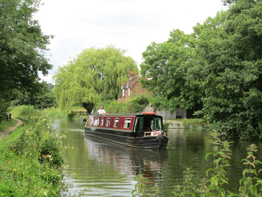
Today, goods and freight have given way to people - those that espouse a leisurely 3 mph with which to appreciate the gradually changing landscape, and with which to escape from the fast pace of modern existence. [2014]
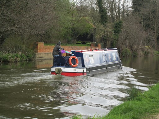
Waves are still made of course, but the boatmen are intensely busy in a leisurely sort of way.
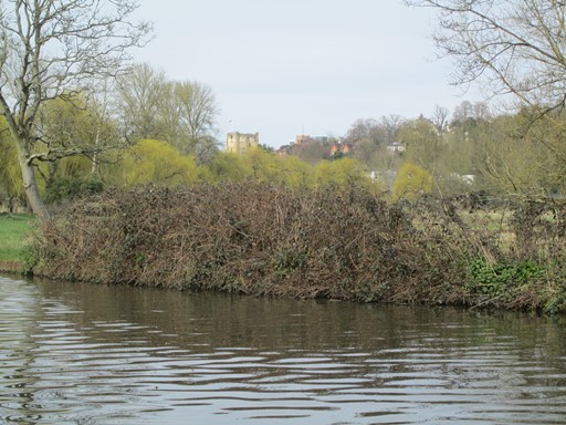
Guildford castle, which we passed this morning, comes into view. Before this point, we pass the spot at the foot of Saint Catherine's Chapel where pilgrims on the Pilgrim's Way used to be ferried across the River Wey. A bit more to add to our "transportation theme".
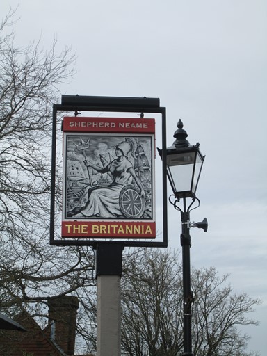
The Britannia Pub is a well frequented Wey-side watering hole. We know that we have almost reached the end of our walk, but for those who enjoy a glass of something and a bit of a chin wag to round off a great day, here's the opportunity..

Britannia speaks of the glorious days of old when of sea battles can be told. But today, we also had our success: more modestly land-based perhaps, but, nevertheless, a walk to be appreciated and perhaps to be revisited on a future occasion.
Thank You All for Two Fine IVC Days Out!
Thank you Paul for suggesting and leading these two walks in the pleasant Surrey countryside. Thank you all for your good company. Thank you to the weather gods for bringing good walking weather with plenty of sunshine and not a spot of rain!
Other Walks in this Area
The Guildford and Godalming area abounds with many possibilities for invigorating walks in pleasant hilly countryside. Nice scenery and plenty of historical interest are both in abundance. To whet your appetite, here are some further possibilities for spending a pleasant day on foot to explore what this attractive part of leafy Surrey has to offer.
- 2015 September 27 : Godalming Circular
- 2015 August 01 : Godalming Circular
- 2013 August 04 : Gomshall to Guildford
Technical Bits and Pieces
There are at least three aspects which I could raise here, including the behaviour of your browser, the behaviour of Windows 10® and general items buried elsewhere on my site.
- Browser Behaviour: If your browser appears to be lazy and does not want to load all the pictures, a friendly press on its refresh button might just get your browser out of its recalcitrant ways. You might notice that in order to speed up loading of individual items, I have split up these pages.
- Windows 10®: I am now using Windows 10® in earnest. So far so seemingly good, and hopefully my continuing experience - and indeed that of other new users - of Windows 10® will remain positive. However, unannounced updates - while now getting shorter in duration - are continuing to be inconvenient for the user, and suggest that Windows 10® is still subject to ongoing development.
- More Technical Items: Whilst I have not had a chance to update the technical items on my "Read Me" page, you might find some further relevant things here.
Eric Scharf
Original: 2016-04-24 @11:11
Updated: 2016-04-26 @13:26
SAGAX REX HANC RETIS ORBIS PAGINAM PINXIT ANNO MMXVI.
© Eric Scharf 2016