 |
OXENHOPE CIRCULAR 2013 - August - 26 |
|
| The Moors Maps Ascent Descent Evening Read Me |
Once More, Out on the Moors!
Our last CLOG walk of an all too short bank holiday visit was a sunny moorland walk. The open expanses of undulating grassland were punctuated by a few pubs (which we only used as landmarks - honest!) and by a few mills whose buildings stayed on as a testament to the busy cloth industry, once the hall mark of this area. In winter, this part of the world could become quite windswept and grey, but today it was a nice summer's day, and we relished the occasion. John E. did the honours, giving us a nice walk, even if his Book of Walks (details to remain nameless) did not always want to play along!
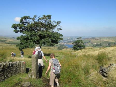
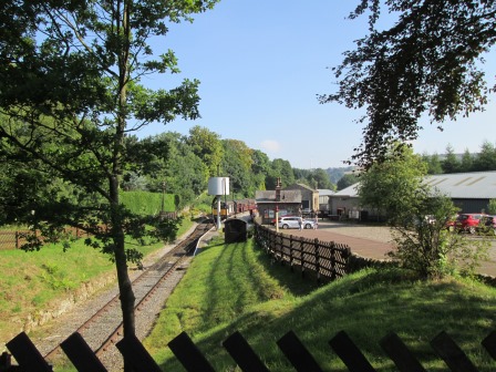
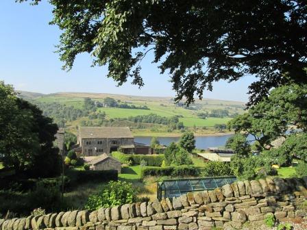
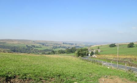
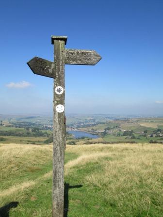
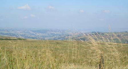
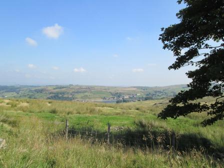
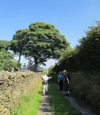
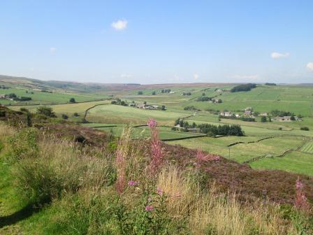
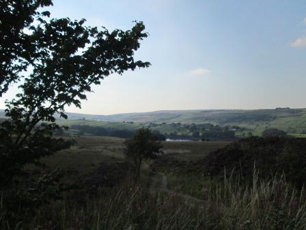
We made a small side step on to the Brontë Way. It was actually off our main route, but thanks John. It meant I could grab this picture which I hope gives a flavour of the day's exploits. Leeming Reservoir is in the distance.
This was again a circular walk, starting this time from Oxenhope Station on the Worth Valley (K&WVR) Line. We circumnavigated the Leeming Reservoir which could be seen from most points on our walk. Wide open spaces, mills, reservoirs and traditional country pubs characterised our walk. We might visit the pubs on a future date, for today we definitely wanted to stay sober for our return to the "Deep South"!
I took the opportunity - having come all this way from deepest Essex - of actually staying on an extra day in Haworth, for I was keen to check out the Worth Valley Railway (K&WVR), amateur "ferroequinologist" that I am. In the evening, I pottered around Haworth and the neighbouring "Penistone Hill" Country Park, looking forward to immersing myself in railwayana the next day.
- Map, Distance and Heights
- Oxenhope Circular - Part 1: Ascent
- Oxenhope Circular - Part 2: Descent
- Evening in Haworth Village
- Contact, Copyright & "Readme"
Map, Distance and Heights
Those of you who like to espouse the more quantitive aspects of existence may wish to tarry here for a short while. Those of you eager for enlightenment of a more pictorial nature could do worse than to click here.
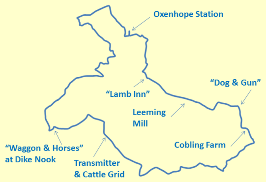
This was a circular morning walk of about 7 miles,
based on Oxenhope Station, the terminus of the Worth Valley Line.
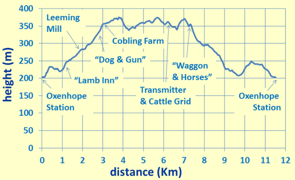
We reached heights of between 350 and 375 metres, which gave us good views in most directions, and nice memories to take home with us.
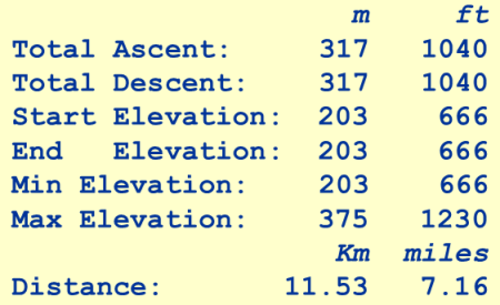
Here are some more figures if you are keen on that sort of thing!
Oxenhope Circular - Part 1
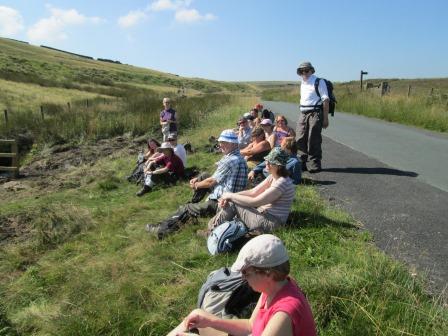
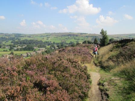
The first part of our walk took us out of the dip in which Oxenhope lies, along Dark Lane, past the Post Office (yes, Oxenhope still has one!), the mill in Lower Town, "The Lamb Inn", and on past Leeming Mill and Reservoir. After the reaching the dizzy heights of the "Dog & Gun", with good views towards the north, what should we meet, but our old friend, the Brontë Way.
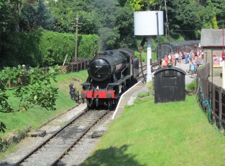
We started off from Oxenhope Station, ...
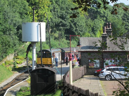
... when the train had entered, this time in the charge of a type 20 diesel, vintage 1960. The first service of the day is diesel-powered (this time also diesel-hauled), since steam locomotives are not turn-on and go, in the manner of more modern traction.
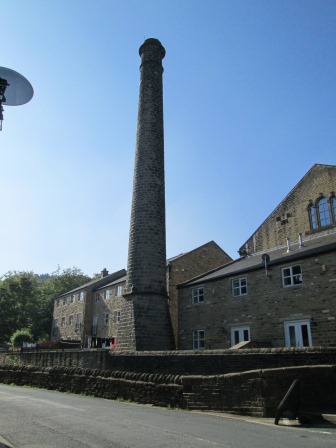
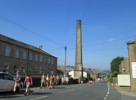
The mill in Oxenhope's Lower Town ...
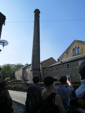
... attracts our attention. In Victorian times, a centrally located steam engine supplied - by a mixture of gears, belts, pulleys and drive shafts - rotary power to all parts of the cloth production process that needed it. An inefficient, but effective, counterpart to modern industrial electrical drives. Of course, the exhaust steam and gases had to be kept clear of the humans toiling away in the different parts of the mill.
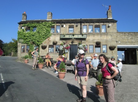
We pause for breath outside the "Lamb Inn", but stay determinedly dry.
Then it's onwards past Leeming Mill ...
... and Leeming Reservoir.
It's onwards, and ever upwards, until we reach the "Dog & Gun" ...
... where we had the chance once again to admire the fine, sunny moorland view to the north.
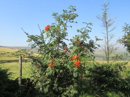
On the way to the Brontë Way and to Cobling Farm, we have a chance to appreciate how pretty the red berries looked in a landscape dominated by greens, blues and yellows.
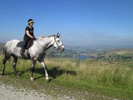
Horseriders were out to catch the morning sun ...
... and to enjoy the distant views.
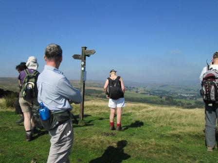
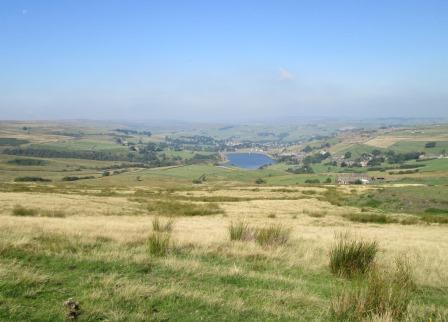
We also enjoyed the views, as we stopped for a quick swig of water, a look at the map and what looks like a call on a mobile - you are never alone with a mobile phone.
And here is another look at the view that absorbed our interest.
We then made a short side-step down the Brontë Way, but then decided, after all, that we had had enough of things Brontë and retraced our steps in order to keep to the higher ground.
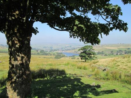
However, without this side step, I would not have caught Leeming Reservoir in this arboreal frame.
Oxenhope Circular - Part 2
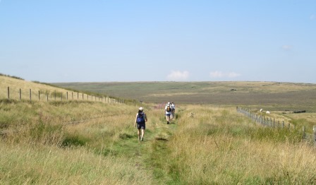
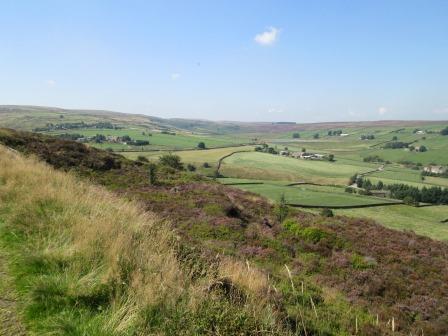
We then took, and kept to, the high road, taking transmission masts, water conduits, pubs, grass and heather all in our stride. Sawood Lane, the Calder/Aire Link, Whitemoor Lane, Intake Lane and "The Waggon & Horses" at Dike Nook, all echoed in succession to the sounds of our footsteps.
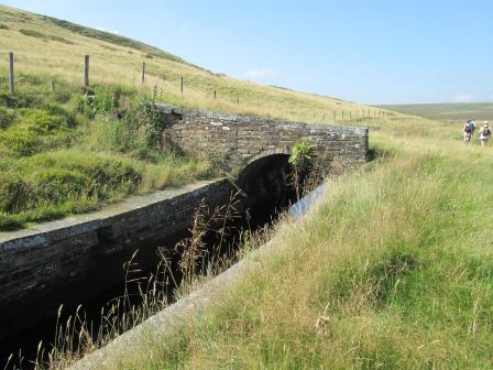
Here is our first water conduit of the day, carefully crafted ...
... so as not to leak its valuable contents into the surrounding countryside.
We enjoy the wide open spaces and the Great Outdoors ...
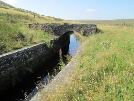
... as we keep the water conduit company to our left.
Before we reach the transmission mast ...
... we have a short "pick-me-up" or mini-picnic.
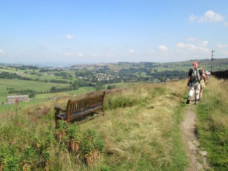
The undulations hereabouts mean that we have a view back to Leeming Reservoir,
where we have been, ...
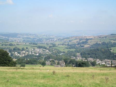
... followed in quick succession by a view further down the valley across to Oxenhope,
where we are going to.
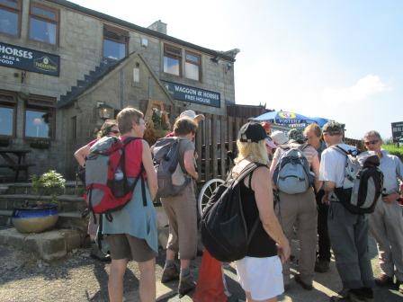
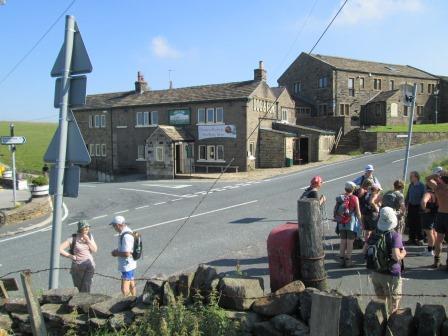
We stop outside the "Waggon & Horses" at Dyke Nook to consult the map, ...
... and still in partial consultation mode, make for Hard Naze Farm.
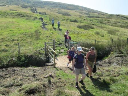
We eschew the sunny bench, as we wade through, ...
... lots ...
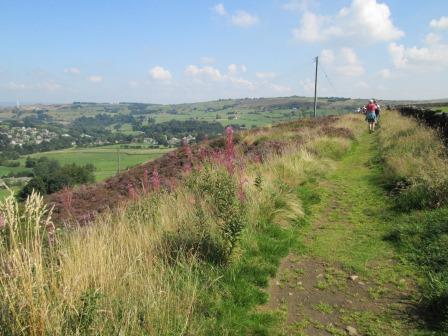
... and lots ...
... and lots ...
... of purple heather!
The footpath enables us to admire someone's nicely kept garden on the outskirts of Oxenhope.
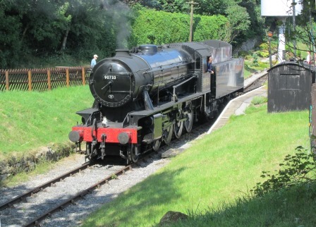
Eventually we reach our starting point - Oxenhope Station - where a 1945 vintage steam locomotive is preparing to take its train back to Keighley.
Watching this we know that we also must return, but it's not to Keighley but to the Deep South. There's time for a snack in the station's café before we say our farewells until we meet again on another CLOG trip.
Evening in Haworth Village
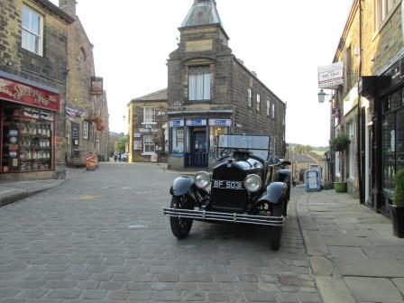
Having checked into the "Old White Lion", I spent the evening doing a mini-walk up to Penistone Hill (a mere 314 metres) behind the Parsonage. I got some shots of the day fading gradually over the moors, and realised how sensitive the light conditions can be when it comes to taking pictures. More grist to the photographic mill was an old BUIC - apparently lovingly looked after - parked at the top of the cobbled High Street; the BUIC gave the village a 20s feel, if one ignored some of the latter day posters.
A funny thing happened on the way to the Parsonage. You might remember that there is a low wall belonging to the church, and only a yard or two from the building. It separates the church grounds from the cobbled street leading to the Parsonage. Well, this evening four ladies, probably in their 50s or 60s, were sitting on this wall, each of them enjoying a Bank Holiday Monday fag. For all I know, they could have been stalwarts of the Skipton Ladies' Guild for advanced "fumaphiles". The opportunity was too good to miss, and I said to them, "Ladies, I hope you will not be too surprised if passers-by, on seeing you here, exclaim 'Holy Smoke!'". Stunned silence, but then the penny dropped. Smiles all round, and I proceeded on my way.
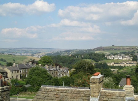
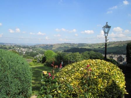
From the hotel window there was a nice view over the Worth Valley.
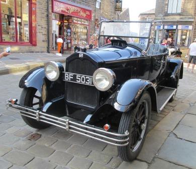
Here is the 20s BUIC, reminiscent of Henry Ford's slogan for his Ford Model Ts, "You can have any color (USA spelling), as long as it's black". OK, according to physicists, black indicates the abscence of colour, but let's not be too finicky at this juncture.
There were approving looks all round, including from the waitress at the "Steam Brewing"
"Café/Bar/Bistro", outside which establishment the vehicle had been strategically parked - perhaps to garner maximum attention.
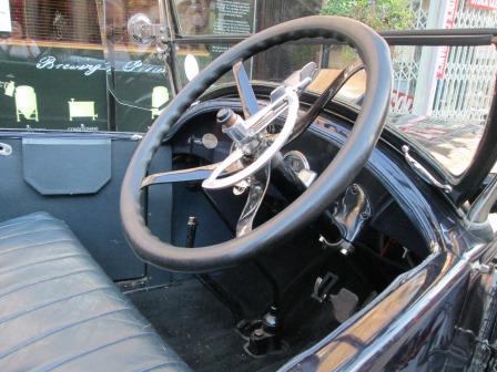
It was a right-hand drive version for the discerning British - or Japanese - driver of the day.
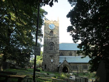
After admiring the automobile technology of the 1920s, I walked out to the moors past the church whose crenellated tower was catching the last rays of the evening sun.
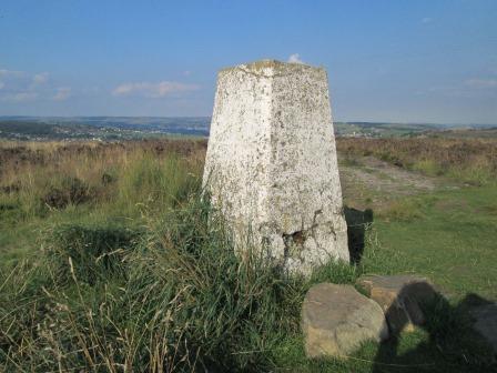
Here is the monument to the Ordnance Survey of the 1930s, one of numerous such monuments up and down the land. This 314 metre high triangulation point marks the top of Penistone Hill outside Haworth Village Top.
This is where the Brontë Way - just discernable in the picture - turns a right angle to join the path we took on Sunday to Top Withins and the Ruins.
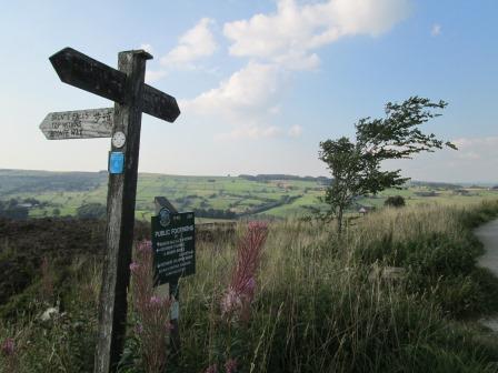
A weathered signpost and a wind-swept tree testify to the right angle,
so - in the common parlance - it's official.
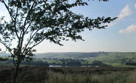
Here's another view across to the Lower Laithe Reservoir of Sunday's walk. The light is fading, ...
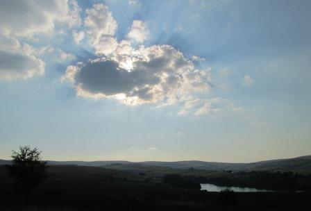
... but it's still sufficient for a shot of this cloud pattern over the Yorkshire-Lancashire border country.
This area is quite well signposted.
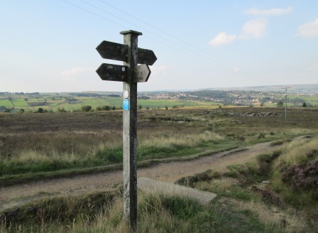
Retracing my steps towards Haworth Village Top I encounter another signpost.
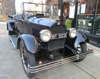
As I return to the "Old White Lion" - in the background of the picture - I found the BUIC is still parked outside the "Old Steam Brewery" ...
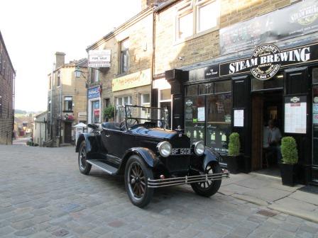
... so I took some more shots of it before retiring for the night.
Eric Scharf
Original: 2013-09-15 @12:32
Updated: 2019-01-17 @13:48
SAGAX REX HANC RETIS ORBIS PAGINAM PINXIT ANNO MMXIII ET MMXIX.
© Eric Scharf 2013 & 2019