 |
CLOG's Second Highland Fling BEN NEVIS Friday 27th May 2011 |
|
| Ben Nevis Ascent Summit Descent Evening Features Read Me |

We climb to the roof of the British Isles
We didn't really want to come all the way to Fort William without going up Ben Nevis (Gaelic for the "terrible or satanic" mountain), especially as the Ben was more or less on our doorstep.
It's quite snowy on Ben Nevis,
there's time for a quick piccy of some of our group.
Using her net-book and the hostel's WiFi, Penny said the weather forecast was OK up to about 13:00, when rain could be expected. Jim therefore suggested leaving the hostel at about 05:30 so that we could start the climb from the Ben Nevis Visitor Centre by about 06:00. Good ploy! We reached the snow-covered summit (temperature minus a few degrees) after about 2.5 hours. We tarried a small while for the obligatory piccies before beginning our descent.
The first half of the ascent is a straightforward stony climb. The second half can be dangerous, especially on the way down. Careful navigation is needed to avoid the precipices which have foreshortened the lives of several unprepared tourists - and may continue to do so in the future despite (in this case, justified) official warnings about the need for appropriate equipment, clothing and food.
On the way down we dodged all the late starters, who probably encountered mini blizzard conditions on top. One latestarter climbed up in his Clan Douglas kilt; I'm not normally that interested in clothes (sorry folks!), but tartans obviously have an historical connotation and the wearer was evidently proud to enlighten me as to his particular clan allegiance.
Our Ascent
The first half of the ascent is a straightforward stony climb. The second half can be dangerous, especially on the way down. Careful navigation is needed to avoid the precipices which have foreshortened the lives of several unprepared tourists - and may unfortunately continue to do so in the future despite (in this case, justified) official warnings about the need for appropriate equipment, clothing and food.
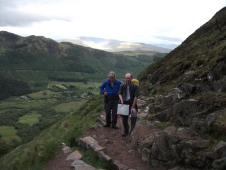
Jim and Ralph pose for a quick "snap-shot" on the ascent.
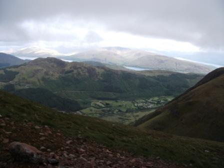
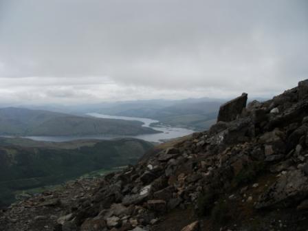
We soak up the views almost at every step.
Here are some more views to appreciate - but we need to watch the rain clouds.
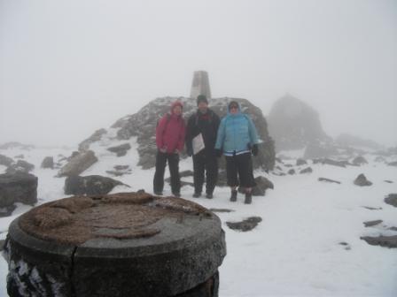
We have reached the Top
The first half of the ascent is a straightforward stony climb. The second half can be dangerous, especially on the way down. Careful navigation is needed to avoid the precipices which have foreshortened the lives of several unprepared tourists - and may unfortunately continue to do so in the future despite (in this case, justified) official warnings about the need for appropriate equipment, clothing and food.
Here we are at the highest (trig) point on the summit, sporting a bit of the Ranulph Fiennes look. We actually split up into about three groups of four, but it was important for each group to stay together, and in our group Ralph did the navigational honours. Thanks Ralph!
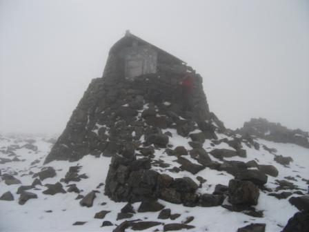
There is still an emergency shelter for two on the summit, but the observatory was closed in 1915, and the restaurant somewhat earlier. The up-and-at-it approach of the Victorians and Edwardians did not last into the Naughty Twenties.
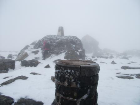
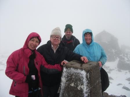
Shelter, Trig Point and Orientation Pillar make a scene of snowy desolation. Brrrh!
But there's still time for a quick piccy of three-quarters of our group.
Our Descent
On our way down we had more stunning views into the distance as we emerged from the clouds. We dodged all the late starters, who probably encountered mini blizzard conditions on top. One late starter climbed up in his Clan Douglas kilt; I'm not normally that interested in clothes (sorry folks!), but tartans obviously have an historical connotation and the wearer was evidently proud to enlighten me as to his particular clan allegiance.
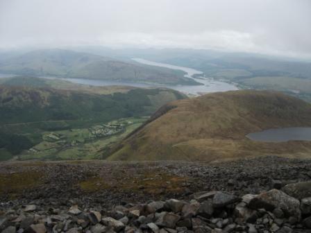
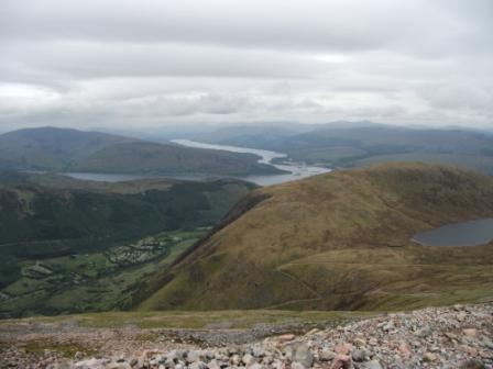
There are more stunning views into the distance as we emerge from the clouds. The picture seems to suggest that the earth is round!
The outcrop looks like an old castle. That's the stuff ghost stories are made of!
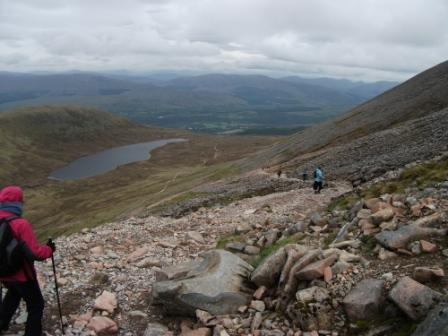
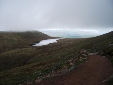
The path wends its way down to the saddle, or half-way point, from which one path diverges to an extremely interesting scrambly ascent to the top. The trio I met on the last day I stayed at Calluna (Tue to Wed) had this ascent in mind.
And here's another picture - for luck - also looking towards the saddle.
Our Evening
As already mentioned, the culinary art in Fort William, was, according to a guide book, still in the ascendancy. However, to give us sustenance at the end of our day, some of us found a suitable eatery in the High Street and others ate in at the "Calluna".
Eric Scharf
Original: 2011-07-10 @12:18
Updated: 2011-10-05 @11:08
SAGAX REX HANC RETIS ORBIS PAGINAM PINXIT ANNO MMXI.