 |
The Iron Road to the Isles PORPOISE ISLE Tuesday 30th May 2011 |
|
| Rail & Sea By Train O'er the Sea On "Muck" Mainland Train Again Evening Read Me |
The Iron Road to the Isles
I had always cherished the ambition to complete one of the Greatest Railway Journeys of the World, so today offered an opportunity that was too good to miss. The weather was conveniently between two fronts, so sunshine was a welcome feature of the day. When I reached Mallaig, a short stroll to the harbour revealed, as luck would have it, an imminent departure to one of the isles - in fact the smallest of the small isles. A bracing crossing of almost two hours landed me on the "Isle of Muck" - which in Gaelic translates as the "Isle of the Porpoises". I had over 1½ hours on the island, before, pleasantly educated and fortified by new experiences, I made the scenic journey - by sea and rail - back to Fort William.
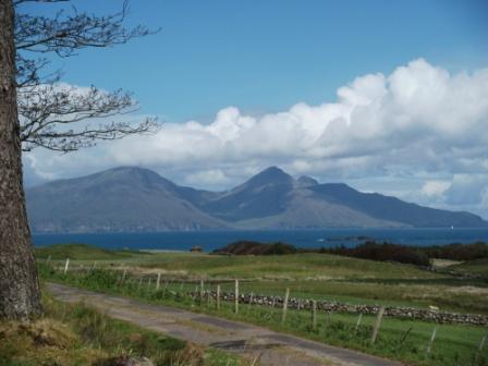
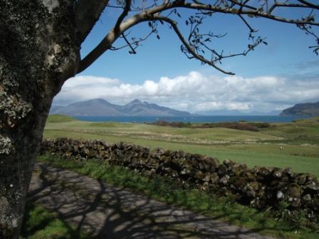
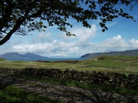
On the "Isle of Muck", the single 1½ mile long road (or track)
links Port Mor with the hamlet of Gallanach
and offers splendid views of Rum and beyond to Skye.
The World's Greatest Train Journey - the Mallaig Extension.
The line from Glasgow to Fort William is already very impressive - see Elaine's recommendation - and opened in 1894. The next section of the line from Fort William to Mallaig was completed in 1901 amid the optimism that surrounded railway enterprise of the dawning Edwardian era. The amount of work - rock cuttings, viaducts and embankments - that descended on the Irish navvies of the time was indeed amazing. All this was done to the plans of Sir Robert McAlpine, who pioneered the use of concrete for major works, such as viaducts. The hoped for fish trade was soon eclipsed by the line's tourist potential, which is the mainstay of the line today. Luckily, the wishes of Beeching to close the line were successfully resisted. The stunning views from the train were of the kind that are usually only offered to the hill walker.
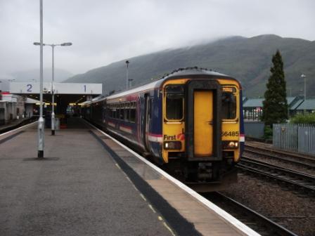
After waving some Cloggies goodbye as they left platform 2 at 07:40 for Glasgow, I took this Sprinter an hour later from the other platform. I would have liked to have taken the steam-hauled Jacobite at 10:20, but this would of course, have delayed my start without the certainty of actually getting a ticket (at £31.00 return) and had the ticket materialised, the stay in Mallaig would have been less than two hours. The Diesel journey, with Railcard, was for the bargain return price of £8.50! Not bad for what proved to be the rail journey of a lifetime. The staff on this first service of the day to Mallaig were really helpful and keen to make the experience for the passenger as memorable as possible. The on-board coffee and shortbread went down well as I savoured the journey.
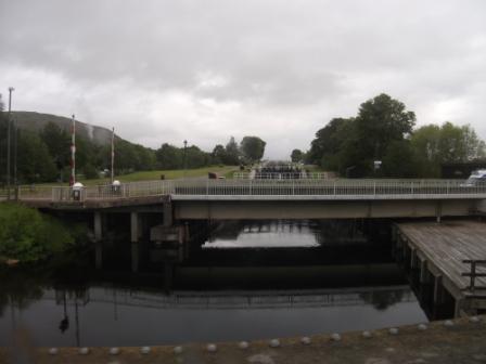
A view from the famous railway swing bridge at Banavie up the even more famous Neptune's Staircase.
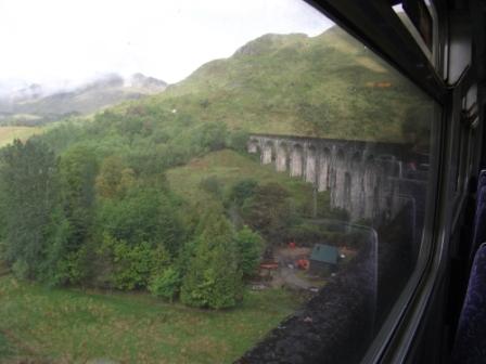
For the convenience of snap-happy tourists, the train slowed to a 5 minute halt on the famous Glenfinnan Viaduct, Sir McAlpine's pioneering composition in concrete.
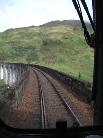
Here is a driver's view of the viaduct.
Here is a view of Loch Shiel and the Young Pretender's Monument, as taken through the specially opened cab window.
And here is the view on the right hand side of the driver's cab. This view was also taken through the specially lowered window.
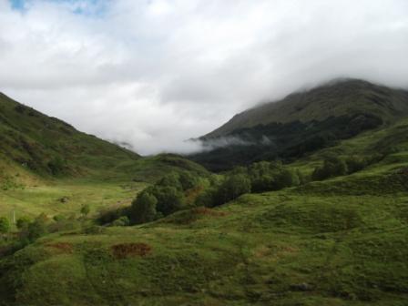
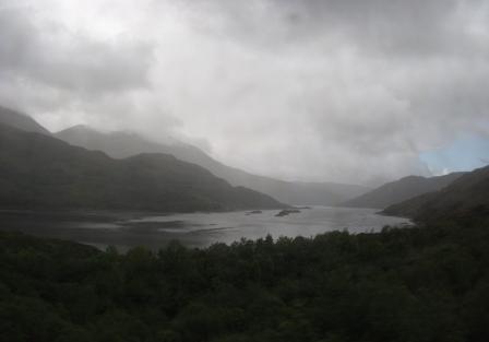
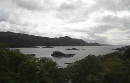
A subsequent view through the train window as the train skirted Loch Eilt.
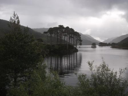
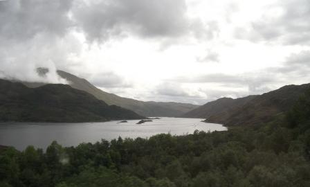
Here is another majestic view through the train window. Picturesque tree-studded islands in Loch nan Uamh. Scots Pine I think.
More of Loch nan Uamh.
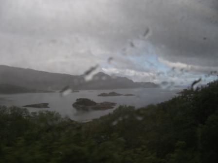
It's rain in Arisaig.
Over the Sea to the Isle of the Porpoises - A Bracing Interlude
In Mallaig the rain - what rain? - had dispersed. The "between two fronts" interlude ruled OK. A short stroll from station to pier revealed that a boat was leaving in 20 minutes for Muck and Eigg. Zero time on Eigg but at least 1½ hours on Muck. What a good idea to visit the smallest of the "Four Small Isles".
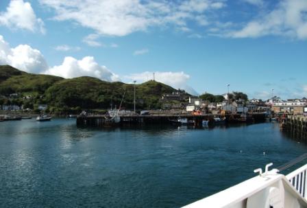
Mallaig Harbour seen from the boat.
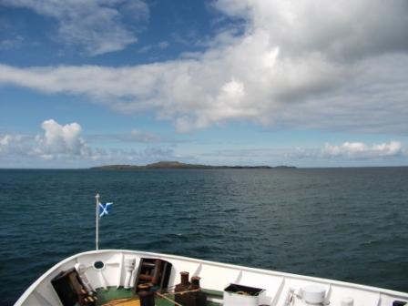
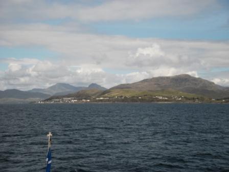
Eigg to the left, Rum to the right.
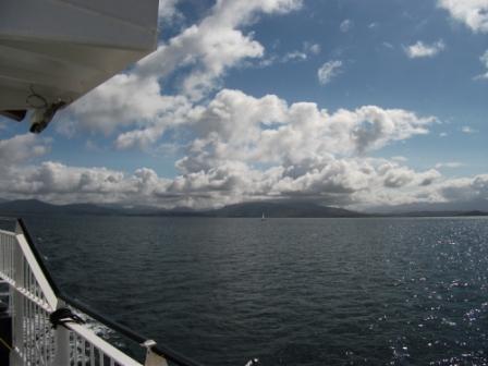
Mallaig and the Mainland are getting smaller and smaller.
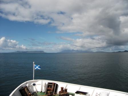
Muck to the left, Eigg to the right. It's nice and breezy as the Scottish flag, in the next picture, indicates. The sea swell is reminiscent of the Cross Channel journeys of old. Real stormy weather was to come, but in fact later in the evening when I was back in Fort William. I rotated these morning on-board snaps a degree or so back to the horizontal position before putting them on the web.
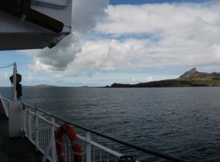
Muck straight ahead. Looks like an upturned boat from here, but is actually not as flat as it looks.
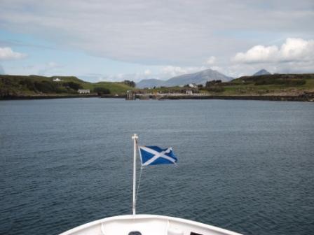
The boat puts in at Port Mor on Muck. The flag of St Andrew flies proudly in the breeze.
On Muck
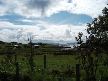
Muck, the smallest of the "Small Isles" - Rum, Eigg, Canaa and Muck - is the smallest in area and, I believe, in population. Its permanent population numbers about 30. I met at least two resident English people, who wanted "to get away from it all". Agriculture - sheep and cattle - is still an important mainstay, but the name of the island has nothing to do with agriculture. The name seems to derive from the Gaelic for Porpoise, which, as you probably know, is a type of small whale. Porpoises are obviously in the neighbourhood, although I was not on the island for long enough to see any. The highest point on Muck is Beinn Airein at 137 m. With more time I might have explored this and the other half of the island. Muck has belonged to the Stewart family for over a century - so probably no freeholds for most of the residents.
The boat leaves the pier for Eigg. I hope it comes back again.
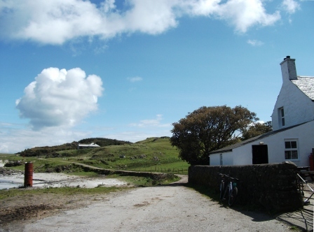
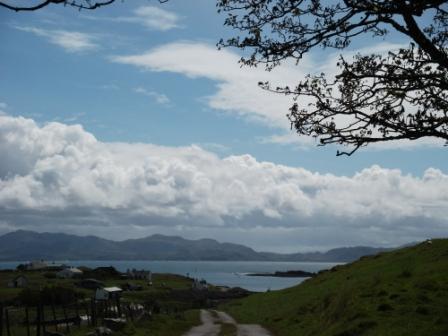
Another view across Port Mor to the mainland.
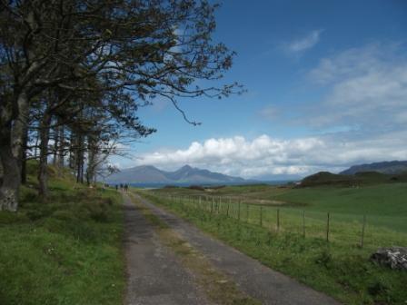
The single 1.5 mile long road (or track) links Port Mor with the hamlet of Gallanach ...
... and offers splendid views of Rum and beyond to Skye.
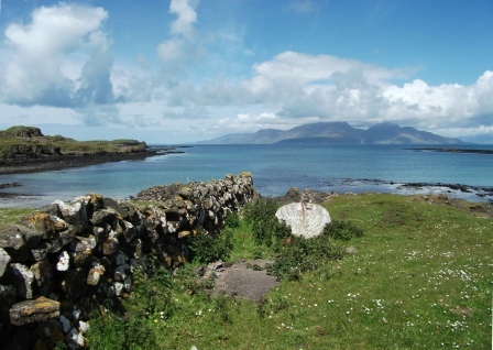
Drystone walls abound.
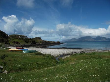
Here at the end of the 1.5 mile road at Gallanach there are sandy beaches ...
... and more dramatic views of Rum.
Now it's time to say "Goodbye Gallanach" and return along the 1.5 mile "highway" as it snakes past the plantation.
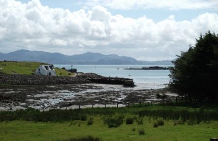
On the way back there is another view of Rum. You can see one of the guest houses, as a white blob, in the middle right of the picture.
I get closer ...
... and closer, to Port Mor.
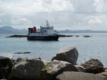
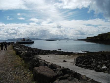
And here comes the boat - the only way today of getting back to Mallaig. I was at the pier about 30 minutes ahead time. Just as well, because the boat left Muck for Mallaig about 10 minutes ahead of schedule.
Over the Sea to Mallaig - Mill Pond all the Way
As the bow flag in the next snap suggests, the return to Mallaig was as smooth as a mill pond. This was effectively the lull before the storm - or at least the stormy weather to come later that evening.
Full speed ahead to Mallaig.
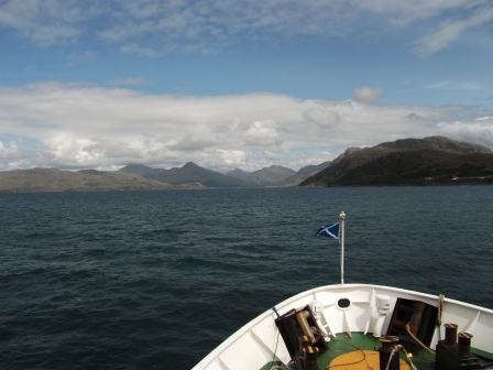
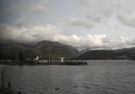
To the north of Mallaig (centre of this picture) is the entrance to Loch Nevis. "Nevis", derived from the Gaelic for "terrible" or "satanic", is thus used to describe a Ben (mountain), a glen, a river AND a loch. It would seem that the locals, in the past, had a right old terrible time. Things are probably much better these days, with the support that the tourists give to the local economy.
The Iron Road back to Fort William
The views from the train were now generally clearer than on this morning's outward rail journey, but rainy weather was indeed very much in the offing - as predicted.
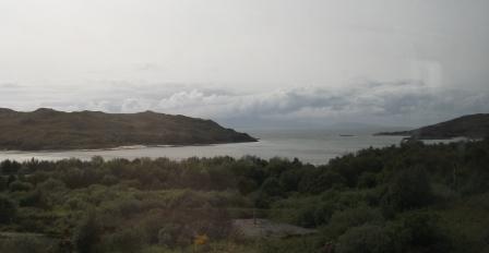
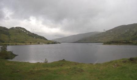
After Mallaig and Morar, the train passes Loch nan Ceall.
A nice quiz question. The answer: Arisaig. Two more quiz ingredients are nearby. The deepest Scottish (and UK) loch is Loch Morar - not Loch Ness. The shortest Scottish (and possibly UK) river is the River Morar.
The island-studded bay at Arisaig.
This looks like Loch Ailort.
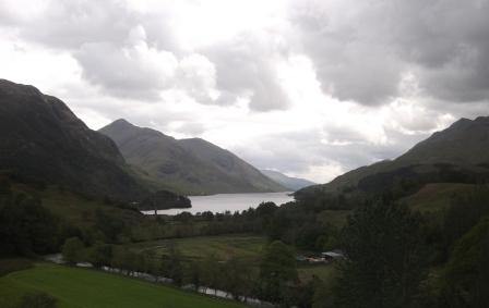
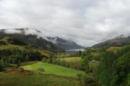
You can just see the Young Pretender's Monument at the head of Loch Shiel, Glenfinnan.
As the train nears Fort William, Ben Nevis, with its almost obligatory cloud hat, hoves clearly into view across Loch Linnhe.
Parting Snaps of Fort William
Back at the "Calluna", in the evening, there was time to speak with the three students - two guys and a gal - who were rearing to go up Ben Nevis the next morning. Their aim was to take the alternative, "scrambly", path to the summit. I wonder how they tackled the weather.
Apart from packing and sorting out some final items, I found some time to take some last minute piccies from the path above the hostel. The weather was indeed preparing to get interesting.
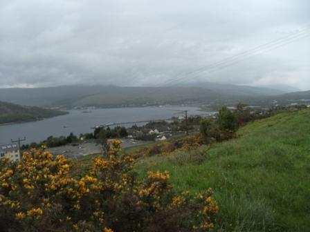
In the evening I went up the path above the "Calluna"
to take this "parting shot" towards Fort William.
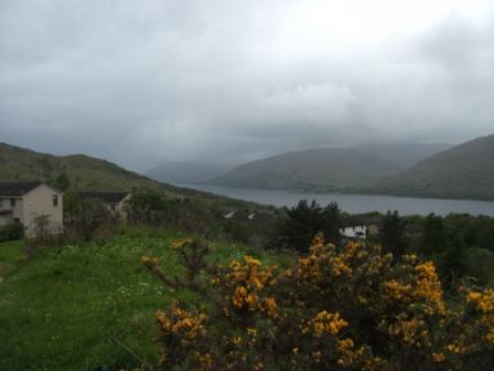
And here is the view from the same spot in the other direction along Loch Linnhe towards the sea. The weather was closing in.
Eric Scharf
Original: 2011-07-10 @12:18
Updated: 2011-10-05 @11:27
SAGAX REX HANC RETIS ORBIS PAGINAM PINXIT ANNO MMXI.
© Eric Scharf 2011