 |
Day of Mountain Mists BOOT & RATTY 2017 April 19 |
|
| The Day Eel Tarn Station Railway Path Church River Esk Walk Read Me |

A Misty Day in Boot
Of Landscape, Sights & Railways
On the first full day in Boot, I started from the hostel and after the Woolpack Inn turned north to Eel Tarn. The intention had been to get to Scafell. However, low cloud limited my walk to a modest 262 m (860 ft) albeit with a total ascent of 541 m (1775 ft). Lin Yutang described a visitor being taken by a local guide up a mountain in a mist; once arrived at the top, the visitor exclaimed, "I can't see anything"! "That's it", says the guide. "I have taken you up the mountain to see nothing!" However, today I felt that, despite the joy of philosophizing on the "Great Outdoors" in the mist, safety in the mountains was still a prime consideration. Still, I did get a feel for the landscape around Boot. I then descended into the village (or is Boot a hamlet?) to the west of Great Barrow, reaching the nicely restored Eskdale Corn Mill at about mid-day.
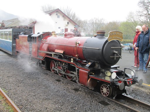
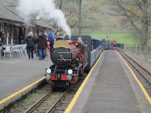
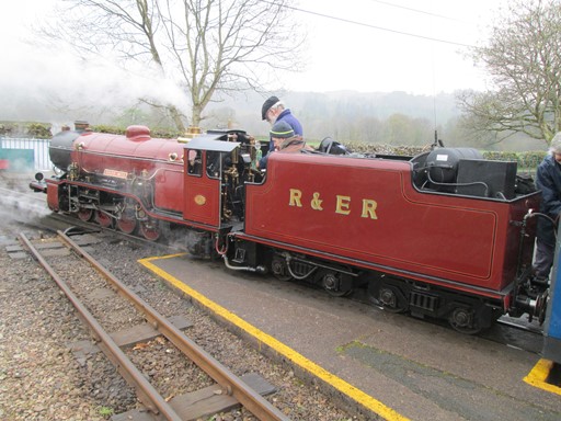
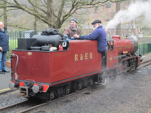
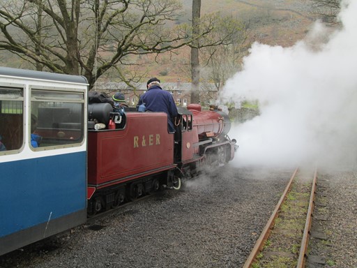
2-8-2 "River Mite" is being readied for the 7-mile return to Ravenglass,
but not before attracting some approving looks from visitors.
The head board proudly proclaims that it is "River Mite's" 50th Anniversary,
Next on the agenda was Dalegarth Station, today's eastern terminus of the Ravenglass and Eskdale. There I watched the comings and goings of tourists visiting from Ravenglass, about 7 miles distant to the west on the coast. In the afternoon I explored the now named railway path which originally took the 3 ft gauge Owd Ratty over the River Esk bridge to the Haematite mines in the Gill Force area on the south bank of the River. These mines were, of course, the original raison d'être for Owd Ratty.
Boot's 14th century Church is nearby on a parallel path. On the north side of the railway bridge, our path leads back along the River Esk to the "Doctor Bridge" and to the hostel.
If you are a determined ferro-equinologist, then on this web page head straight for the "Dalegarth" and "Railway Path" sections. The other sections provide a "landscape backcloth" to T' La'al Ratty.
Boot via Eel Tarn
The Great Outdoors - Tarn, Mill and Barrow
After the Woolpack Inn a path turned north to Eel Tarn. Despite the low cloud I got as far as Eel Tarn and up to about 260 metres above it. This gave a good impression of the wide-open landscape in which Boot nestled. I then descended into Boot on the west side of Great Barrow and by about mid-day reached its old mill. The nicely restored Eskdale Mill is of course now a museum but was once of great practical and no doubt social importance in these erstwhile very rural parts.
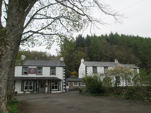
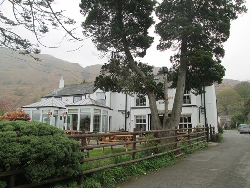
The " Woolpack Inn" is a nice place to dine of an evening.
Names of pubs and inns often reflect aspects of the neighbourhood. In this case we see that sheep farming was an important industry in these parts. Apparently, sheep farmers are now paid to keep their sheep, in order to keep the hillsides in their "natural" states and in order to provide the "traditional appearance". The famous Hardknott Pass is further east and was guarded at the Boot end by a Roman Fort whose remains can be visited. Not on today's schedule!
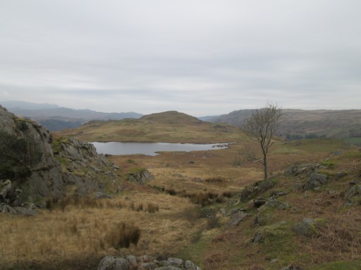
Eel Tarn nestles in the quiet misty landscape.
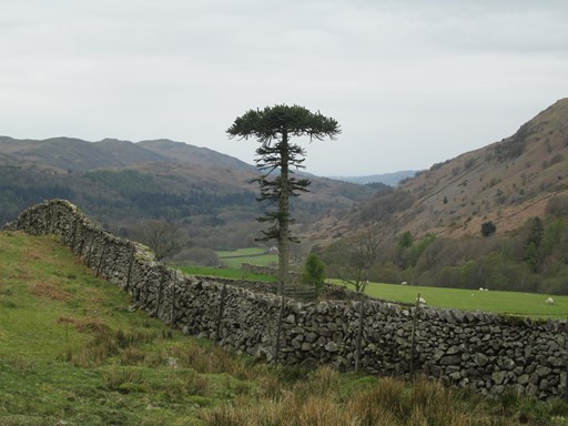
The descent into Eskdale is to the west of Great Barrow.
Barrow, in Anglo-Saxon, is a hill or long ridge, and can refer to an ancient burial place.
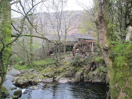
Then we come to the listed Eskdale Corn Mill, (see Link), which dates back to 1547, and whose two overshot water wheels were designed to harness the waters of the River Esk.
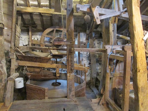
Within we see the original machinery.
Tourists were a known phenomenon in Eskdale since at least Victorian times.
The "Brook House Inn" probably has quite a story to tell.
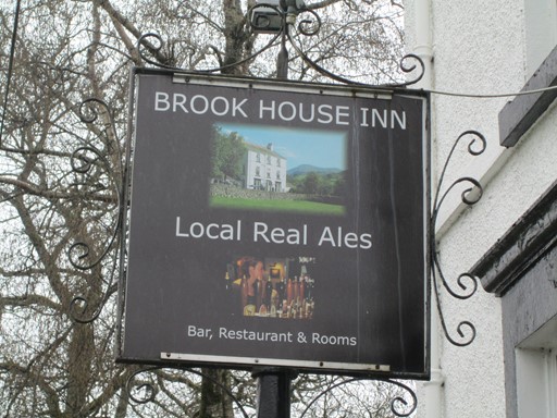
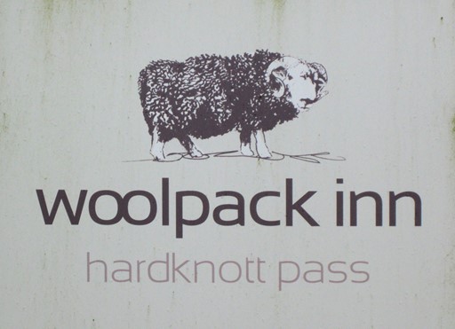
The sign ensures that nobody misses it!
So, also see "Eskdale Stores"!
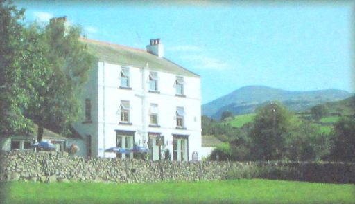
The Inn has expanded somewhat over the years
as we can see from the picture gracing the inn sign.
Dalegarth Station
My First Encounter with T' La'al Ratty
Close by is Dalegarth Station, the furthest point by rail from Ravenglass - almost 7 miles. The line, in its 3ft gauge incarnation, originally continued beyond the turntable (green fence), across the field and along the "Railway Path", crossing the River Esk by the girder bridge to reach the mines at Gyll Force on the south bank of the River Esk.
Back to the present. After a short while, the Ravenglass train entered the station. In charge of the train was 2-8-2 "River Mite", celebrating its 50th Anniversary. For me there was also time for a short visit to the station café and for a short browse through the offerings of the bookshop, although I now try and store my souvenirs in my camera - kind of saves space!
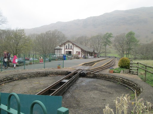
The turntable marks the extremity of the R&ER. The 3ft line used to continue past the green fencing on the left and onwards to the iron ore mines at Gyll Force.
The train cometh.
"River Mite" seems to have both "Gresley" and "Stanier" characteristics.
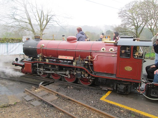
"River Mite" is about to go through the turntable ritual.
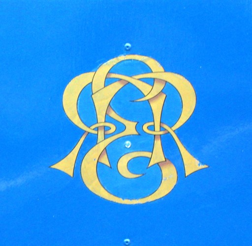
Monograms often consist of letters intertwined to the limits of the barely recognizable.
The R&ER monogram appears on red, green and blue backgrounds.
Here it is on the sides of the blue carriages.
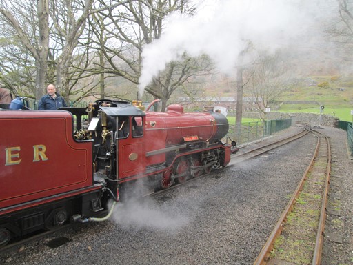
"River Mite" runs around its train
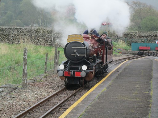
Getting ready for the seven miles to Ravenglass
"River Mite" is locomotive engineering in miniature
and attracts admiring inspection from passengers.
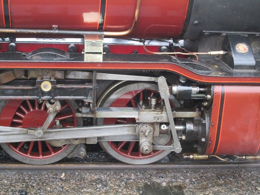
Cylinders, pistons, con rods and all things steam.
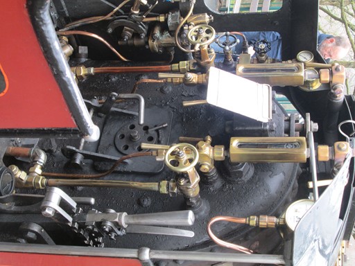
Here's how to drive "River Mite".
Almost ready to go.
And it's off for the return trip down Esk Dale!
The Railway Path
The Track to the Iron Ore
The original purpose of the 3ft gauge Owd Ratty in 1875 was to access the Haematite Ore in the Gyll Force area just to the south of the River Esk. The track bed of the line continued from the present Dalegarth terminus across a field and along a path bordered by stone walls and now suitably called the "Railway Path". It then continued unfenced along the northern bank of the Esk until it reached the specially constructed Girder Bridge to reach the ore deposits on the other side of the river. There the track split two ways. Here you can see a few pictures I took of the "mortal remains" of Owd Ratty's track bed.
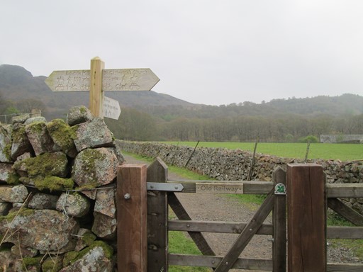
Walkers can get to the "Railway Path" after the field which separates this point from Dalegarth.
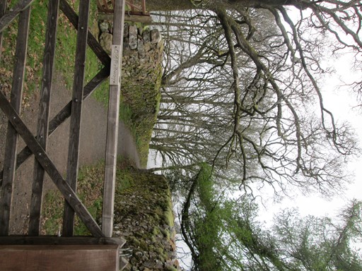
Here's is the other end of the part of the
path sandwiched between the two walls of Lakeland stone,
A short section along the north bank of the Esk.
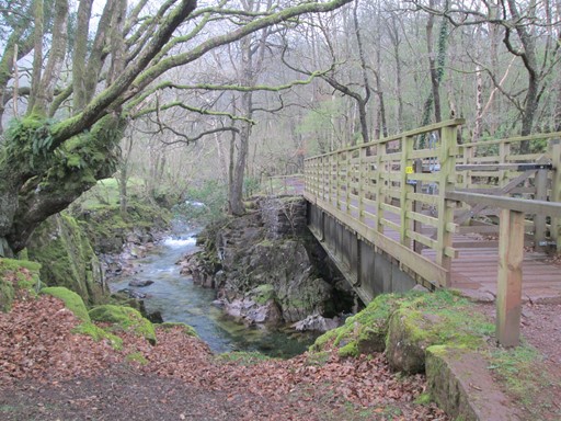
Then it's the Girder Bridge which leads to the open mines in the Gyll Force area.
I return from the Girder Bridge, and will turn right to the Doctor Bridge.
Just right of centre, the track returns to Dalegarth -
the way I came along the north bank of the Esk.
Saint Catherine's Church
A visit to Boot's past centuries
Boot's 14th century Church is nearby on a path roughly parallel to the railway path. Churches often document the history of a community, and here we can take a glimpse into the 1700s. Boot's church was built to withstand the harsh winters that one can associate with this part of the Lake District. Simple, but rugged, and in Lakeland tradition, with a gable-end bellcote.
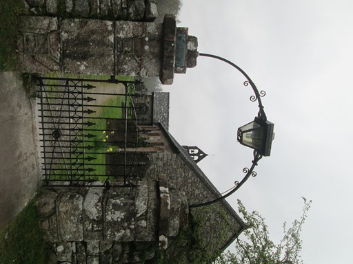
Church Gate
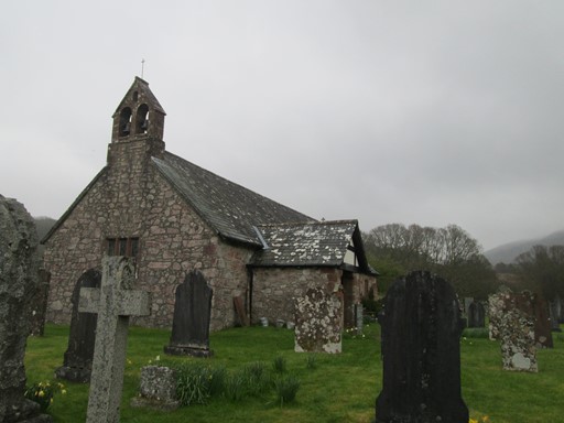
Rugged Simplicity, both without ...

... and within.
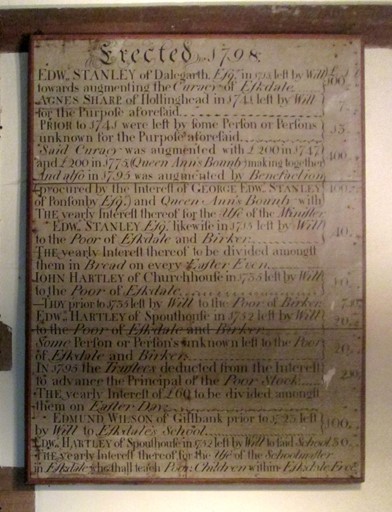
On one of the walls there is a
"Table of 18th Century Benefactors".
This refers to "Queen Ann's Bounty".
Note that "Anne" is spelt minus the "e", but it's OUR Queen Anne!
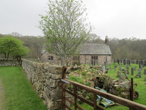
Church and Churchyard
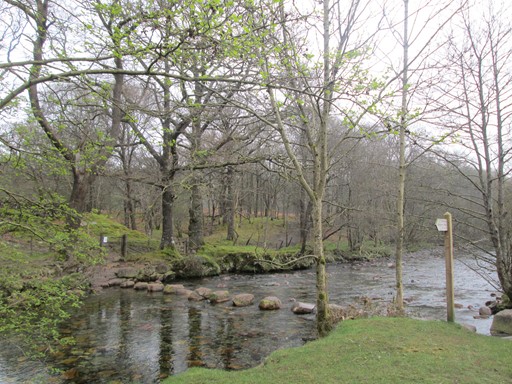
Stepping Stones over the River Esk are nearby.
The successful daring keep their feet dry!
The Babbling River Esk
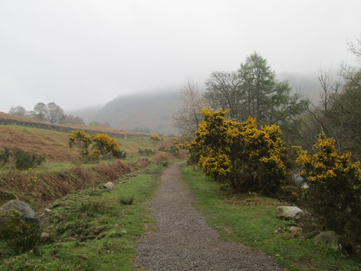
Of Mists, Bracken, Gorse & the Doctor Bridge
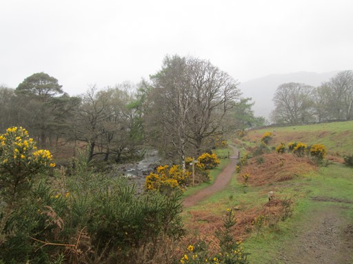
From the Girder Bridge, our path follows the River Esk, leading on through the mists and bracken, with occasional glimpses of the mountains. There's lots of Gorse to brighten our way. Then we reach the "Doctor Bridge" and the "Woolpack Inn". Almost back to enjoy our evening!
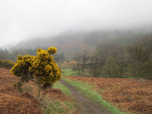
Mist, Bracken and Gorse.
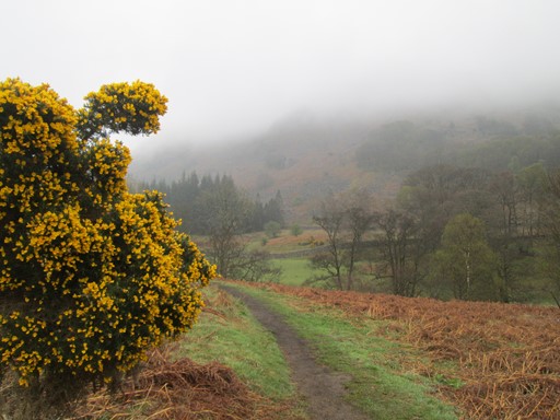
Yellow gorse, yellow gorse!
You're so pretty, of course, of course!
And in "the Lakes" you're out in force,
But Oh, your thorns ... show no remorse!
This verse of mine is my own "home grown" souvenir from my Wasdale Visit.
However, it seems to fit here!
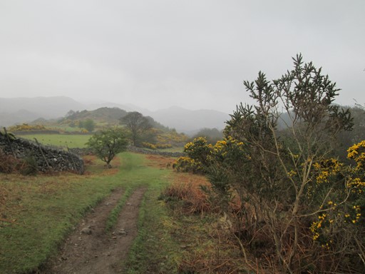
Yes, the mountains are there!

caption
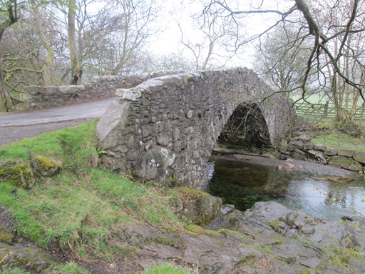
The packhorse "Doctor Bridge"
was widened in 1734 to let the local doctor cross on his rounds.
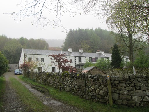
After the "Doctor Bridge" the path reaches the "Woolpack Inn",
where we shall meet for our last evening meal tonight.
Evening at the End the Day
The end of the day was spent meeting some of my walking colleagues at the "Woolpack". Two had reached the "Hardknott" Roman Fort. Some had apparently reached Scafell (not the Pike) which was shrouded - in "Lin Yutang" fashion - in the Lake Land mist, which said mist also visited their ascent. There was much to talk about. Tomorrow would be the day of departure for many in our group. For me a visit to the full length "Ratty" would be on the agenda.
Eric Scharf
Original: 2021-05-11 @15:29
SAGAX REX HANC RETIS ORBIS PAGINAM PINXIT ANNO MMXXI.