 |
GREAT DODD Scales: Lake District 4th June 2016 |
|
| Day Two St John's Coach Rd Clough Hd Gt Dodd Return Features |
Day Two - The Great Dodd
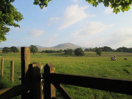
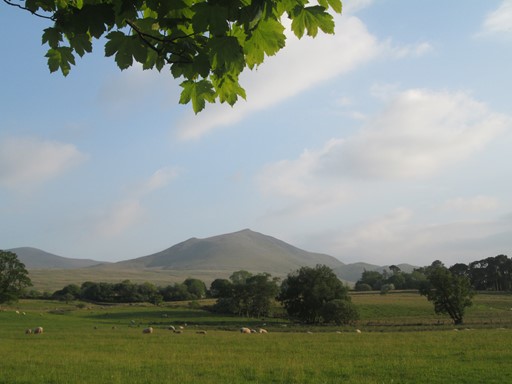
Starting out from the "doorstep of our residence" in Scales, we initially kept to the low ground, in the valleys of Gleneramackin and Saint John's Beck, before we reached the Old Coach Road. Here, a lunch stop was in order, not only to admire the view, but also to gather strength for the steep climb up on to Clough Head (726 m). We kept to the high ground and then reached the Great Dodd (857 m) - nice views all round.. Our descent, via some boggy terrain, eventually got us back to Scales by about 20:20. This anti-clockwise circular walk of about 15 miles was led by Eric S., suitably aided and abetted by colleagues.
Here we are on Clough Head (726 m), enjoying life after a steep ascent from The Old Coach Road.
Here's what you will see of our second day in the Lake District, a day on which we definitely climbed to higher things:
- Day Two - The Great Dodd
- To the Valley of St John's Beck
- The Old Coach Road
- Clough Head
- The Great Dodd
- Homewards to Scales
- Walk Features
- Our Second Evening
- Please Read Me! Thankyou!
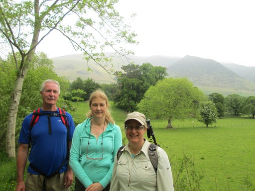
To The Valley of St John's Beck
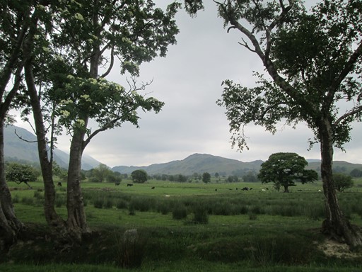
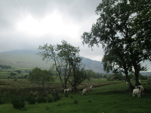
We started out from Scales at about 10:00 in order to let Ralph's group head for the Keswick bus. Initially we went along Glenderamackin's sunny banks, as yesterday. Then we aimed for part of the old track-bed of the much lamented Penrith to Keswick railway line. On we went, through pastures so very green, where sheep and cattle were enjoying the rich grass of late spring.
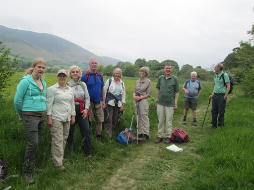
Here we are on the bank of the Glenderamackin ...
... and here are some of us on a stretch of the old Penrith to Keswick railway.
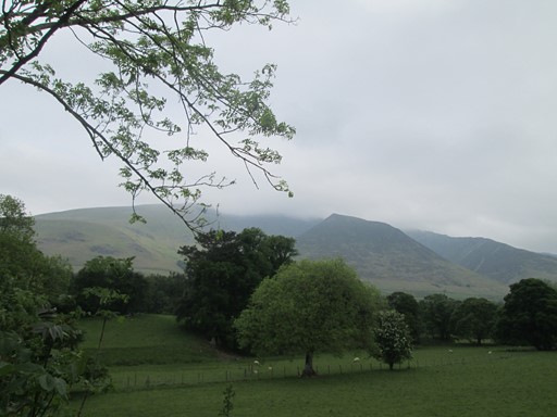
Clouds and mist are visiting Blencathra's summit ...
... but visibility is OK in the valley.
Some more mountain and cloud ...
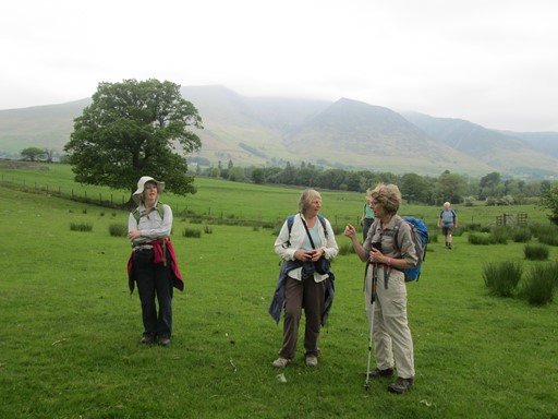
... but now it's time for a bit of a chin wag.
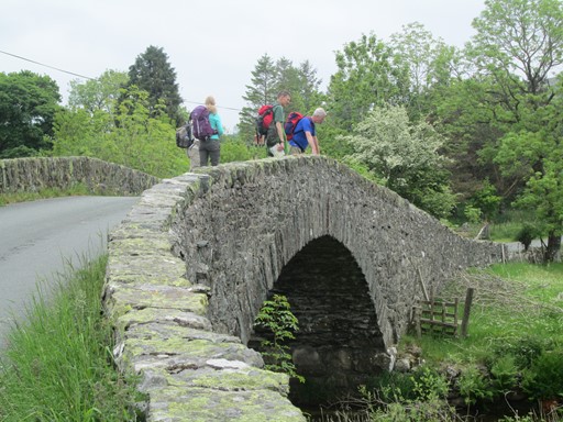
Lakeland abounds with these Roman-style "hump-backed" bridges
which look a bit like those in parts of Northern Spain.
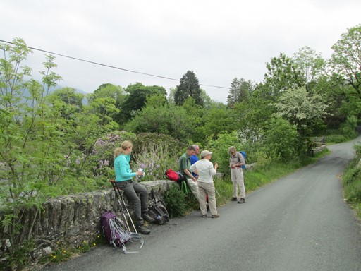
Time for a short water stop ...
... and a look at the colourful countryside.
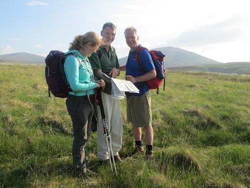
The Old Coach Road
Eventually we reached the Old Coach Road. I think this may have been used by the Stage Coaches which plied this part of the land before the railway snatched their trade - our forebears had to watch these new-fangled modes of transport! At least, this sounds like a nice explanation for the name - true or not true. So there! A little way up and along the said Old Coach Road, we were impressed by the view which was already unfolding. So a good place for lunch.
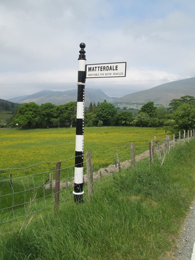
Yes, it's Matterdale on the west side of Ullswater,
and not Patterdale at the southern end of Ullswater.
Anyway, the sign points to the Old Coach Road
which leads to a number of places, including Matterdale.
As we come up on the Old Coach Road, it's time for lunch.
Indeed, a nice place from which to soak in the views.
Clough Head
The path from the Old Coach Road up to Clough Head was clearly delineated and visible in practice. But, it's surprising that the said path does not - as on the date of our visit - feature on OS Maps - 50,000 or 25,000. However, some confirmation from the locals, many of whom, of course, regularly enjoy this - their - attractive part of the world, put us on the right track. He (or she) who asks, shall find. Never feel too distant or proud not to ask the locals. These are at least two of my, oh so humble, mottos. Anyway, philosophising aside, we had a strenuous climb, but - as so often - were rewarded by a fine all-round view. That's what the Lake District is so often about.
It's been a steep climb from the Old Coach Road onto White Pike ...
... so we tarry a short while for the view.
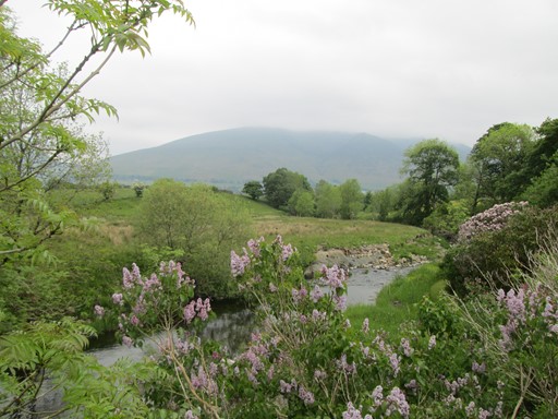
From White Pike we can see a stretch of Water, which could be Bassenthwaite Lake,
the only lake in the Lake District. Now there's a quiz question.
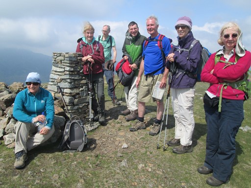
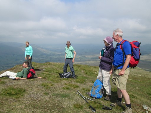
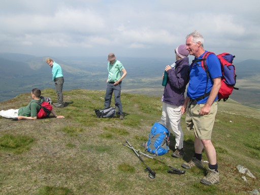
It's just a short ascent to Clough Head (726 m), where tradition calls for ...
... some group "piccys".
And here is a mountain "still life".
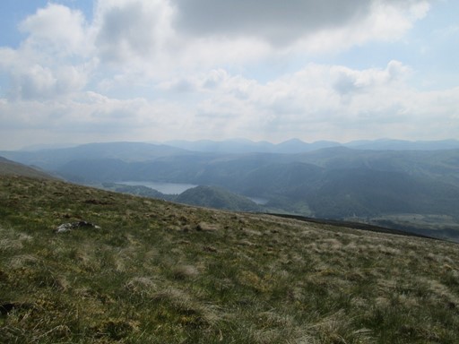
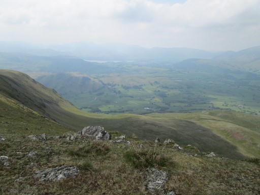
Another view from Clough Head. I'm not sure what the "water" is.
The Great Dodd
The Great Dodd - the highest part of our walk - was actually nearer and easier to reach than our first impressions would have us believe. It seemed a good idea "to go for it". In the event we only arrived back at Scales an hour after our colleagues who left us at Calfhow Pike in the modest dip between Clough Head and Great Dodd. There are a number of "Dodds" on the way from Helvellyn northwards to Great Dodd. Apparently, "Dodd" means "a rounded summit". I learn something new all the time! Anyway, on Great Dodd we met Ralph's group who had come on from Helvellyn and were making haste to get to the "Horse and Farrier" in Threlkeld, so as not to miss their evening dinner reservation. The view from Great Dodd, as expected, was marvellous, albeit with a bit more haze than on Clough Head. Our descent back to the Old Coach Road was also very scenic. A good feeling of the "Great Outdoors". We probably cut off a kilometre or so, by making a short cut scramble - on steep scrub and grass slopes - on to the said Coach Road.
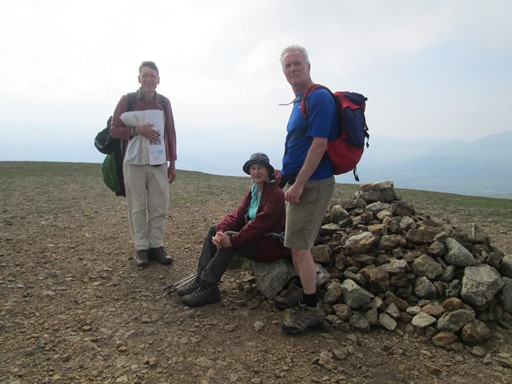
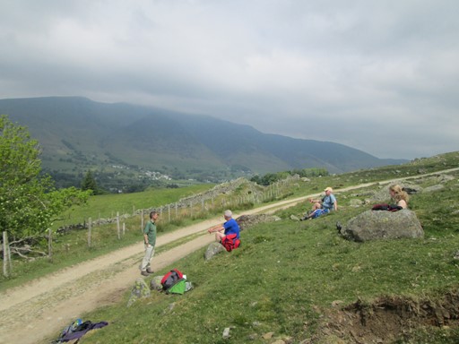
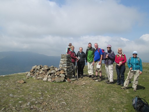
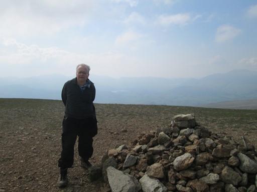
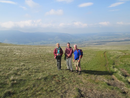
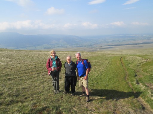
Four of us decided to "go for" Great Dodd (857 m),
and here is three quarters of the our party.
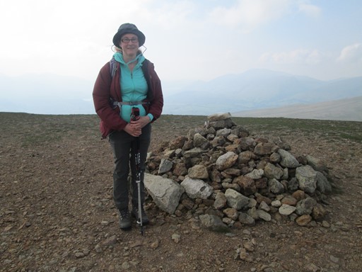
Here is Katherine again! Yes, we have made it ...
... and now it is yours truly. Thanks, Katherine, for taking the picture.
You see, I still need to work on my "selfie technique".
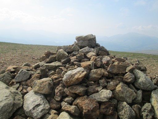
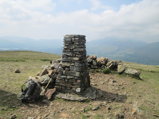
There's only a cairn on Great Dodd, not a thirties trig point as on Clough Head.
Our descent from Clough Head ...
... was bathed in the evening sun.
The longest day is not too far off.
Homewards to Scales
Having reached the Old Coach Road again, it was an interesting task to find the sign post showing the path back to Scales. In the event, we found it as a mini-signpost, about a foot or so off the ground. May be its forebears were of standard height and thus easily succumbed to the wind and the rain which in these parts are probably quite common place. Having eventually found the path, we were in for a boggy treat. Indeed, at one place the mire tried its hardest to suck me into its embrace. Wasn't there a reference in the "Hound of the Baskervilles" to a particular "Grimpen Mire", albeit in far-away Dartmoor. All the while, the setting sun was casting its shadows which grew longer and longer as we approached Scales.
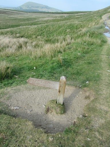
Here is the mini sign post.
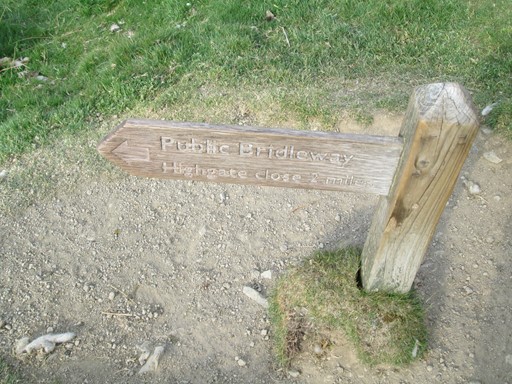
The bridle path leads across boggy landscape to "Highgate".
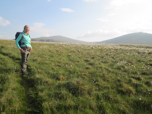
Here is Katherine, gracing the landscape. To the right is the Great Dodd,
and in the foreground are myriads of what look like fluffy white cotton flowers.
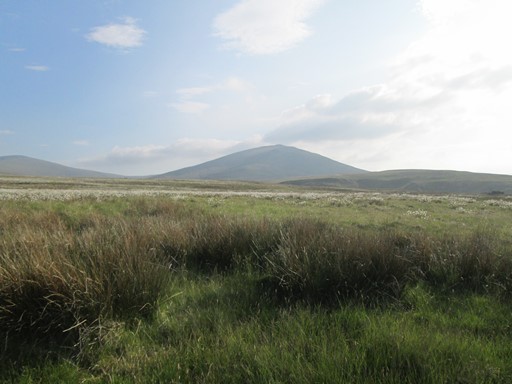
Another view of Great Dodd with swampy reeds and - in the distance - those cotton flowers
The path loses itself in a reed swamp, before we reach "Highgate". Some consultation of the map is therefore in order. Having reached the end of this path at the said "Highgate", we shall see a notice which tells us that in wet weather the bridle path is not fit for horses. We're not sure if it is really fit for humans either, even in this sunny weather - but we made it to solid ground.
Just beyond Wallthwaite we traverse a nice green pasture with ...
... grazing sheep. It's lambing time. As we came out onto the small side road leading up to Scales we saw an errant ewe and lamb, which we tried to coax back into back into the field from which they had probably made their escape. Not so easy, controlling sheep. No luck, but at least we got them going off to the south and away from the A66, which busy highway we would shortly be crossing to reach Scales.
Our Second Evening - at "The White Horse Inn"
We eventually reached Scales at about 20:20, and some of us decided that we would be dining that evening at the "White Horse", which was doing meals until 21:00. We felt that with our evening repast we had deserved a nice bottle of Rioja (vino tinto seco), shared between four of us. And so ended Day Two. We had had good exercise and celebrated our exploits of the day with a modicum of style.
Eric Scharf
Original: 2016-06-22 @09:15
Updated: 2016-06-26 @12:43
SAGAX REX HANC RETIS ORBIS PAGINAM PINXIT ANNO MMXVI.
© Eric Scharf 2016