 |
STEBBING CIRCULAR 14th February 2016 |
|

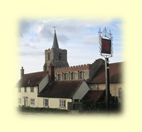
Essex: Stebbing Circular
This Sunday walk was organised by the "Basildon Green Way" ramblers and ably led by John Henton. The walk was a 13 mile clockwise circular walk based on the picturesque Essex village of Stebbing. Our walk took in pleasant farm land and also included the landing strip of Andrewsfield (which also accommodates a weather station for the Met Office) as well as the village of Rayne. The return to Stebbing was on part of the "Flitch Way". A visit to Stebbing's parish church of St Mary the Virgin, with its famous stone rood screen, was a fitting cultural finale to our exhilarating winter walk. Weather was sunny and dry, and the temperature was just below 5°C.
History abounds in the picturesque and - at least on a Sunday morning - quiet Essex village of Stebbing. A nice village in which to start and finish our walk.
So here is what these pages have in store for you. Even if you were not able to join us, here's your chance to find out how we enjoyed our fine mid-February Sunday walk - a walk to remove those winter cobwebs.
- Arriving in Stebbing
- Morning Walk
- The Flitch Way
- Return to Stebbing
- Features of Our Walk
- Thank You All for a nice day out!
- Access to this Walk by Public Transport
- Technical Bits and Pieces
- Please Read Me - Thank you!
Enjoy your browse!
Arriving in Stebbing
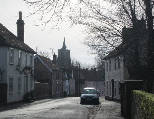
Our walk started at 10:00 on Sunday morning. We met in the Stebbing's interesting High Street, a few yards (or metres!) south of the "White Hart". Before the walk, there was enough time for introductions and for taking few pictures of Stebbing's interesting High Street.
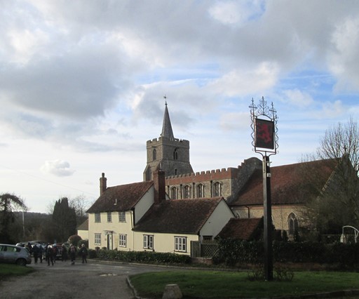
Here's looking south towards Stebbing's time honoured church of Saint Mary the Virgin, which we would have a chance to visit in the afternoon after the end of our walk.
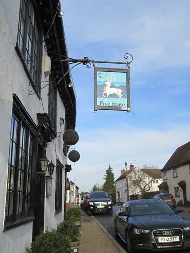
We parked just south of the "White Hart", ...
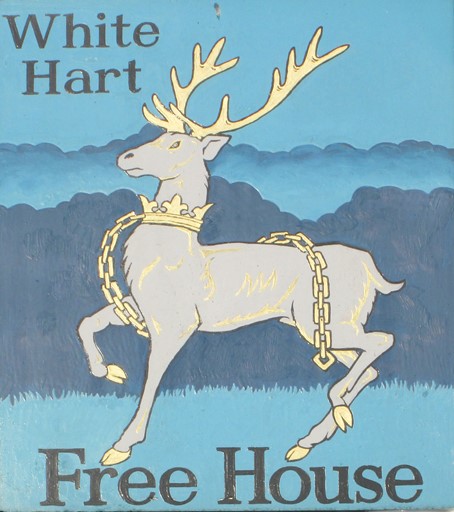
... whose inn sign shows the White Hart proudly prancing across the said sign.
Roughly opposite the "White Hart" ...
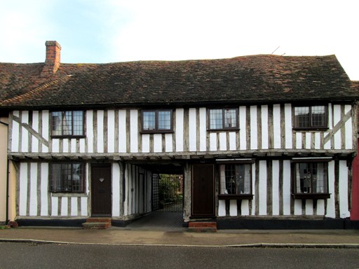
... is a "Ye Olde" timber framed house appearing to have witnessed
quite a few centuries of Stebbing's past.
Morning Walk to Rayne
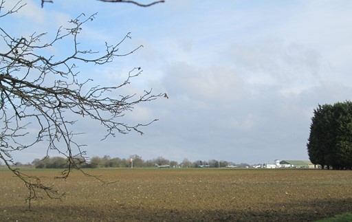
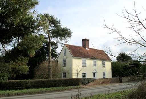
In the morning we make our way across farmland and savour the typical Essex scene: land stretching into the distance under the open sky. As we leave Stebbing we pass "The Mount" - old defensive earthworks. However, we soon hit upon open country. Andrewsfield landing strip is on our route; we see some nice rural abodes and even come across a herd of rather timid deer.
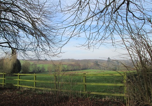
We leave Stebbing via some hilly ground to the north. Stebbing was built in a valley, perhaps to give some protection from the elements.
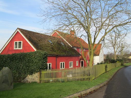
As we leave Stebbing, we are greeted by these houses, which, by virtue of their red paint,
exude an almost Scandinavian air.
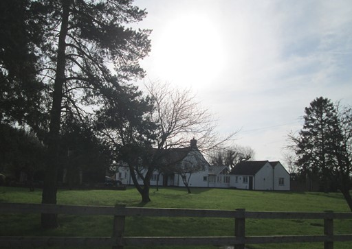
We pass Gatehouse Farm ...
... and Whitehouse Farm. The countryside hereabouts is populated by many farms,
for Essex has good agricultural land.
On our route is RAF Andrewsfield. It was originally called RAF Great Saling, from the nearby village, but then became known as "Andrews Field" in honour of USAAF General Frank M. Andrews, who was killed in an airplane crash in Iceland in May 1943. Nowadays, the airfield is reduced in size and caters for small private planes. It also accommodates the Met Office weather station, known, as you might expect, as Andrewsfield.
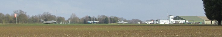
Aviation enthusiasts would be keen to note the different types of aircraft "on display".
We pass Onchor's Farm, ...
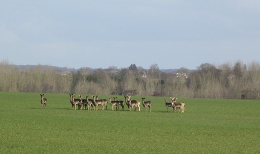
... before we see this herd of rather shy deer. How is the herd managed, and by whom? Why don't some deer occasionally go missing (for whatever reason!)?
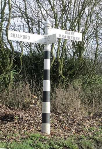
An old style sign post points in at least two directions.
We are getting close to Rayne, our "afternoon snack stop".
The Flitch Way
The railway line between Braintree and Bishops Stortford was opened in 1869 by the Great Eastern Railway. Competition with road transport led to the cessation of passenger services in 1952 and goods traffic in 1971. Much of the track bed was subsequently converted to a footpath and given the name "Flitch Way" to commemorate the "Flitch of Dunmow". Had the line not closed, then it could have served the burgeoning commuter traffic generated by the housing developments in places like Dunmow. In addition, the opening of Stansted Airport could have provided rail access from various parts of east Essex, avoiding the need to travel via London, while at the same time, keeping down road traffic. Of course, this would have implied forward thinking which may have been in short supply at the time of the line's closure. Anyway, today, the old track bed of this former cross country railway line serves the walking and hiking communities.
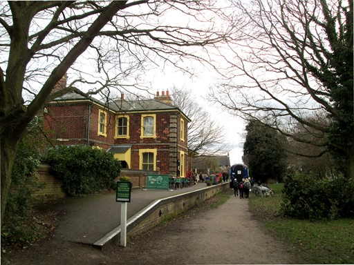
We reach Rayne Station, built in the typical style of rural Great Eastern Railway stations.
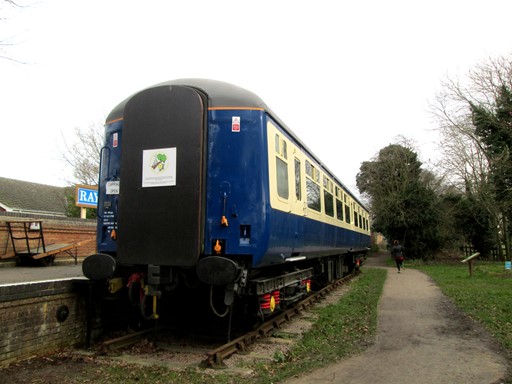
A Mk 2 coach is parked outside.
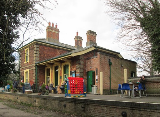
Both the station buildings, ...

... and the railway coach, provide some light refreshments for hikers and day trippers.
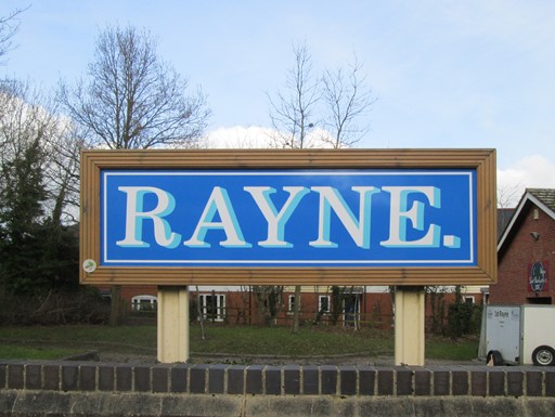
Dark blue was a Great Eastern Railway colour - was it not the colour of their express locomotives? This recently crafted station sign reminds us of the GER colour scheme.
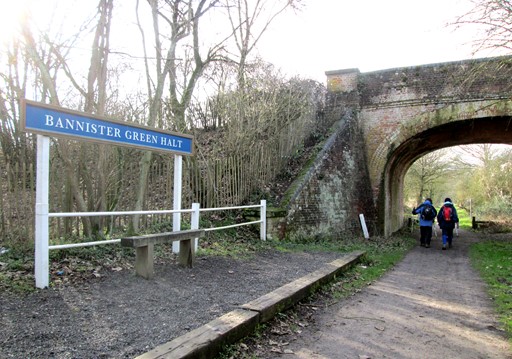
To recapture some of the lost passenger traffic, the GER installed a number of halts, such as this, originally built to serve Bannister Green, a mere kilometre away to the south. Still, late in the evening, it was still a kilometre on foot, whatever the weather and your state of fitness.
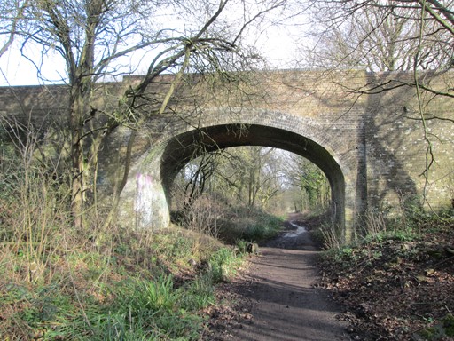
Many overbridges remain, testifying to the age of steam, when the railway was really the main way to access rural communities.
Return to Stebbing
After leaving the Flitch Way, we negotiate the only - ever so gentle - hilly section of the walk. We get a picturesque - one might even say, typically Essex - view of Stebbing as we approach the village. Stebbing's church of Saint Mary the Virgin certainly merits a vist as we are about to see. A last look at the time honoured High Street, and then it's time to leave Stebbing for the south. It was a nice sunny winter ramble - on flat terrain maybe, but full of interest.
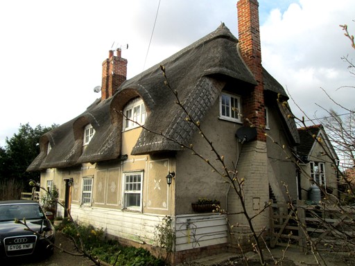
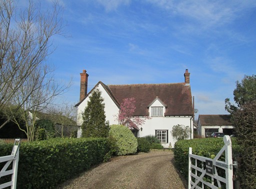
After crossing the busy A120 (underpass!) we reach the B1256, where it follows Stane Street, the old Roman road. On the north side is this house with the appropriate rural credentials: thatched roof and pargetting. Behind is what looks like a garage built into the ground, giving the impression that it may once have served as an air raid shelter. After all, Essex was on the front line during WWII.
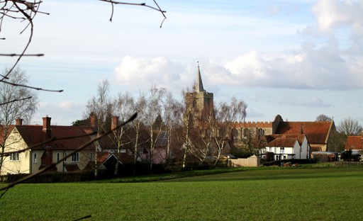
As we approach Stebbing from the south,
this nice rural - one might say typically Essex - scene unfolds
As we enter Stebbing we see what seems to be the case in many villages the length and breadth of England: a close juxtaposition of the two aspects spiritual,
namely the divine (the church) and the secular (the pub).
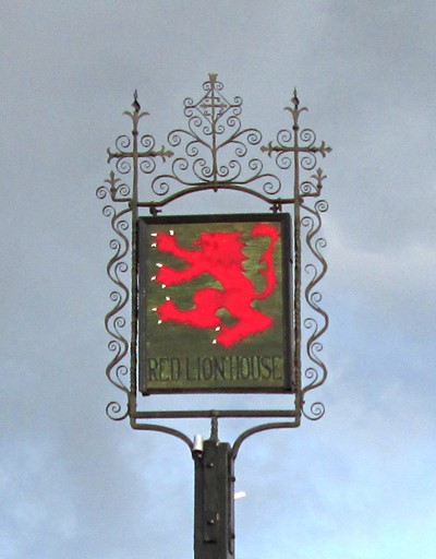
The pub, just to be different, is not called "The Red Lion", but, "The Red Lion House".
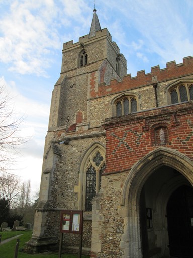
It's just a few paces to the church.
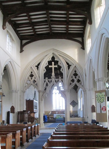
Once within, we are greeted by this magnificent stone rood screen. Apparently, this is one of only three that survive in Europe. Another is at Great Bardfield, about 7.5 Km (4.6 miles) to the north of here. The third is in Trondheim, in Norway, somewhat further away!

A picture (looks like an oil painting) in an ornate gilded frame hangs high up on the wall to the left of the entrance. The picture reminds us that this church is dedicated to Saint Mary the Virgin - here with the infant Jesus.
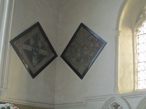
Many village churches have one or more hatchments.
These two hatchments grace the right hand corner by the altar, ...
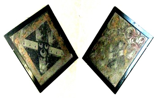
... and processing of the picture with GIMP reveals the ornate nature of these hatchments.
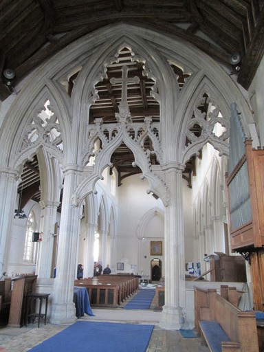
Here, once again, is the rood screen, first looking back to the entrance, ...
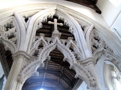
... then, looking up to the roof of the nave, ...
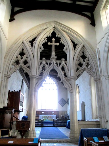
... and here, looking back to the altar. Magnificence indeed!
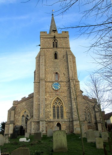
As we leave the church for the High Street, the church tower seems to watch our departure,
as it has watched countless parishioners and visitors in ages past.
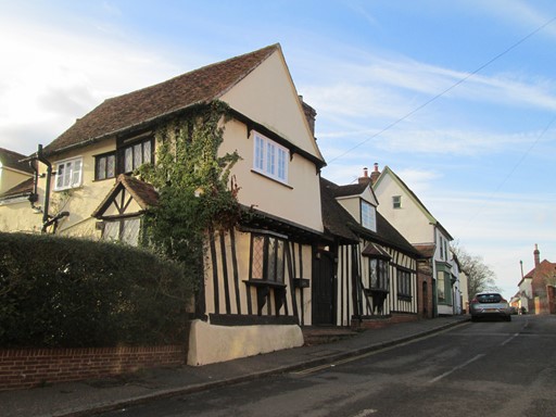
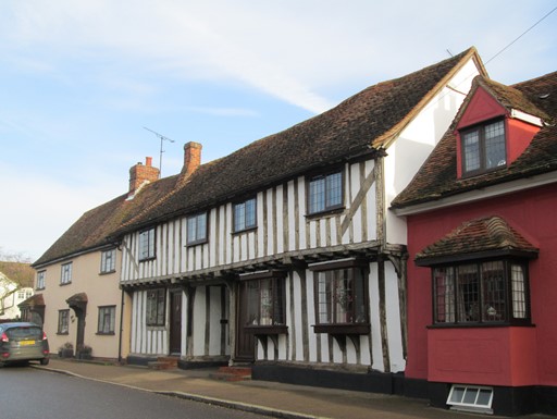
The time-honoured half-timbered houses in the High Street greet us on our return ...
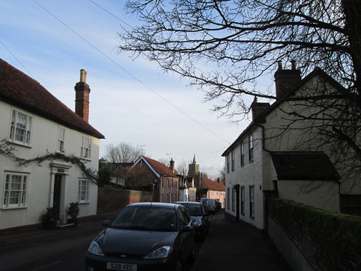
... and here we back to the southern end of the High Street and to the church we have just visited.
Thank You All for a Nice Day Out!
Thank you John of the Basildon Greenway Ramblers for suggesting and leading this walk. Thank you everyone for making this an enjoyable "Ramblers" walk. Thank you to the weather gods for bringing good walking weather - cold yes, but with plenty of winter sunshine!
Access to this Walk by Public Transport
Stebbing is in "deepest Essex" and is difficult to reach by public transport, even during the week and on Saturdays. However, this walk could be started from Braintree Station, which itself can readily be reached from Liverpool Street Station in London. The Flitch Way, as expected, starts at Braintree Station and the route of walk itself can be reached at Rayne Station. About 3½ Km (about 2.2 miles), each way, are then added to the length of the walk, but, as pointed out the overall length of the walk is compensated by the very small average gradients actually encountered on this walk.
Technical Bits and Pieces
There are at least three aspects which I could raise here, including the behaviour of your browser, the behaviour of Windows 10® and general items buried elsewhere on my site.
- Browser Behaviour: If your browser appears to be lazy and does not want to load all the pictures, a friendly press on its refresh button might just get your browser out of its recalcitrant ways. You might notice that in order to speed up loading of individual items, I have split up these pages.
- Windows 10®: I have started to use Windows 10® in earnest. So far so seemingly good, and hopefully my continuing experience - and indeed that of other new users - of Windows 10® will remain positive. However, unannounced updates are inconvenient for the user, and suggest that Windows 10® is still subject to ongoing development.
- More Technical Items: Whilst I have not had a chance to update the technical items on my "Read Me" page, you might find some further relevant things here.
Eric Scharf
Original: 2016-02-20 @21:11
SAGAX REX HANC RETIS ORBIS PAGINAM PINXIT ANNO MMXVI.
© Eric Scharf 2016