 |
Lakeland Delight FAIRFIELD HORSESHOE 2013 - June - 08 |
|
| The Walk Ascent On Top Descent Map : This Walk Flashback Maps : All Walks Read Me |
Fairfield - The Walk
The Fairfield Horeshoe is an old favourite in the Lake District. It is conceptually easy to walk - especially in clear weather. Just keep the valley of the Rydal Beck always on your right if going clockwise - and of course on the left, the other way round. We took the more strenuous clockwise option - more strenuous because the initial climb is the steeper of the two options.
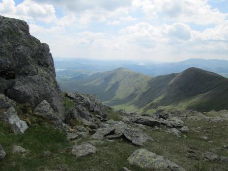
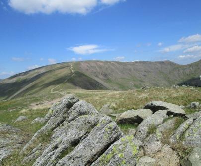
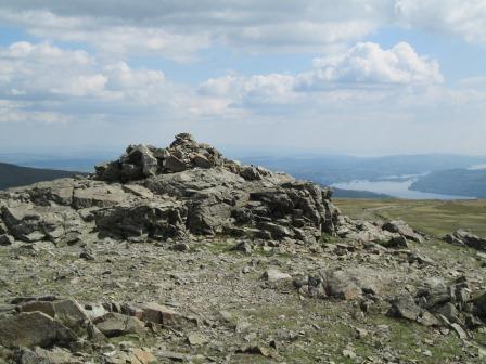
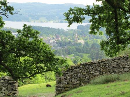
On top we have a dramatically stony view towards Windermere (Lake).
If you like good Lakeland views, then the Horseshoe is for you. The highest point is on Fairfield itself, at 873 metres, one of the higher points in the Lakes. Yes, the locals used to hold fairs on Fairfield itself - everything had to be carted up, but no doubt, great fun, of an elevated nature, was had by all in those distant days of yore.
The Ascent
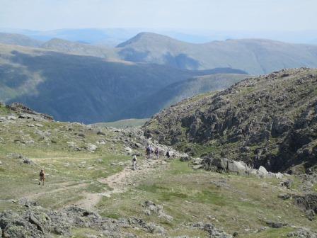
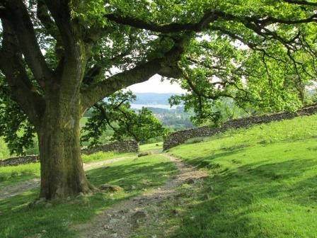
There is a nice "Wordsworthian" start in Rydal, and then you are soon on the horseshoe, enjoying good views all around, but especially towards Ambleside and Lake Windermere. A steep climb, but there's really no need to rush.
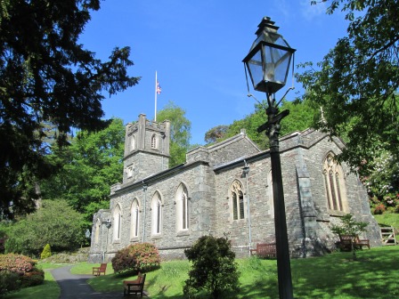
This is the church attended by Wordsworth. It is built on the end of the rocky Nab Scar. In fact, the ground is so rocky that burials are not possible. Maybe you noticed the absence of gravestones.
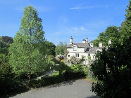
This is one of the houses in which Wordsworth resided. Now it is open to visitors. If the weather is too inclement for walking, then this is one of the many cultural visitor attractions which the Lake District can offer. Across the way there is also the historic Rydal Hall.
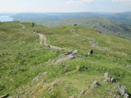
Once above Nab Scar, the "Great Outdoors" rules OK.
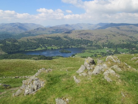
On the way to Heron Pike, there is a lovely view of Grasmere (the mere or lake, that is) with its wooded island.
Is this Heron Pike?
Well, that's the way we came ...
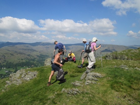
... and it's time for a quick stop. Not for me, for I keep going at my slow but steady pace ...
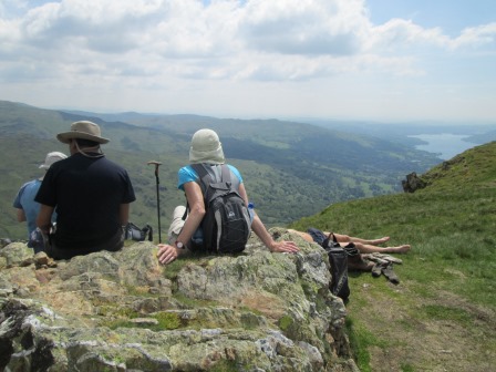
... but not before taking some more piccies to grace this web page. Note on this picture the roasting trotters in the centre right beyond the foreground rock. More roasting, less admiring the view!
And here is another view looking back the way we came.
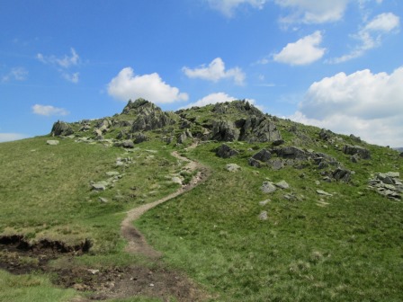
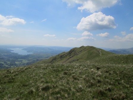
Great Rigg has a rocky top, like some mediaeval castle.
The view looking back the way we came gets even better ...
... and Fairfield is not too far away.
Fairfield - On Top
Fairfield, the highest part of the walk, was indeed where the locals used to hold their fairs. Everything had to be carted or lugged up. There does not seem to be any incentive nowadays for such exertions. However, walkers like Cloggies still like rise to higher things, and the "Horseshoe" provides a splendid opportunity in this regard.
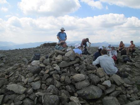
A rest is called for at the highest point on our walk.
Yes, it is flattish up here on Fairfield - stuff won't roll off that easily - and this place is accessible from more than one valley. Good for fairs and merry making. One can see that Fairfield could have had an appeal for the locals of yore.

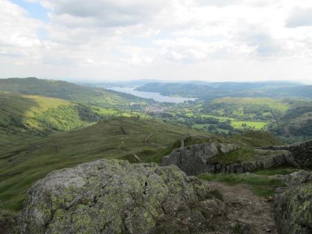
It's time to leave, but not before before admiring the view to the north east. Is this the "Black Buttress?
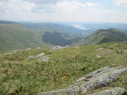
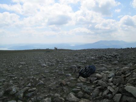
A dramatically stony view shows the way we ascended ...
... and another shows the way we shall descend.
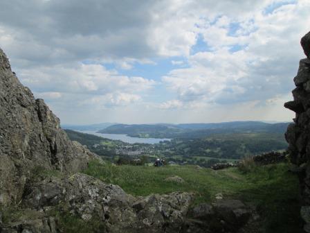
It'll be a little bit of "down and up", but not dramatically so.
One last view from the Fairfield plateau.
Descent
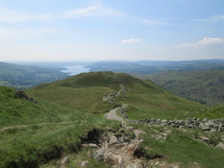
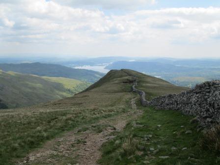
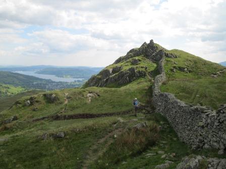
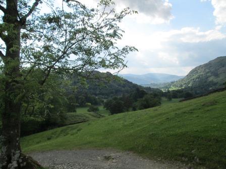
On the descent, Ambleside is always ahead. No great twists or turns on our part. For a while a drystone wall keeps us company. The wall may have been the boundary between neighbouring landowners. It provides a helpful reference and this time obviates the need for map and compass.
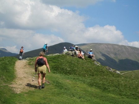
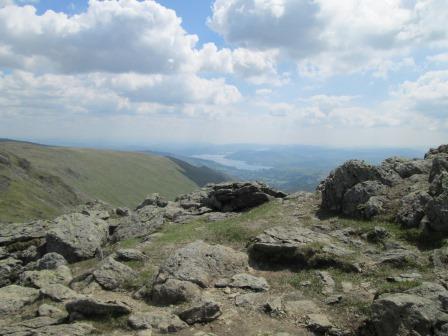
At High Pike ...
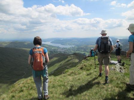
... it's time to stop awhile to have another dose of the view. Views like this don't come that readily in the deep south.

There's a nice bit if scrambling off High Pike ...
... and then it looks as if we are getting to Low Pike.
At the Brock Crags - High and Low - there is another nice view.
Things get even more aesthetically appealing with this stony frame. It's the gateway to Ambleside.
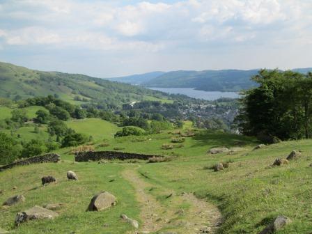
We are getting close to our first day "Sweden Bridges" walk.
The evening sun is casting patterns through the verdant foliage.
Here is Ambleside.
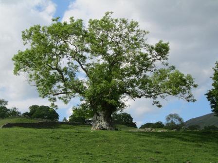
I couldn't resist a shot of this gracious looking tree gnarled by the ravages of time.
This is a view towards Grasmere - the view we had on the first day.
The Unicorn
For the evening we had the Unicorn Inn in our gastronomical sights, and were not disappointed. The Unicorn has the honour of being Ambleside's oldest coaching inn, but lack of further information on the web leaves me to surmise that it is so old that no one knows how old it is. Anyway, it was a positive visit. With thoughts of what mountain to visit tomorrow it's then time to call it a very pleasurable and active day.
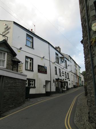
The Unicorn seems to dance up one of Ambleside's numerous narrow steep streets.
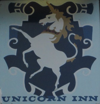
The Unicorn prances merrily on the inn sign.
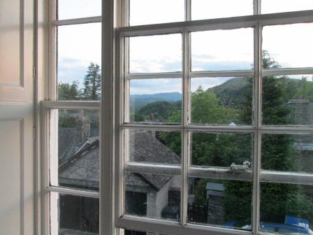
From our hostel room we can watch the evening sun play upon Loughrigg. Notwithstanding the presence of such nice views, we find that the activities of the day call for a reasonably early night. Tomorrow already beckons with the thoughts of more mountain walks.
Flash back to 2009
On Easter Monday, 13th April, 2009, Ralph led a CLOG walk - a foursome - on the Fairfield Horseshoe, in the anti-clockwise direction, starting, therefore, in Ambleside and ascending via the Low Sweden Bridge. This meant at the time a gentler climb than on today's walk.
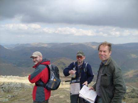
On April 13th, 2009 there were four of us doing the Fairfield Horseshoe in the anti-clockwise direction. The picture shows from left to right: Mark (do you remember him - he looked as if he could be related to Ralph), and then of course Ralph (different glasses) and unmistakably John E.; yours truly is the photographer. The picture was taken on Hart Crag, between Dove Crag and Fairfield itself. At that time the girls in our CLOG party thought that the Fairfield Horseshoe was only something for the boys. Four years on and I don't think such thoughts would find accord.
Features of Today's Walk
Doing the Fairfield Horseshoe in the clockwise direction - as we did today - means a steeper climb than with the anti-clockwise option. Whichever way one goes, the valley is always an easy spatial reference. Thus it should be very difficult to get lost in clear weather. Coming back into Ambleside is of course convenient if you are based in Ambleside - as we were this time. For the record, I took the higher - Low Sweden Bridge - route on the final way in.
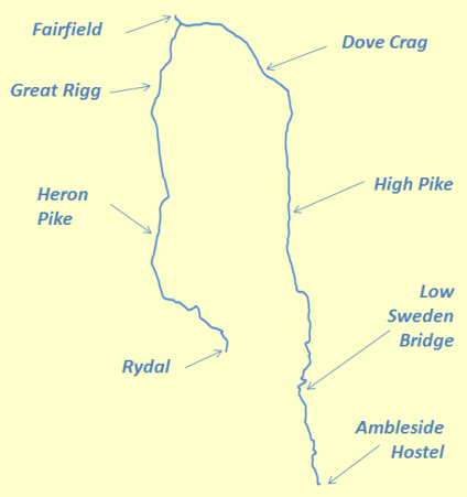
The clockwise walk was all of 15.6 Km or 9.7 miles, starting in Rydal.
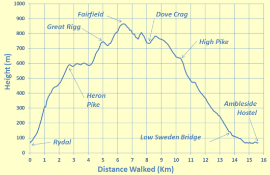
Fairfield was the highest point. The steeper initial gradients on our clockwise option are clearly evident in the height profile.
Eric Scharf
Original: 2013-06-17 @20:29
Last Update: 2019-03-11 @19:52
SAGAX REX HANC RETIS ORBIS PAGINAM PINXIT ANNO MMXIII.
© Eric Scharf 2013